Property Record
156 Commons Dr, Eugene, OR 97401


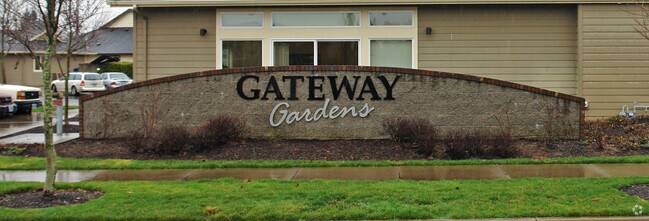
Property Detail
156 Commons Dr
Eugene-Springfield, OR
SUBDIVISION PLAT UNIVERSITY COMMONS PUD LOT 3 TL 00100
1612082
LANE
Commercialbuilding
Oregon
R-3
3
C and X Area of minimal flood hazard, usually depicted on FIRMs as above the 500-year flood level.
2.32 AC
2025
Lane County
2025
Portland
003104
NEARBY LISTINGS FOR SALE OR LEASE
DEMOGRAPHICS near 156 Commons Dr
1 mile
3 mile
5 mile
2025 Total Population
14,232
109,760
194,392
2030 Population
14,045
109,158
193,271
Pop Growth 2025-2030
(1.31%)
(0.55%)
(0.58%)
Average Age
38
38
40
2025 Total Households
6,098
46,779
81,697
HH Growth 2025-2030
(1.30%)
(0.68%)
(0.70%)
Median Household Inc
$64,367
$57,651
$66,298
Avg Household Size
2.20
2.10
2.20
2025 Avg HH Vehicles
2.00
2.00
2.00
Median Home Value
$473,644
$466,311
$463,229
Median Year Built
1987
1975
1975
Nearby Places
Map Layers
Map Styles
 Street
 Aerial
Layers
 Traffic
 Biking
Places
Listings with unknown addresses are not visible on the map
- Restaurants
- Banks
- Shops
- Fitness
- Groceries
PUBLIC TRANSPORTATION
COMMUTER RAIL
Eugene (Amtrak Cascades - Amtrak, Coast Starlight - Amtrak)
Drive
Walk
Distance
Eugene (Amtrak Cascades - Amtrak, Coast Starlight - Amtrak)
6 min
2.5 mi
AIRPORT
Mahlon Sweet Field
Drive
Walk
Distance
Mahlon Sweet Field
21 min
11.7 mi
Freight Ports
Port of Coos Bay, OR
Drive
Walk
Distance
Port of Coos Bay, OR
158 min
111.3 mi
Nearby Properties
Address
Land Use
TOTAL SIZE
Lot Size
Zoning
Address
Land Use
TOTAL SIZE
Lot Size
Zoning
110.25 AC
PL
Address
Land Use
TOTAL SIZE
Lot Size
Zoning
15.37 AC
PL
Address
Land Use
TOTAL SIZE
Lot Size
Zoning
71.87 AC
PL
Address
Land Use
TOTAL SIZE
Lot Size
Zoning
1.56 AC
C-2
Address
Land Use
TOTAL SIZE
Lot Size
Zoning
1.86 AC
C-2
Address
Land Use
TOTAL SIZE
Lot Size
Zoning
9.57 AC
LD
Address
Land Use
TOTAL SIZE
Lot Size
Zoning
24 AC
C-2
Address
Land Use
TOTAL SIZE
Lot Size
Zoning
13.82 AC
PL
Address
Land Use
TOTAL SIZE
Lot Size
Zoning
9.81 AC
C-2
Address
Land Use
TOTAL SIZE
Lot Size
Zoning
3.99 AC
I-3
Address
Land Use
TOTAL SIZE
Lot Size
Zoning
5.87 AC
C-2
Address
Land Use
TOTAL SIZE
Lot Size
Zoning
2.76 AC
C-3
Address
Land Use
TOTAL SIZE
Lot Size
Zoning
3.10 AC
S-WS
Address
Land Use
TOTAL SIZE
Lot Size
Zoning
2.56 AC
C-2
Address
Land Use
TOTAL SIZE
Lot Size
Zoning
1.23 AC
C-3
Address
Land Use
TOTAL SIZE
Lot Size
Zoning
16.80 AC
PL
Address
Land Use
TOTAL SIZE
Lot Size
Zoning
2.77 AC
C-2
Address
Land Use
TOTAL SIZE
Lot Size
Zoning
14.39 AC
E-1
Address
Land Use
TOTAL SIZE
Lot Size
Zoning
3.29 AC
S-RP
Address
Land Use
TOTAL SIZE
Lot Size
Zoning
1.21 AC
C-2
Address
Land Use
TOTAL SIZE
Lot Size
Zoning
9.59 AC
R-1
Address
Land Use
TOTAL SIZE
Lot Size
Zoning
14.54 AC
C-2
Address
Land Use
TOTAL SIZE
Lot Size
Zoning
2.15 AC
PL
Address
Land Use
TOTAL SIZE
Lot Size
Zoning
Address
Land Use
TOTAL SIZE
Lot Size
Zoning
17.37 AC
AG
Address
Land Use
TOTAL SIZE
Lot Size
Zoning
25.78 AC
C-2
Address
Land Use
TOTAL SIZE
Lot Size
Zoning
13.55 AC
CI
Address
Land Use
TOTAL SIZE
Lot Size
Zoning
4.31 AC
C-2
Address
Land Use
TOTAL SIZE
Lot Size
Zoning
Address
Land Use
TOTAL SIZE
Lot Size
Zoning
2.59 AC
C-2
The World's #1 Commercial Real Estate Marketplace
Connect with us
© 2026 CoStar Group
The information above has been obtained from sources believed reliable. While we do not doubt its accuracy we have not verified it and make no guarantee, warranty or representation about it. It is your responsibility to independently confirm its accuracy and completeness. Any projections, opinions, assumptions, or estimates used are for example only and do not represent the current or future performance of the property. The value of this transaction to you depends on tax and other factors which should be evaluated by your tax, financial, and legal advisors. You and your advisors should conduct a careful, independent investigation of the property to determine to your satisfaction the suitability of the property for your needs.