Property Record
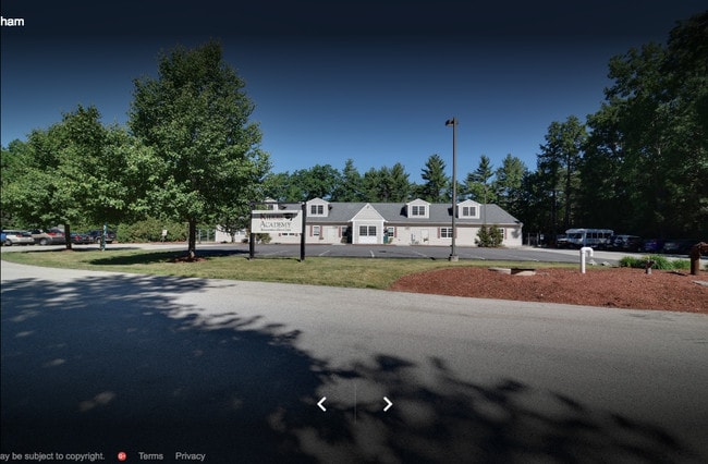
156 Haverhill Rd, Windham, NH 03087


Property Detail
156 Haverhill Rd
WNDM-000009-A000000-000600
Rockingham
Daycare
New Hampshire
NBD
600
B and X Area of moderate flood hazard, usually the area between the limits of the 100-year and 500-year floods.
2.47 AC
2025
Rockingham
2025
Boston
106101
Boston-Cambridge-Newton, MA-NH
8,504 SF
NEARBY LISTINGS FOR SALE OR LEASE
DEMOGRAPHICS near 156 Haverhill Rd
1 mile
3 mile
5 mile
2025 Total Population
2,298
20,751
57,607
2030 Population
2,307
21,018
58,530
Pop Growth 2025-2030
+ 0.39%
+ 1.29%
+ 1.60%
Average Age
42
42
42
2025 Total Households
787
7,197
20,839
HH Growth 2025-2030
+ 0.25%
+ 1.25%
+ 1.58%
Median Household Inc
$143,055
$165,533
$146,731
Avg Household Size
2.90
2.80
2.70
2025 Avg HH Vehicles
2.00
3.00
2.00
Median Home Value
$658,311
$621,680
$529,547
Median Year Built
1982
1985
1985
Nearby Places
Map Layers
Map Styles
 Street
 Aerial
Layers
 Traffic
 Biking
Places
Listings with unknown addresses are not visible on the map
- Restaurants
- Banks
- Shops
- Fitness
- Groceries
PUBLIC TRANSPORTATION
AIRPORT
Manchester Boston Regional
Drive
Walk
Distance
Manchester Boston Regional
29 min
12.8 mi
General Edward Lawrence Logan International
Drive
Walk
Distance
General Edward Lawrence Logan International
56 min
41.5 mi
Freight Ports
Port of Boston
Drive
Walk
Distance
Port of Boston
57 min
41.2 mi
SALE & LEASE HISTORY
LISTING DATE
SALE/LEASE

Nov 21, 2017
For Sale
Nearby Properties
Address
Land Use
TOTAL SIZE
Lot Size
Zoning
Address
Land Use
TOTAL SIZE
Lot Size
Zoning
195,778 SF
101.88 AC
RD
Address
Land Use
TOTAL SIZE
Lot Size
Zoning
58,339 SF
47.49 AC
RD
Address
Land Use
TOTAL SIZE
Lot Size
Zoning
80,710 SF
20 AC
AR-I
Address
Land Use
TOTAL SIZE
Lot Size
Zoning
13,158 SF
52.40 AC
VCD
Address
Land Use
TOTAL SIZE
Lot Size
Zoning
71,854 SF
26 AC
RD
Address
Land Use
TOTAL SIZE
Lot Size
Zoning
11.28 AC
C-I
Address
Land Use
TOTAL SIZE
Lot Size
Zoning
59,626 SF
7.40 AC
VCD
Address
Land Use
TOTAL SIZE
Lot Size
Zoning
142,524 SF
8.80 AC
ID
Address
Land Use
TOTAL SIZE
Lot Size
Zoning
13,673 SF
11.76 AC
CDA
Address
Land Use
TOTAL SIZE
Lot Size
Zoning
115,747 SF
9.99 AC
ID
Address
Land Use
TOTAL SIZE
Lot Size
Zoning
17,214 SF
18.60 AC
ID
Address
Land Use
TOTAL SIZE
Lot Size
Zoning
85,145 SF
6.10 AC
ID
Address
Land Use
TOTAL SIZE
Lot Size
Zoning
19,875 SF
4.56 AC
ID
Address
Land Use
TOTAL SIZE
Lot Size
Zoning
31,404 SF
7.10 AC
CDA
Address
Land Use
TOTAL SIZE
Lot Size
Zoning
3,200 SF
3.62 AC
VCD
Address
Land Use
TOTAL SIZE
Lot Size
Zoning
18,187 SF
8.60 AC
MZ
Address
Land Use
TOTAL SIZE
Lot Size
Zoning
57,012 SF
6.76 AC
ID
Address
Land Use
TOTAL SIZE
Lot Size
Zoning
12,300 SF
9.93 AC
AR-1/C
Address
Land Use
TOTAL SIZE
Lot Size
Zoning
24,225 SF
7 AC
AR-I
Address
Land Use
TOTAL SIZE
Lot Size
Zoning
48,675 SF
3.83 AC
ID
Address
Land Use
TOTAL SIZE
Lot Size
Zoning
5,914 SF
3 AC
HD
Address
Land Use
TOTAL SIZE
Lot Size
Zoning
3,095 SF
5.61 AC
NBD
Address
Land Use
TOTAL SIZE
Lot Size
Zoning
12,028 SF
2.29 AC
HD
Address
Land Use
TOTAL SIZE
Lot Size
Zoning
37,590 SF
3.94 AC
ID
Address
Land Use
TOTAL SIZE
Lot Size
Zoning
25,140 SF
3.64 AC
ID
Address
Land Use
TOTAL SIZE
Lot Size
Zoning
36,068 SF
2.17 AC
ID
Address
Land Use
TOTAL SIZE
Lot Size
Zoning
31,370 SF
13.05 AC
ID
Address
Land Use
TOTAL SIZE
Lot Size
Zoning
7,732 SF
1.06 AC
CDA
Address
Land Use
TOTAL SIZE
Lot Size
Zoning
8,142 SF
2.40 AC
VCD
Address
Land Use
TOTAL SIZE
Lot Size
Zoning
26,764 SF
9.22 AC
R2
The World's #1 Commercial Real Estate Marketplace
Connect with us
© 2026 CoStar Group
The information above has been obtained from sources believed reliable. While we do not doubt its accuracy we have not verified it and make no guarantee, warranty or representation about it. It is your responsibility to independently confirm its accuracy and completeness. Any projections, opinions, assumptions, or estimates used are for example only and do not represent the current or future performance of the property. The value of this transaction to you depends on tax and other factors which should be evaluated by your tax, financial, and legal advisors. You and your advisors should conduct a careful, independent investigation of the property to determine to your satisfaction the suitability of the property for your needs.