Property Record
156 Pearidge Rd, Bostic, NC 28018

Property Detail
156 Pearidge Rd
Forest City, NC
GPIN:1650002374930000; PEA RIDGE RD
416869
RUTHERFORD
Vacantlandnec
North Carolina
AE The base floodplain where base flood elevations are provided. AE Zones are now used on new format FIRMs instead of A1-A30 Zones.
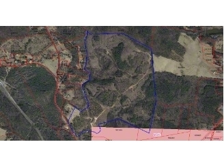
163.38 AC
2025
North Carolina West/Cherokee Area
2025
Other Market Areas
960103
NEARBY LISTINGS FOR SALE OR LEASE
-
-
View all Bostic listings for sale on LoopNet.com
DEMOGRAPHICS near 156 Pearidge Rd
1 mile
3 mile
5 mile
2025 Total Population
189
2,396
12,646
2030 Population
190
2,401
12,731
Pop Growth 2025-2030
+ 0.53%
+ 0.21%
+ 0.67%
Average Age
44
44
43
2025 Total Households
77
974
5,037
HH Growth 2025-2030
0.00%
+ 0.21%
+ 0.62%
Median Household Inc
$52,857
$56,623
$47,848
Avg Household Size
2.30
2.40
2.40
2025 Avg HH Vehicles
2.00
2.00
2.00
Median Home Value
$165,217
$174,680
$173,754
Median Year Built
1973
1981
1973
Nearby Places
Map Layers
Map Styles
 Street
 Aerial
Transit
 Traffic
 Biking
Places
Listings with unknown addresses are not visible on the map
- Restaurants
- Banks
- Shops
- Fitness
- Groceries
SALE & LEASE HISTORY
LISTING DATE
SALE/LEASE

Sep 24, 2016
For Sale
May 08, 2017
For Sale
Nearby Properties
Address
Land Use
TOTAL SIZE
Lot Size
Zoning
Address
Land Use
TOTAL SIZE
Lot Size
Zoning
200,301 SF
30 AC
Address
Land Use
TOTAL SIZE
Lot Size
Zoning
37,979 SF
9.36 AC
R8
Address
Land Use
TOTAL SIZE
Lot Size
Zoning
3,808 SF
65.75 AC
Address
Land Use
TOTAL SIZE
Lot Size
Zoning
8,880 SF
11.85 AC
C3
Address
Land Use
TOTAL SIZE
Lot Size
Zoning
1.25 AC
R8
Address
Land Use
TOTAL SIZE
Lot Size
Zoning
34,756 SF
2.38 AC
C2
Address
Land Use
TOTAL SIZE
Lot Size
Zoning
6,000 SF
24.43 AC
R6
Address
Land Use
TOTAL SIZE
Lot Size
Zoning
2,288 SF
3.38 AC
C3
Address
Land Use
TOTAL SIZE
Lot Size
Zoning
25,317 SF
4.62 AC
C3
Address
Land Use
TOTAL SIZE
Lot Size
Zoning
2,340 SF
5.38 AC
C3
Address
Land Use
TOTAL SIZE
Lot Size
Zoning
30,048 SF
31.65 AC
M1
Address
Land Use
TOTAL SIZE
Lot Size
Zoning
2,370 SF
10.07 AC
M1
Address
Land Use
TOTAL SIZE
Lot Size
Zoning
20,696 SF
2.24 AC
R15
Address
Land Use
TOTAL SIZE
Lot Size
Zoning
6,890 SF
21.39 AC
Address
Land Use
TOTAL SIZE
Lot Size
Zoning
60,000 SF
11.25 AC
M1
Address
Land Use
TOTAL SIZE
Lot Size
Zoning
8,448 SF
9.15 AC
R8
Address
Land Use
TOTAL SIZE
Lot Size
Zoning
210 SF
3.66 AC
C3
Address
Land Use
TOTAL SIZE
Lot Size
Zoning
1,063 SF
1.50 AC
C2
Address
Land Use
TOTAL SIZE
Lot Size
Zoning
16,772 SF
13.33 AC
M1
Address
Land Use
TOTAL SIZE
Lot Size
Zoning
2,900 SF
10 AC
R8
Address
Land Use
TOTAL SIZE
Lot Size
Zoning
70.57 AC
M1
Address
Land Use
TOTAL SIZE
Lot Size
Zoning
18,700 SF
1.85 AC
C3
Address
Land Use
TOTAL SIZE
Lot Size
Zoning
2,254 SF
0.63 AC
C2
Address
Land Use
TOTAL SIZE
Lot Size
Zoning
8,520 SF
1.15 AC
M1ETJ
Address
Land Use
TOTAL SIZE
Lot Size
Zoning
10,068 SF
17.33 AC
Address
Land Use
TOTAL SIZE
Lot Size
Zoning
10,424 SF
20.51 AC
Address
Land Use
TOTAL SIZE
Lot Size
Zoning
7,239 SF
0.93 AC
C2
Address
Land Use
TOTAL SIZE
Lot Size
Zoning
7.42 AC
C2
Address
Land Use
TOTAL SIZE
Lot Size
Zoning
1,050 SF
2 AC
Address
Land Use
TOTAL SIZE
Lot Size
Zoning
4,109 SF
1.57 AC
R15
The World's #1 Commercial Real Estate Marketplace
Connect with us
© 2026 CoStar Group
The information above has been obtained from sources believed reliable. While we do not doubt its accuracy we have not verified it and make no guarantee, warranty or representation about it. It is your responsibility to independently confirm its accuracy and completeness. Any projections, opinions, assumptions, or estimates used are for example only and do not represent the current or future performance of the property. The value of this transaction to you depends on tax and other factors which should be evaluated by your tax, financial, and legal advisors. You and your advisors should conduct a careful, independent investigation of the property to determine to your satisfaction the suitability of the property for your needs.