Property Record
1560 Bradford Rd, Chesterbrook, PA 19087

NEARBY LISTINGS FOR SALE OR LEASE
Property Detail
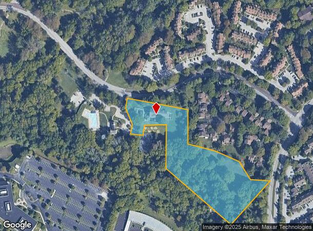
1560 Bradford Rd
43-005-0026.28A0
5 AC & COMM BLDG
Privateschool
Chester
X
Pennsylvania
42029C0110G
5 AC
2024
King of Prussia/Wayne
2025
Philadelphia
300106
Philadelphia-Camden-Wilmington, PA-NJ-DE-MD
11,916 SF
DEMOGRAPHICS near 1560 Bradford Rd
1 Mile
3 Mile
5 Mile
2024 Total Population
6,328
39,842
123,798
2029 Population
6,533
41,628
128,042
Pop Growth 2024-2029
+ 3.24%
+ 4.48%
+ 3.43%
Average Age
42
42
41
2024 Total Households
2,656
16,226
49,287
HH Growth 2024-2029
+ 3.43%
+ 4.83%
+ 3.61%
Median Household Inc
$138,683
$134,459
$121,311
Avg Household Size
2.30
2.40
2.40
2024 Avg HH Vehicles
2.00
2.00
2.00
Median Home Value
$440,099
$651,711
$546,328
Median Year Built
1983
1975
1975
Nearby Places
Map Layers
Map Styles
 Street
 Aerial
- Restaurants
- Banks
- Shops
- Fitness
- Groceries
PUBLIC TRANSPORTATION
COMMUTER RAIL
Berwyn (R5 - Southeastern Pennsylvania Transportation Authority Regional Rail (SEPTA Regional Rail))
DRIVE
WALK
Distance
Berwyn (R5 - Southeastern Pennsylvania Transportation Authority Regional Rail (SEPTA Regional Rail))
7 min
3.0 mi
Daylesford (R5 - Southeastern Pennsylvania Transportation Authority Regional Rail (SEPTA Regional Rail))
DRIVE
WALK
Distance
Daylesford (R5 - Southeastern Pennsylvania Transportation Authority Regional Rail (SEPTA Regional Rail))
7 min
3.6 mi
AIRPORT
Philadelphia International
DRIVE
WALK
Distance
Philadelphia International
43 min
24.5 mi
Freight Ports
South Jersey Port
DRIVE
WALK
Distance
South Jersey Port
40 min
26.6 mi
SALE & LEASE HISTORY
LISTING DATE
SALE/LEASE

Sep 27, 2023
For Sale
Nearby Properties
Address
Land Use
TOTAL SIZE
Lot Size
Zoning
Address
Land Use
TOTAL SIZE
Lot Size
Zoning
628,694 SF
6.89 AC
AG
Address
Land Use
TOTAL SIZE
Lot Size
Zoning
649,339 SF
3.69 AC
AG
Address
Land Use
TOTAL SIZE
Lot Size
Zoning
325,016 SF
1.62 AC
P
Address
Land Use
TOTAL SIZE
Lot Size
Zoning
547,377 SF
3.28 AC
AG
Address
Land Use
TOTAL SIZE
Lot Size
Zoning
1,173,683 SF
56.30 AC
LI
Address
Land Use
TOTAL SIZE
Lot Size
Zoning
583,559 SF
AG
Address
Land Use
TOTAL SIZE
Lot Size
Zoning
451,865 SF
19.90 AC
R2
Address
Land Use
TOTAL SIZE
Lot Size
Zoning
493,690 SF
4.75 AC
AG
Address
Land Use
TOTAL SIZE
Lot Size
Zoning
488,970 SF
24.68 AC
AR
Address
Land Use
TOTAL SIZE
Lot Size
Zoning
414,642 SF
3.70 AC
AG
Address
Land Use
TOTAL SIZE
Lot Size
Zoning
63,648 SF
8.60 AC
C2
Address
Land Use
TOTAL SIZE
Lot Size
Zoning
322,736 SF
22 AC
LI
Address
Land Use
TOTAL SIZE
Lot Size
Zoning
377,378 SF
33.20 AC
LI
Address
Land Use
TOTAL SIZE
Lot Size
Zoning
351,149 SF
12.73 AC
OA
Address
Land Use
TOTAL SIZE
Lot Size
Zoning
253,500 SF
5.47 AC
AG
Address
Land Use
TOTAL SIZE
Lot Size
Zoning
238,137 SF
6.29 AC
C1
Address
Land Use
TOTAL SIZE
Lot Size
Zoning
163,400 SF
16.90 AC
R2
Address
Land Use
TOTAL SIZE
Lot Size
Zoning
259,941 SF
1.60 AC
AG
Address
Land Use
TOTAL SIZE
Lot Size
Zoning
290,066 SF
8.50 AC
SM
Address
Land Use
TOTAL SIZE
Lot Size
Zoning
153,470 SF
10 AC
LI
Address
Land Use
TOTAL SIZE
Lot Size
Zoning
223,303 SF
15.80 AC
LI
Address
Land Use
TOTAL SIZE
Lot Size
Zoning
68,865 SF
20.63 AC
AR
Address
Land Use
TOTAL SIZE
Lot Size
Zoning
299,258 SF
11.90 AC
OA
Address
Land Use
TOTAL SIZE
Lot Size
Zoning
304,505 SF
22.40 AC
LI
Address
Land Use
TOTAL SIZE
Lot Size
Zoning
225,534 SF
34 AC
SC
Address
Land Use
TOTAL SIZE
Lot Size
Zoning
141,810 SF
20 AC
LI
Address
Land Use
TOTAL SIZE
Lot Size
Zoning
129,162 SF
14.53 AC
P
Address
Land Use
TOTAL SIZE
Lot Size
Zoning
243,260 SF
2 AC
AG
Address
Land Use
TOTAL SIZE
Lot Size
Zoning
166,392 SF
8.44 AC
OA
Address
Land Use
TOTAL SIZE
Lot Size
Zoning
235,094 SF
30 AC
OA
The World's #1 Commercial Real Estate Marketplace
Connect with us
© 2025 CoStar Group
The information above has been obtained from sources believed reliable. While we do not doubt its accuracy we have not verified it and make no guarantee, warranty or representation about it. It is your responsibility to independently confirm its accuracy and completeness. Any projections, opinions, assumptions, or estimates used are for example only and do not represent the current or future performance of the property. The value of this transaction to you depends on tax and other factors which should be evaluated by your tax, financial, and legal advisors. You and your advisors should conduct a careful, independent investigation of the property to determine to your satisfaction the suitability of the property for your needs.