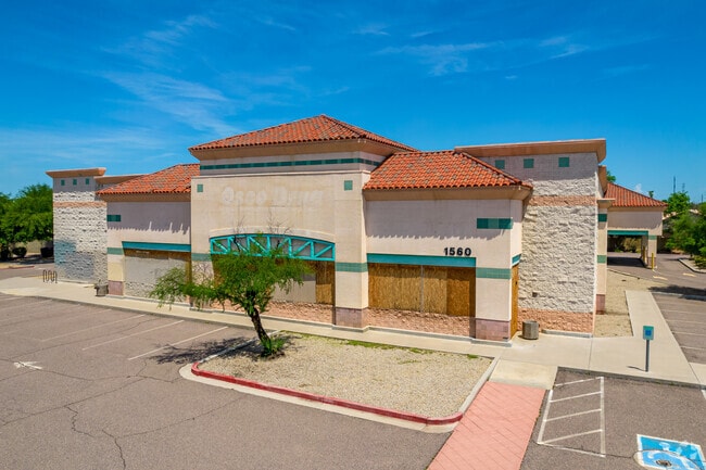
Property Record
1560 E Elliot Rd, Gilbert, AZ 85234


Current Lease Availabilities
Property Detail
1560 E Elliot Rd
304-13-019S
PT SE4 SE4 DAF BEG SE COR SEC TH W 83.46F N 33F TO TPOB TH W 317.47F N 362.45F E 362.45F S 317.47F W 50F S 50.02F TO TPOB EX TH PT CONV P/F 95-0072365 & EX R/W P/F 98-0889315
Storebuilding
Maricopa
C-N
Arizona
C and X Area of minimal flood hazard, usually depicted on FIRMs as above the 500-year flood level.
2.42 AC
2025
Gilbert
2025
Phoenix
422509
Phoenix-Mesa-Chandler, AZ
16,972 SF
NEARBY LISTINGS FOR SALE OR LEASE
DEMOGRAPHICS near 1560 E Elliot Rd
1 mile
3 mile
5 mile
2025 Total Population
13,598
123,258
346,942
2030 Population
13,947
127,285
359,567
Pop Growth 2025-2030
+ 2.57%
+ 3.27%
+ 3.64%
Average Age
38
37
38
2025 Total Households
4,442
42,367
124,667
HH Growth 2025-2030
+ 2.57%
+ 3.35%
+ 3.90%
Median Household Inc
$111,513
$112,886
$98,932
Avg Household Size
3.00
2.80
2.70
2025 Avg HH Vehicles
2.00
2.00
2.00
Median Home Value
$519,508
$551,040
$470,928
Median Year Built
1993
1995
1994
Nearby Places
Map Layers
Map Styles
 Street
 Aerial
Transit
 Traffic
 Biking
Places
Listings with unknown addresses are not visible on the map
- Restaurants
- Banks
- Shops
- Fitness
- Groceries
PUBLIC TRANSPORTATION
AIRPORT
Phoenix-Mesa Gateway
Drive
Walk
Distance
Phoenix-Mesa Gateway
15 min
8.0 mi
Phoenix Sky Harbor International
Drive
Walk
Distance
Phoenix Sky Harbor International
31 min
21.0 mi
Freight Ports
Port of San Diego
Drive
Walk
Distance
Port of San Diego
412 min
373.5 mi
Nearby Properties
Address
Land Use
TOTAL SIZE
Lot Size
Zoning
Address
Land Use
TOTAL SIZE
Lot Size
Zoning
981,158 SF
43.42 AC
C-G
Address
Land Use
TOTAL SIZE
Lot Size
Zoning
9.25 AC
I-1
Address
Land Use
TOTAL SIZE
Lot Size
Zoning
479,727 SF
14.25 AC
MFM
Address
Land Use
TOTAL SIZE
Lot Size
Zoning
290,450 SF
38.47 AC
PF
Address
Land Use
TOTAL SIZE
Lot Size
Zoning
441,928 SF
17.31 AC
RM3
Address
Land Use
TOTAL SIZE
Lot Size
Zoning
238,386 SF
40.25 AC
BP
Address
Land Use
TOTAL SIZE
Lot Size
Zoning
387,535 SF
15.80 AC
C-G
Address
Land Use
TOTAL SIZE
Lot Size
Zoning
380,383 SF
14.79 AC
C-G
Address
Land Use
TOTAL SIZE
Lot Size
Zoning
461,845 SF
21.62 AC
LI
Address
Land Use
TOTAL SIZE
Lot Size
Zoning
112,628 SF
17.37 AC
I-1
Address
Land Use
TOTAL SIZE
Lot Size
Zoning
185,382 SF
23.37 AC
C-G
Address
Land Use
TOTAL SIZE
Lot Size
Zoning
16.57 AC
PF
Address
Land Use
TOTAL SIZE
Lot Size
Zoning
372,953 SF
14.36 AC
C-C
Address
Land Use
TOTAL SIZE
Lot Size
Zoning
16,133 SF
1.79 AC
PF
Address
Land Use
TOTAL SIZE
Lot Size
Zoning
267,868 SF
13.18 AC
R-CH
Address
Land Use
TOTAL SIZE
Lot Size
Zoning
63,507 SF
83.58 AC
PF
Address
Land Use
TOTAL SIZE
Lot Size
Zoning
143,232 SF
26.94 AC
PF
Address
Land Use
TOTAL SIZE
Lot Size
Zoning
238,856 SF
6.53 AC
R3
Address
Land Use
TOTAL SIZE
Lot Size
Zoning
7,418 SF
2.37 AC
C-G
Address
Land Use
TOTAL SIZE
Lot Size
Zoning
237,329 SF
9.76 AC
C-N
Address
Land Use
TOTAL SIZE
Lot Size
Zoning
292,095 SF
15.38 AC
M-M
Address
Land Use
TOTAL SIZE
Lot Size
Zoning
100,580 SF
22.70 AC
C-G
Address
Land Use
TOTAL SIZE
Lot Size
Zoning
98,852 SF
1.23 AC
C-G
Address
Land Use
TOTAL SIZE
Lot Size
Zoning
90,920 SF
2.27 AC
C-O
Address
Land Use
TOTAL SIZE
Lot Size
Zoning
82,212 SF
40 AC
PF
Address
Land Use
TOTAL SIZE
Lot Size
Zoning
233,188 SF
7.34 AC
RM4
Address
Land Use
TOTAL SIZE
Lot Size
Zoning
208,046 SF
23.54 AC
I-1
Address
Land Use
TOTAL SIZE
Lot Size
Zoning
3.83 AC
C-C
Address
Land Use
TOTAL SIZE
Lot Size
Zoning
309,059 SF
15.49 AC
M-M
Address
Land Use
TOTAL SIZE
Lot Size
Zoning
93,287 SF
29.54 AC
PF
The World's #1 Commercial Real Estate Marketplace
Connect with us
© 2026 CoStar Group
The information above has been obtained from sources believed reliable. While we do not doubt its accuracy we have not verified it and make no guarantee, warranty or representation about it. It is your responsibility to independently confirm its accuracy and completeness. Any projections, opinions, assumptions, or estimates used are for example only and do not represent the current or future performance of the property. The value of this transaction to you depends on tax and other factors which should be evaluated by your tax, financial, and legal advisors. You and your advisors should conduct a careful, independent investigation of the property to determine to your satisfaction the suitability of the property for your needs.