Property Record
1560 Mesa Rd, Nipomo, CA 93444
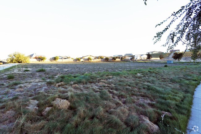

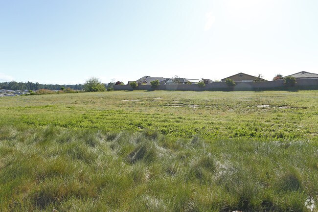
Property Detail
1560 Mesa Rd
091-603-009
TRACT 2341-1 LT 1259
Officebuilding
San Luis Obispo
CS
California
B and X Area of moderate flood hazard, usually the area between the limits of the 100-year and 500-year floods.
1259
2024
1.01 AC
2025
South 101 Corridor
012306
San Luis Obispo/Paso Robles
9,854 SF
San Luis Obispo-Paso Robles, CA
NEARBY LISTINGS FOR SALE OR LEASE
-
-
View all Nipomo listings for sale on LoopNet.com
DEMOGRAPHICS near 1560 Mesa Rd
1 mile
3 mile
5 mile
2025 Total Population
3,126
9,912
29,006
2030 Population
3,149
9,702
28,303
Pop Growth 2025-2030
+ 0.74%
(2.12%)
(2.42%)
Average Age
54
50
43
2025 Total Households
1,319
3,951
10,118
HH Growth 2025-2030
+ 0.53%
(2.23%)
(2.67%)
Median Household Inc
$138,586
$129,900
$105,341
Avg Household Size
2.30
2.40
2.80
2025 Avg HH Vehicles
2.00
2.00
2.00
Median Home Value
$1,059,348
$1,000,924
$830,118
Median Year Built
2008
1998
1989
Nearby Places
Map Layers
Map Styles
 Street
 Aerial
Layers
 Traffic
 Biking
Places
Listings with unknown addresses are not visible on the map
- Restaurants
- Banks
- Shops
- Fitness
- Groceries
PUBLIC TRANSPORTATION
COMMUTER RAIL
Drive
Walk
Distance
9 min
5.4 mi
AIRPORT
San Luis County Regional
Drive
Walk
Distance
San Luis County Regional
33 min
19.4 mi
Nearby Properties
Address
Land Use
TOTAL SIZE
Lot Size
Zoning
Address
Land Use
TOTAL SIZE
Lot Size
Zoning
46,998 SF
564 AC
IND
Address
Land Use
TOTAL SIZE
Lot Size
Zoning
728 SF
4.50 AC
PF
Address
Land Use
TOTAL SIZE
Lot Size
Zoning
43.16 AC
RR
Address
Land Use
TOTAL SIZE
Lot Size
Zoning
124,604 SF
10.51 AC
IND
Address
Land Use
TOTAL SIZE
Lot Size
Zoning
276.22 AC
Address
Land Use
TOTAL SIZE
Lot Size
Zoning
1,200 SF
386.52 AC
AG
Address
Land Use
TOTAL SIZE
Lot Size
Zoning
71.70 AC
RR
Address
Land Use
TOTAL SIZE
Lot Size
Zoning
39.09 AC
RR
Address
Land Use
TOTAL SIZE
Lot Size
Zoning
87,964 SF
4.67 AC
IND
Address
Land Use
TOTAL SIZE
Lot Size
Zoning
47,500 SF
AG
Address
Land Use
TOTAL SIZE
Lot Size
Zoning
253.32 AC
AG
Address
Land Use
TOTAL SIZE
Lot Size
Zoning
216.60 AC
AG
Address
Land Use
TOTAL SIZE
Lot Size
Zoning
31,790 SF
2.28 AC
CS
Address
Land Use
TOTAL SIZE
Lot Size
Zoning
47,041 SF
8.98 AC
IND
Address
Land Use
TOTAL SIZE
Lot Size
Zoning
301 AC
AG
Address
Land Use
TOTAL SIZE
Lot Size
Zoning
194.65 AC
AG
Address
Land Use
TOTAL SIZE
Lot Size
Zoning
2,520 SF
39.20 AC
RR
Address
Land Use
TOTAL SIZE
Lot Size
Zoning
19.51 AC
Address
Land Use
TOTAL SIZE
Lot Size
Zoning
124.60 AC
AG
Address
Land Use
TOTAL SIZE
Lot Size
Zoning
0.01 AC
IND
Address
Land Use
TOTAL SIZE
Lot Size
Zoning
19,200 SF
1.24 AC
IND
Address
Land Use
TOTAL SIZE
Lot Size
Zoning
286 AC
AG
Address
Land Use
TOTAL SIZE
Lot Size
Zoning
122.84 AC
AG
Address
Land Use
TOTAL SIZE
Lot Size
Zoning
20.78 AC
RR
Address
Land Use
TOTAL SIZE
Lot Size
Zoning
76,234 SF
4.67 AC
IND
Address
Land Use
TOTAL SIZE
Lot Size
Zoning
41,952 SF
2.38 AC
IND
Address
Land Use
TOTAL SIZE
Lot Size
Zoning
4,544 SF
55.75 AC
AG
Address
Land Use
TOTAL SIZE
Lot Size
Zoning
119 AC
AG
Address
Land Use
TOTAL SIZE
Lot Size
Zoning
31.50 AC
RR
Address
Land Use
TOTAL SIZE
Lot Size
Zoning
1.28 AC
The World's #1 Commercial Real Estate Marketplace
Connect with us
© 2026 CoStar Group
The information above has been obtained from sources believed reliable. While we do not doubt its accuracy we have not verified it and make no guarantee, warranty or representation about it. It is your responsibility to independently confirm its accuracy and completeness. Any projections, opinions, assumptions, or estimates used are for example only and do not represent the current or future performance of the property. The value of this transaction to you depends on tax and other factors which should be evaluated by your tax, financial, and legal advisors. You and your advisors should conduct a careful, independent investigation of the property to determine to your satisfaction the suitability of the property for your needs.