Property Record
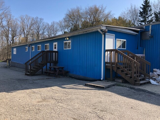
1560 Noble Rd, Williamston, MI 48895


NEARBY LISTINGS FOR SALE OR LEASE
Property Detail
1560 Noble Rd
07-07-14-100-025
E 66 FT OF THE W 1/2 OF NW 1/4OF NW 1/4 OF SEC 14 LYING N OF FROST DRAIN ALSO THAT PART OF W 1/2 OF NW 1/4 OF NW 1/4 SEC 14
Manufacturinglight
Ingham
X
Michigan
26065C0193D
5.46 AC
2024
Mason/SE Ingham County
2025
West Michigan
005700
Lansing-East Lansing, MI
16,500 SF
DEMOGRAPHICS near 1560 Noble Rd
1 Mile
3 Mile
5 Mile
2024 Total Population
212
5,758
10,138
2029 Population
208
5,690
9,989
Pop Growth 2024-2029
(1.89%)
(1.18%)
(1.47%)
Average Age
44
41
42
2024 Total Households
79
2,326
3,964
HH Growth 2024-2029
(1.27%)
(1.20%)
(1.49%)
Median Household Inc
$107,500
$90,748
$103,658
Avg Household Size
2.70
2.40
2.50
2024 Avg HH Vehicles
2.00
2.00
2.00
Median Home Value
$277,585
$251,249
$265,522
Median Year Built
1977
1985
1981
Nearby Places
Map Layers
Map Styles
 Street
 Aerial
- Restaurants
- Banks
- Shops
- Fitness
- Groceries
PUBLIC TRANSPORTATION
AIRPORT
Capital Region International
DRIVE
WALK
Distance
Capital Region International
36 min
23.2 mi
Bishop International
DRIVE
WALK
Distance
Bishop International
71 min
47.5 mi
SALE & LEASE HISTORY
LISTING DATE
SALE/LEASE

Jun 14, 2022
For Sale
Nearby Properties
Address
Land Use
TOTAL SIZE
Lot Size
Zoning
Address
Land Use
TOTAL SIZE
Lot Size
Zoning
75,760 SF
105.10 AC
I-1
Address
Land Use
TOTAL SIZE
Lot Size
Zoning
9,700 SF
45 AC
I-2
Address
Land Use
TOTAL SIZE
Lot Size
Zoning
75,760 SF
37.51 AC
I-1
Address
Land Use
TOTAL SIZE
Lot Size
Zoning
153,984 SF
12.03 AC
I-2
Address
Land Use
TOTAL SIZE
Lot Size
Zoning
63.34 AC
I-1
Address
Land Use
TOTAL SIZE
Lot Size
Zoning
48,846 SF
0.97 AC
C-1
Address
Land Use
TOTAL SIZE
Lot Size
Zoning
9,260 SF
0.58 AC
R-3
Address
Land Use
TOTAL SIZE
Lot Size
Zoning
21,294 SF
4.02 AC
C-2
Address
Land Use
TOTAL SIZE
Lot Size
Zoning
8,544 SF
7.16 AC
C-2
Address
Land Use
TOTAL SIZE
Lot Size
Zoning
37,347 SF
16.98 AC
C-2
Address
Land Use
TOTAL SIZE
Lot Size
Zoning
34,769 SF
2.02 AC
C-1
Address
Land Use
TOTAL SIZE
Lot Size
Zoning
13,016 SF
4.69 AC
R-3
Address
Land Use
TOTAL SIZE
Lot Size
Zoning
13,680 SF
3.83 AC
R-3
Address
Land Use
TOTAL SIZE
Lot Size
Zoning
1,920 SF
30 AC
MH
Address
Land Use
TOTAL SIZE
Lot Size
Zoning
10,140 SF
2.58 AC
I-2
Address
Land Use
TOTAL SIZE
Lot Size
Zoning
5,720 SF
0.76 AC
PO-1
Address
Land Use
TOTAL SIZE
Lot Size
Zoning
7,964 SF
7.84 AC
B-2
Address
Land Use
TOTAL SIZE
Lot Size
Zoning
2,100 SF
3.01 AC
I-1
Address
Land Use
TOTAL SIZE
Lot Size
Zoning
222.84 AC
A-1
Address
Land Use
TOTAL SIZE
Lot Size
Zoning
9,260 SF
0.58 AC
Address
Land Use
TOTAL SIZE
Lot Size
Zoning
226.80 AC
A-1
Address
Land Use
TOTAL SIZE
Lot Size
Zoning
14,598 SF
1.76 AC
C-2
Address
Land Use
TOTAL SIZE
Lot Size
Zoning
200 AC
A-2
Address
Land Use
TOTAL SIZE
Lot Size
Zoning
6,068 SF
3.15 AC
PO-1
Address
Land Use
TOTAL SIZE
Lot Size
Zoning
195.02 AC
A-1
Address
Land Use
TOTAL SIZE
Lot Size
Zoning
200 AC
A-1
Address
Land Use
TOTAL SIZE
Lot Size
Zoning
197.53 AC
A-1
Address
Land Use
TOTAL SIZE
Lot Size
Zoning
10,418 SF
39.90 AC
R-1
Address
Land Use
TOTAL SIZE
Lot Size
Zoning
10,488 SF
1.51 AC
C-3
Address
Land Use
TOTAL SIZE
Lot Size
Zoning
2,480 SF
2.06 AC
C-2
The World's #1 Commercial Real Estate Marketplace
Connect with us
© 2025 CoStar Group
The information above has been obtained from sources believed reliable. While we do not doubt its accuracy we have not verified it and make no guarantee, warranty or representation about it. It is your responsibility to independently confirm its accuracy and completeness. Any projections, opinions, assumptions, or estimates used are for example only and do not represent the current or future performance of the property. The value of this transaction to you depends on tax and other factors which should be evaluated by your tax, financial, and legal advisors. You and your advisors should conduct a careful, independent investigation of the property to determine to your satisfaction the suitability of the property for your needs.