Property Record
15629 Clayton Ave E, Rosemount, MN 55068


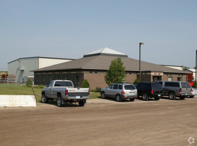
Property Detail
15629 Clayton Ave E
Minneapolis-St. Paul-Bloomington, MN-WI
36 115 19 S 476.54 FT OF N 764.73 FT OF E 1196.83 FT OF N 1/2 OF SE 1/4 EX S 443.55 FT OF N 731.74 FT OF E 735.43 FT OF SAID N 1/2 OF SE 1/4 SECTION 36 TWN 115 RANGE 19
08-03600-77-011
Dakota
Industrialgeneral
Minnesota
B and X Area of moderate flood hazard, usually the area between the limits of the 100-year and 500-year floods.
11
2024
5.46 AC
2024
South Central
061001
Minneapolis/St Paul
33,624 SF
NEARBY LISTINGS FOR SALE OR LEASE
-
-
View all Rosemount listings for sale on LoopNet.com
DEMOGRAPHICS near 15629 Clayton Ave E
1 mile
3 mile
5 mile
2025 Total Population
169
3,931
20,144
2030 Population
174
4,303
21,260
Pop Growth 2025-2030
+ 2.96%
+ 9.46%
+ 5.54%
Average Age
41
36
38
2025 Total Households
65
1,256
6,975
HH Growth 2025-2030
+ 3.08%
+ 9.63%
+ 5.51%
Median Household Inc
$112,500
$168,913
$123,620
Avg Household Size
2.60
3.10
2.90
2025 Avg HH Vehicles
3.00
2.00
2.00
Median Home Value
$447,222
$553,809
$447,365
Median Year Built
1978
2010
2004
Nearby Places
Map Layers
Map Styles
 Street
 Aerial
Layers
 Traffic
 Biking
Places
Listings with unknown addresses are not visible on the map
- Restaurants
- Banks
- Shops
- Fitness
- Groceries
PUBLIC TRANSPORTATION
AIRPORT
Minneapolis-St Paul International/Wold-Chamberlain
Drive
Walk
Distance
Minneapolis-St Paul International/Wold-Chamberlain
30 min
21.1 mi
Nearby Properties
Address
Land Use
TOTAL SIZE
Lot Size
Zoning
Address
Land Use
TOTAL SIZE
Lot Size
Zoning
569,250 SF
97.05 AC
Address
Land Use
TOTAL SIZE
Lot Size
Zoning
267,085 SF
84.38 AC
Address
Land Use
TOTAL SIZE
Lot Size
Zoning
600 SF
348.83 AC
Address
Land Use
TOTAL SIZE
Lot Size
Zoning
275,535 SF
7.52 AC
Address
Land Use
TOTAL SIZE
Lot Size
Zoning
114,778 SF
27.86 AC
Address
Land Use
TOTAL SIZE
Lot Size
Zoning
2,345 SF
626.03 AC
Address
Land Use
TOTAL SIZE
Lot Size
Zoning
200,768 SF
4.49 AC
Address
Land Use
TOTAL SIZE
Lot Size
Zoning
178,943 SF
15.45 AC
Address
Land Use
TOTAL SIZE
Lot Size
Zoning
470.06 AC
Address
Land Use
TOTAL SIZE
Lot Size
Zoning
253,896 SF
121.68 AC
Address
Land Use
TOTAL SIZE
Lot Size
Zoning
159,414 SF
25.25 AC
Address
Land Use
TOTAL SIZE
Lot Size
Zoning
41,928 SF
19.44 AC
Address
Land Use
TOTAL SIZE
Lot Size
Zoning
57,238 SF
51.12 AC
Address
Land Use
TOTAL SIZE
Lot Size
Zoning
238.57 AC
Address
Land Use
TOTAL SIZE
Lot Size
Zoning
35.79 AC
Address
Land Use
TOTAL SIZE
Lot Size
Zoning
40,500 SF
81.33 AC
Address
Land Use
TOTAL SIZE
Lot Size
Zoning
92,800 SF
11.58 AC
Address
Land Use
TOTAL SIZE
Lot Size
Zoning
56,594 SF
34.09 AC
Address
Land Use
TOTAL SIZE
Lot Size
Zoning
94,782 SF
32.84 AC
Address
Land Use
TOTAL SIZE
Lot Size
Zoning
Address
Land Use
TOTAL SIZE
Lot Size
Zoning
3,660 SF
87.34 AC
Address
Land Use
TOTAL SIZE
Lot Size
Zoning
35,504 SF
28.35 AC
Address
Land Use
TOTAL SIZE
Lot Size
Zoning
20,208 SF
12.63 AC
Address
Land Use
TOTAL SIZE
Lot Size
Zoning
23,249 SF
10.65 AC
Address
Land Use
TOTAL SIZE
Lot Size
Zoning
28,800 SF
10.02 AC
Address
Land Use
TOTAL SIZE
Lot Size
Zoning
12,792 SF
259.67 AC
The World's #1 Commercial Real Estate Marketplace
Connect with us
© 2026 CoStar Group
The information above has been obtained from sources believed reliable. While we do not doubt its accuracy we have not verified it and make no guarantee, warranty or representation about it. It is your responsibility to independently confirm its accuracy and completeness. Any projections, opinions, assumptions, or estimates used are for example only and do not represent the current or future performance of the property. The value of this transaction to you depends on tax and other factors which should be evaluated by your tax, financial, and legal advisors. You and your advisors should conduct a careful, independent investigation of the property to determine to your satisfaction the suitability of the property for your needs.