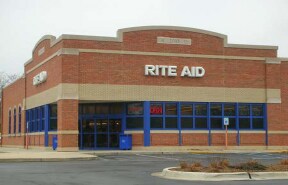
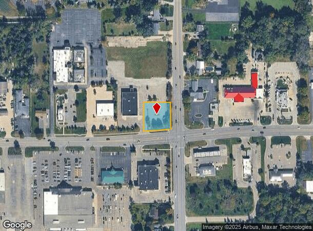
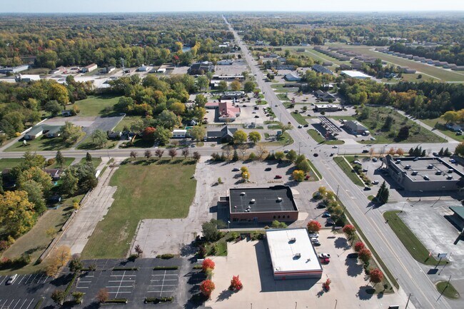
Property Record
1567 E Pierson Rd, Flushing, MI 48433
NEARBY LISTINGS FOR SALE OR LEASE
Property Detail
1567 E Pierson Rd
55-25-400-008
S 218.15 FT OF E 200 FT OF SE 1/4 SEC 25 T8N R5E 1.00 A. REINSTATED PER MTT DOCKET #433682 (12)
Commercialacreage
Genesee
X
Michigan
26049C0162D
1 AC
2024
Flint
2025
Detroit
010603
Flint, MI
DEMOGRAPHICS near 1567 E Pierson Rd
1 mile
3 mile
5 mile
2024 Total Population
3,512
21,532
60,799
2029 Population
3,389
20,849
59,796
Pop Growth 2024-2029
(3.50%)
(3.17%)
(1.65%)
Average Age
44
43
42
2024 Total Households
1,456
8,854
24,890
HH Growth 2024-2029
(3.57%)
(3.21%)
(1.69%)
Median Household Inc
$66,774
$69,005
$52,839
Avg Household Size
2.30
2.40
2.40
2024 Avg HH Vehicles
2.00
2.00
2.00
Median Home Value
$162,382
$181,544
$146,183
Median Year Built
1965
1973
1967
Nearby Places
Map Layers
Map Styles
 Street
 Aerial
Transit
 Traffic
 Biking
Places
Listings with unknown addresses are not visible on the map
- Restaurants
- Banks
- Shops
- Fitness
- Groceries
PUBLIC TRANSPORTATION
AIRPORT
Bishop International
Drive
Walk
Distance
Bishop International
25 min
11.1 mi
Freight Ports
Port of Toledo
Drive
Walk
Distance
Port of Toledo
141 min
118.8 mi
SALE & LEASE HISTORY
LISTING DATE
SALE/LEASE

Oct 11, 2022
For Sale
May 23, 2023
For Sale
Jan 09, 2020
For Sale
Nearby Properties
Address
Land Use
TOTAL SIZE
Lot Size
Zoning
Address
Land Use
TOTAL SIZE
Lot Size
Zoning
159,326 SF
25.20 AC
Address
Land Use
TOTAL SIZE
Lot Size
Zoning
106,551 SF
11.44 AC
R3-B (HDR)
Address
Land Use
TOTAL SIZE
Lot Size
Zoning
72,367 SF
10.60 AC
R3-B (HDR)
Address
Land Use
TOTAL SIZE
Lot Size
Zoning
11.97 AC
Address
Land Use
TOTAL SIZE
Lot Size
Zoning
10.30 AC
Address
Land Use
TOTAL SIZE
Lot Size
Zoning
41,298 SF
9.49 AC
Address
Land Use
TOTAL SIZE
Lot Size
Zoning
67,266 SF
8.11 AC
CBD CENTL
Address
Land Use
TOTAL SIZE
Lot Size
Zoning
133,008 SF
7.46 AC
RES R-3 A
Address
Land Use
TOTAL SIZE
Lot Size
Zoning
11.12 AC
Address
Land Use
TOTAL SIZE
Lot Size
Zoning
9.46 AC
Address
Land Use
TOTAL SIZE
Lot Size
Zoning
13.20 AC
Address
Land Use
TOTAL SIZE
Lot Size
Zoning
Address
Land Use
TOTAL SIZE
Lot Size
Zoning
5.10 AC
Address
Land Use
TOTAL SIZE
Lot Size
Zoning
62,121 SF
6.23 AC
B-2 CC GEN
Address
Land Use
TOTAL SIZE
Lot Size
Zoning
104.81 AC
Address
Land Use
TOTAL SIZE
Lot Size
Zoning
Address
Land Use
TOTAL SIZE
Lot Size
Zoning
5.70 AC
Address
Land Use
TOTAL SIZE
Lot Size
Zoning
2.02 AC
Address
Land Use
TOTAL SIZE
Lot Size
Zoning
1.41 AC
Address
Land Use
TOTAL SIZE
Lot Size
Zoning
3.32 AC
Address
Land Use
TOTAL SIZE
Lot Size
Zoning
10,402 SF
2.10 AC
Address
Land Use
TOTAL SIZE
Lot Size
Zoning
21,763 SF
4.36 AC
B-2 CC GEN
Address
Land Use
TOTAL SIZE
Lot Size
Zoning
31,008 SF
6.14 AC
R3-B (HDR)
Address
Land Use
TOTAL SIZE
Lot Size
Zoning
18.66 AC
Address
Land Use
TOTAL SIZE
Lot Size
Zoning
3.52 AC
Address
Land Use
TOTAL SIZE
Lot Size
Zoning
2.74 AC
Address
Land Use
TOTAL SIZE
Lot Size
Zoning
Address
Land Use
TOTAL SIZE
Lot Size
Zoning
12,500 SF
6.84 AC
Address
Land Use
TOTAL SIZE
Lot Size
Zoning
8,576 SF
5.75 AC
Address
Land Use
TOTAL SIZE
Lot Size
Zoning
34,708 SF
5.05 AC
B-2 CC GEN
The World's #1 Commercial Real Estate Marketplace
Connect with us
© 2026 CoStar Group
The information above has been obtained from sources believed reliable. While we do not doubt its accuracy we have not verified it and make no guarantee, warranty or representation about it. It is your responsibility to independently confirm its accuracy and completeness. Any projections, opinions, assumptions, or estimates used are for example only and do not represent the current or future performance of the property. The value of this transaction to you depends on tax and other factors which should be evaluated by your tax, financial, and legal advisors. You and your advisors should conduct a careful, independent investigation of the property to determine to your satisfaction the suitability of the property for your needs.