Property Record
1567 Cherry Rd, Memphis, TN 38117
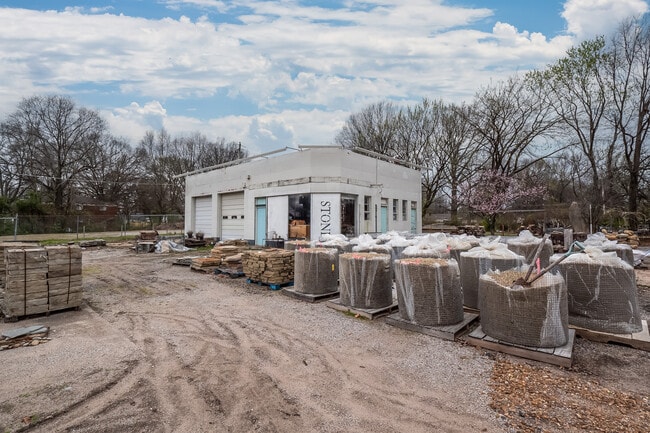
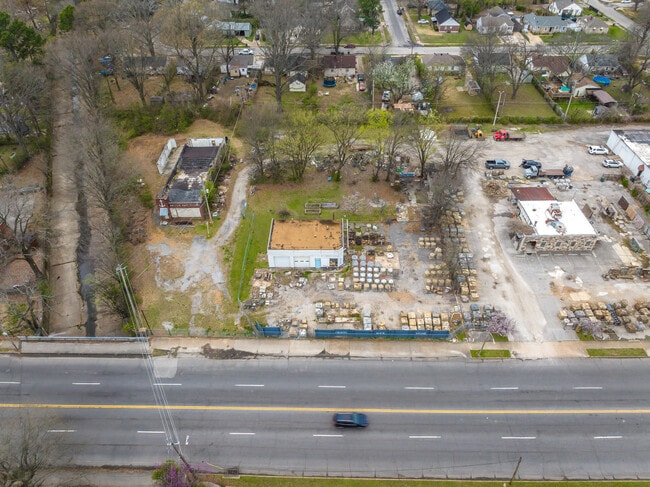
This Property Is For Sale
NEARBY LISTINGS FOR SALE OR LEASE
Property Detail
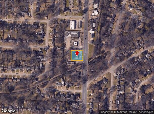
1567 Cherry Rd
Memphis, TN-MS-AR
Taras Cherry St
05-8155-0-0097C
WS CHERRY RD
Autorepair
Shelby
X
Tennessee
47157C0435F
3&pt2
2024
0.43 AC
2025
Southeast
011800
Memphis
1,376 SF
DEMOGRAPHICS near 1567 Cherry Rd
1 Mile
3 Mile
5 Mile
2024 Total Population
12,647
97,044
220,125
2029 Population
12,410
96,122
218,204
Pop Growth 2024-2029
(1.87%)
(0.95%)
(0.87%)
Average Age
34
37
37
2024 Total Households
4,708
38,801
89,991
HH Growth 2024-2029
(2.04%)
(1.09%)
(0.98%)
Median Household Inc
$44,385
$44,542
$47,460
Avg Household Size
2.60
2.40
2.40
2024 Avg HH Vehicles
2.00
2.00
2.00
Median Home Value
$113,154
$158,792
$205,857
Median Year Built
1956
1964
1966
Nearby Places
- Restaurants
- Banks
- Shops
- Fitness
- Groceries
PUBLIC TRANSPORTATION
COMMUTER RAIL
Central Station (Riverfront Loop - Memphis Area Transit Authority Trolley (MataTrolley))
DRIVE
WALK
Distance
Central Station (Riverfront Loop - Memphis Area Transit Authority Trolley (MataTrolley))
17 min
10.0 mi
AIRPORT
Memphis International
DRIVE
WALK
Distance
Memphis International
12 min
7.6 mi
Freight Ports
Port of Shreveport
DRIVE
WALK
Distance
Port of Shreveport
412 min
377.4 mi
Nearby Properties
Address
Land Use
TOTAL SIZE
Lot Size
Zoning
Address
Land Use
TOTAL SIZE
Lot Size
Zoning
189,536 SF
49.14 AC
CMU-2
Address
Land Use
TOTAL SIZE
Lot Size
Zoning
286,167 SF
18.91 AC
R-10
Address
Land Use
TOTAL SIZE
Lot Size
Zoning
190,263 SF
6.59 AC
R-10
Address
Land Use
TOTAL SIZE
Lot Size
Zoning
118,073 SF
4.75 AC
CMU-1
Address
Land Use
TOTAL SIZE
Lot Size
Zoning
24.72 AC
R-10
Address
Land Use
TOTAL SIZE
Lot Size
Zoning
109,774 SF
8.80 AC
CMU-1
Address
Land Use
TOTAL SIZE
Lot Size
Zoning
269,022 SF
23.76 AC
RU-3
Address
Land Use
TOTAL SIZE
Lot Size
Zoning
188,458 SF
29.19 AC
RU-3
Address
Land Use
TOTAL SIZE
Lot Size
Zoning
66,067 SF
3.01 AC
CMU-3
Address
Land Use
TOTAL SIZE
Lot Size
Zoning
145,980 SF
16.50 AC
RU-3
Address
Land Use
TOTAL SIZE
Lot Size
Zoning
206,186 SF
13.64 AC
CMU-2
Address
Land Use
TOTAL SIZE
Lot Size
Zoning
123,976 SF
10.31 AC
CMU-3
Address
Land Use
TOTAL SIZE
Lot Size
Zoning
87,283 SF
2.14 AC
CMU-1
Address
Land Use
TOTAL SIZE
Lot Size
Zoning
81,454 SF
EMP
Address
Land Use
TOTAL SIZE
Lot Size
Zoning
58.21 AC
R-6
Address
Land Use
TOTAL SIZE
Lot Size
Zoning
76,115 SF
4.94 AC
CMU-3
Address
Land Use
TOTAL SIZE
Lot Size
Zoning
100,182 SF
9.39 AC
CMU-3
Address
Land Use
TOTAL SIZE
Lot Size
Zoning
300,702 SF
14.40 AC
RU-3
Address
Land Use
TOTAL SIZE
Lot Size
Zoning
15,370 SF
18.69 AC
RU-3
Address
Land Use
TOTAL SIZE
Lot Size
Zoning
55,250 SF
7.15 AC
CMU-3
Address
Land Use
TOTAL SIZE
Lot Size
Zoning
129 AC
CMP-1
Address
Land Use
TOTAL SIZE
Lot Size
Zoning
181.02 AC
R-15
Address
Land Use
TOTAL SIZE
Lot Size
Zoning
1,012,609 SF
38.67 AC
IH
Address
Land Use
TOTAL SIZE
Lot Size
Zoning
200,040 SF
12 AC
R-10
Address
Land Use
TOTAL SIZE
Lot Size
Zoning
274,100 SF
7.79 AC
CMU-3
Address
Land Use
TOTAL SIZE
Lot Size
Zoning
369,190 SF
23.75 AC
EMP
Address
Land Use
TOTAL SIZE
Lot Size
Zoning
173,089 SF
10.92 AC
EMP
Address
Land Use
TOTAL SIZE
Lot Size
Zoning
81,516 SF
2.76 AC
RU-3
Address
Land Use
TOTAL SIZE
Lot Size
Zoning
138,881 SF
9.91 AC
CMU-2
Address
Land Use
TOTAL SIZE
Lot Size
Zoning
19.54 AC
R-10
The World's #1 Commercial Real Estate Marketplace
Connect with us
© 2025 CoStar Group
The information above has been obtained from sources believed reliable. While we do not doubt its accuracy we have not verified it and make no guarantee, warranty or representation about it. It is your responsibility to independently confirm its accuracy and completeness. Any projections, opinions, assumptions, or estimates used are for example only and do not represent the current or future performance of the property. The value of this transaction to you depends on tax and other factors which should be evaluated by your tax, financial, and legal advisors. You and your advisors should conduct a careful, independent investigation of the property to determine to your satisfaction the suitability of the property for your needs.