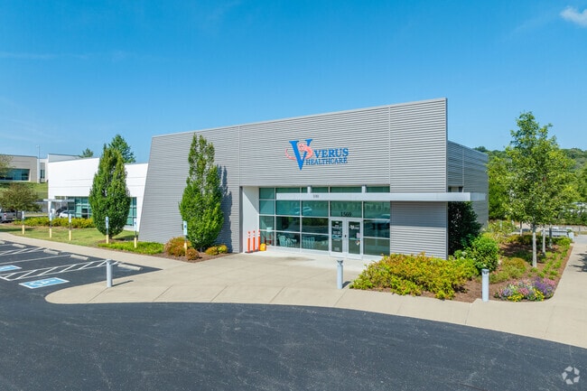
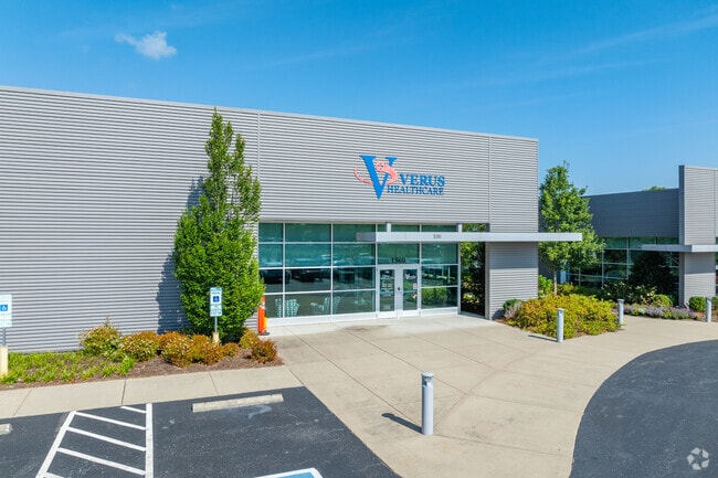
Property Record
1569 Mallory Ln, Brentwood, TN 37027
NEARBY LISTINGS FOR SALE OR LEASE
Property Detail
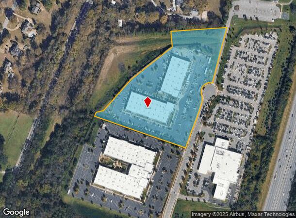
1569 Mallory Ln
Nashville-Davidson--Murfreesboro--Franklin, TN
Mallory Park
035I-F-002.01
SUBD MALLORY PARK PH2 PB 61 PG 63 LOT 0203
Miscellaneous
Williamson
X
Tennessee
47187C0206F
0203
2024
7.79 AC
2025
Cool Springs
050306
Nashville
64,327 SF
DEMOGRAPHICS near 1569 Mallory Ln
1 Mile
3 Mile
5 Mile
2024 Total Population
3,553
30,347
95,086
2029 Population
4,042
34,665
107,137
Pop Growth 2024-2029
+ 13.76%
+ 14.23%
+ 12.67%
Average Age
42
42
41
2024 Total Households
1,225
11,980
35,941
HH Growth 2024-2029
+ 13.88%
+ 14.55%
+ 12.71%
Median Household Inc
$132,802
$116,503
$127,634
Avg Household Size
2.90
2.50
2.60
2024 Avg HH Vehicles
2.00
2.00
2.00
Median Home Value
$693,228
$730,513
$671,241
Median Year Built
1976
1993
1996
Nearby Places
Map Layers
Map Styles
 Street
 Aerial
- Restaurants
- Banks
- Shops
- Fitness
- Groceries
PUBLIC TRANSPORTATION
AIRPORT
Nashville International
DRIVE
WALK
Distance
Nashville International
28 min
17.7 mi
Freight Ports
Port of Mobile
DRIVE
WALK
Distance
Port of Mobile
471 min
432.3 mi
SALE & LEASE HISTORY
LISTING DATE
SALE/LEASE

Sep 25, 2016
For Lease
Nearby Properties
Address
Land Use
TOTAL SIZE
Lot Size
Zoning
Address
Land Use
TOTAL SIZE
Lot Size
Zoning
968,734 SF
50.12 AC
Address
Land Use
TOTAL SIZE
Lot Size
Zoning
54,218 SF
53.35 AC
Address
Land Use
TOTAL SIZE
Lot Size
Zoning
1,666,724 SF
10.29 AC
Address
Land Use
TOTAL SIZE
Lot Size
Zoning
645,388 SF
60.30 AC
Address
Land Use
TOTAL SIZE
Lot Size
Zoning
742,974 SF
48.30 AC
Address
Land Use
TOTAL SIZE
Lot Size
Zoning
534,414 SF
45.07 AC
Address
Land Use
TOTAL SIZE
Lot Size
Zoning
510,452 SF
32.21 AC
Address
Land Use
TOTAL SIZE
Lot Size
Zoning
424,987 SF
28.23 AC
Address
Land Use
TOTAL SIZE
Lot Size
Zoning
416,140 SF
26.01 AC
Address
Land Use
TOTAL SIZE
Lot Size
Zoning
385,251 SF
20.56 AC
Address
Land Use
TOTAL SIZE
Lot Size
Zoning
614,370 SF
9.59 AC
Address
Land Use
TOTAL SIZE
Lot Size
Zoning
594,489 SF
6.18 AC
Address
Land Use
TOTAL SIZE
Lot Size
Zoning
271,830 SF
13.99 AC
Address
Land Use
TOTAL SIZE
Lot Size
Zoning
337,166 SF
23.37 AC
Address
Land Use
TOTAL SIZE
Lot Size
Zoning
175,922 SF
4.16 AC
Address
Land Use
TOTAL SIZE
Lot Size
Zoning
191,646 SF
5.21 AC
Address
Land Use
TOTAL SIZE
Lot Size
Zoning
208,640 SF
6.37 AC
Address
Land Use
TOTAL SIZE
Lot Size
Zoning
184,173 SF
25.13 AC
Address
Land Use
TOTAL SIZE
Lot Size
Zoning
255,104 SF
32.04 AC
Address
Land Use
TOTAL SIZE
Lot Size
Zoning
264,048 SF
6.51 AC
Address
Land Use
TOTAL SIZE
Lot Size
Zoning
182,125 SF
13.91 AC
Address
Land Use
TOTAL SIZE
Lot Size
Zoning
181,476 SF
25.23 AC
Address
Land Use
TOTAL SIZE
Lot Size
Zoning
205,133 SF
6.80 AC
Address
Land Use
TOTAL SIZE
Lot Size
Zoning
159,650 SF
16.06 AC
Address
Land Use
TOTAL SIZE
Lot Size
Zoning
204,215 SF
5.99 AC
Address
Land Use
TOTAL SIZE
Lot Size
Zoning
217,324 SF
21.14 AC
Address
Land Use
TOTAL SIZE
Lot Size
Zoning
206,736 SF
18.08 AC
Address
Land Use
TOTAL SIZE
Lot Size
Zoning
166,653 SF
15.86 AC
Address
Land Use
TOTAL SIZE
Lot Size
Zoning
96,726 SF
18.72 AC
Address
Land Use
TOTAL SIZE
Lot Size
Zoning
166,653 SF
11.69 AC
The World's #1 Commercial Real Estate Marketplace
Connect with us
© 2025 CoStar Group
The information above has been obtained from sources believed reliable. While we do not doubt its accuracy we have not verified it and make no guarantee, warranty or representation about it. It is your responsibility to independently confirm its accuracy and completeness. Any projections, opinions, assumptions, or estimates used are for example only and do not represent the current or future performance of the property. The value of this transaction to you depends on tax and other factors which should be evaluated by your tax, financial, and legal advisors. You and your advisors should conduct a careful, independent investigation of the property to determine to your satisfaction the suitability of the property for your needs.