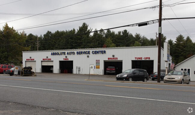
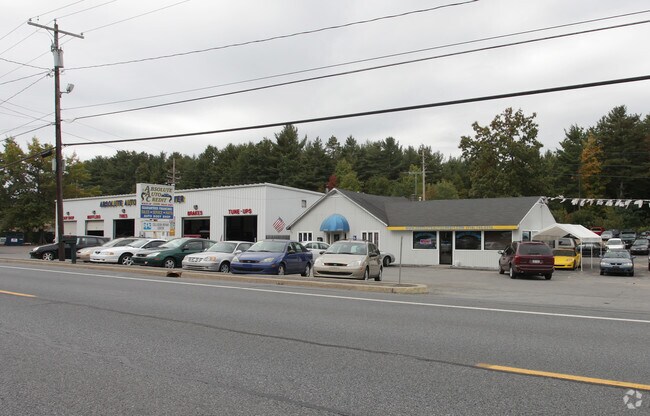
Property Record
1569 Route 9, Fort Edward, NY 12828
NEARBY LISTINGS FOR SALE OR LEASE
Property Detail
1569 Route 9
Albany-Schenectady-Troy, NY
Saratoga
414489-063-000-0001-017-000-0000
New York
Autorepair
17.000
2025
3.94 AC
2024
Saratoga County
060102
Albany/Schenectady/Troy
2,160 SF
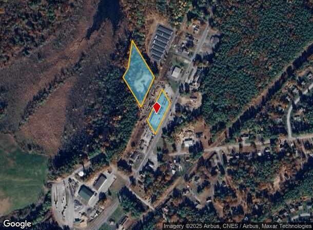
DEMOGRAPHICS near 1569 Route 9
1 Mile
3 Mile
5 Mile
2024 Total Population
3,374
18,388
55,259
2029 Population
3,491
18,809
55,184
Pop Growth 2024-2029
+ 3.47%
+ 2.29%
(0.14%)
Average Age
44
43
42
2024 Total Households
1,412
7,777
23,525
HH Growth 2024-2029
+ 3.47%
+ 2.17%
(0.26%)
Median Household Inc
$89,608
$80,697
$70,315
Avg Household Size
2.40
2.30
2.30
2024 Avg HH Vehicles
2.00
2.00
2.00
Median Home Value
$226,932
$206,586
$193,230
Median Year Built
1982
1974
1966
Nearby Places
Map Layers
Map Styles
 Street
 Aerial
- Restaurants
- Banks
- Shops
- Fitness
- Groceries
PUBLIC TRANSPORTATION
COMMUTER RAIL
DRIVE
WALK
Distance
10 min
5.3 mi
Freight Ports
Albany, NY Port
DRIVE
WALK
Distance
Albany, NY Port
66 min
50.7 mi
Nearby Properties
Address
Land Use
TOTAL SIZE
Lot Size
Zoning
Address
Land Use
TOTAL SIZE
Lot Size
Zoning
115.90 AC
WR
Address
Land Use
TOTAL SIZE
Lot Size
Zoning
9,216 SF
32.20 AC
UR
Address
Land Use
TOTAL SIZE
Lot Size
Zoning
938 SF
80.03 AC
C1
Address
Land Use
TOTAL SIZE
Lot Size
Zoning
5,680 SF
39.79 AC
UR
Address
Land Use
TOTAL SIZE
Lot Size
Zoning
144,029 SF
28.34 AC
R1
Address
Land Use
TOTAL SIZE
Lot Size
Zoning
22,317 SF
5.28 AC
C1
Address
Land Use
TOTAL SIZE
Lot Size
Zoning
16.20 AC
R1
Address
Land Use
TOTAL SIZE
Lot Size
Zoning
125,082 SF
17.54 AC
R2
Address
Land Use
TOTAL SIZE
Lot Size
Zoning
76,451 SF
23.20 AC
R2
Address
Land Use
TOTAL SIZE
Lot Size
Zoning
64,654 SF
4.03 AC
GC1
Address
Land Use
TOTAL SIZE
Lot Size
Zoning
4,340 SF
0.40 AC
PUD
Address
Land Use
TOTAL SIZE
Lot Size
Zoning
55,069 SF
6.76 AC
CI-18
Address
Land Use
TOTAL SIZE
Lot Size
Zoning
1,216 SF
34.17 AC
R2
Address
Land Use
TOTAL SIZE
Lot Size
Zoning
11,068 SF
6.90 AC
CLI
Address
Land Use
TOTAL SIZE
Lot Size
Zoning
1,400 SF
31.07 AC
R3
Address
Land Use
TOTAL SIZE
Lot Size
Zoning
56,884 SF
8.73 AC
R2
Address
Land Use
TOTAL SIZE
Lot Size
Zoning
129,675 SF
11.69 AC
CLI
Address
Land Use
TOTAL SIZE
Lot Size
Zoning
62,278 SF
6.86 AC
C1
Address
Land Use
TOTAL SIZE
Lot Size
Zoning
36,657 SF
5.12 AC
C2
Address
Land Use
TOTAL SIZE
Lot Size
Zoning
66,060 SF
6.18 AC
MS
Address
Land Use
TOTAL SIZE
Lot Size
Zoning
80,806 SF
1.45 AC
GC2
Address
Land Use
TOTAL SIZE
Lot Size
Zoning
25,400 SF
9.38 AC
CLI
Address
Land Use
TOTAL SIZE
Lot Size
Zoning
43,555 SF
3.57 AC
CI-18
Address
Land Use
TOTAL SIZE
Lot Size
Zoning
31,596 SF
4.18 AC
GC2
Address
Land Use
TOTAL SIZE
Lot Size
Zoning
53,590 SF
13.74 AC
R1
Address
Land Use
TOTAL SIZE
Lot Size
Zoning
151,358 SF
17.03 AC
HI
Address
Land Use
TOTAL SIZE
Lot Size
Zoning
63,146 SF
4.70 AC
CLI
Address
Land Use
TOTAL SIZE
Lot Size
Zoning
4,715 SF
43.55 AC
RP
Address
Land Use
TOTAL SIZE
Lot Size
Zoning
18,000 SF
5.18 AC
LI
Address
Land Use
TOTAL SIZE
Lot Size
Zoning
11,784 SF
3.85 AC
R-M
The World's #1 Commercial Real Estate Marketplace
Connect with us
© 2026 CoStar Group
The information above has been obtained from sources believed reliable. While we do not doubt its accuracy we have not verified it and make no guarantee, warranty or representation about it. It is your responsibility to independently confirm its accuracy and completeness. Any projections, opinions, assumptions, or estimates used are for example only and do not represent the current or future performance of the property. The value of this transaction to you depends on tax and other factors which should be evaluated by your tax, financial, and legal advisors. You and your advisors should conduct a careful, independent investigation of the property to determine to your satisfaction the suitability of the property for your needs.