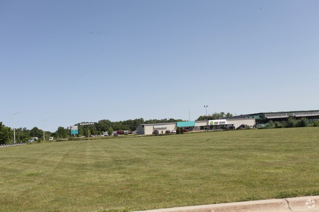
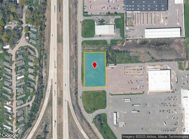
Property Record
157 73Rd St, South Haven, MI 49090
NEARBY LISTINGS FOR SALE OR LEASE
Property Detail
157 73Rd St
80-53-869-026-01
C926 2-1-17 903-389 * COM AT SE COR OF SEC, TH S88D04'22"W ON S SEC L 235.0', TH N1D55'38"W AT RT ANG 573.0', TH S88D04' 22"W
Commercialacreage
Van Buren
X
Michigan
26159C0017D
1.52 AC
2024
Van Buren County
2025
West Michigan
010500
Kalamazoo-Portage, MI
DEMOGRAPHICS near 157 73Rd St
1 Mile
3 Mile
5 Mile
2024 Total Population
2,240
10,275
14,076
2029 Population
2,324
10,721
14,608
Pop Growth 2024-2029
+ 3.75%
+ 4.34%
+ 3.78%
Average Age
47
48
47
2024 Total Households
1,036
4,780
6,325
HH Growth 2024-2029
+ 4.25%
+ 4.81%
+ 4.22%
Median Household Inc
$45,238
$54,538
$56,634
Avg Household Size
2.10
2.10
2.20
2024 Avg HH Vehicles
2.00
2.00
2.00
Median Home Value
$258,536
$285,535
$274,871
Median Year Built
1971
1972
1974
Nearby Places
- Restaurants
- Banks
- Shops
- Fitness
- Groceries
Nearby Properties
Address
Land Use
TOTAL SIZE
Lot Size
Zoning
Address
Land Use
TOTAL SIZE
Lot Size
Zoning
190,640 SF
12.53 AC
Address
Land Use
TOTAL SIZE
Lot Size
Zoning
199,297 SF
28.26 AC
B-4
Address
Land Use
TOTAL SIZE
Lot Size
Zoning
5,878 SF
21.47 AC
Address
Land Use
TOTAL SIZE
Lot Size
Zoning
223,972 SF
14.11 AC
B-2
Address
Land Use
TOTAL SIZE
Lot Size
Zoning
50,000 SF
3.11 AC
Address
Land Use
TOTAL SIZE
Lot Size
Zoning
36,203 SF
4.40 AC
RM-1
Address
Land Use
TOTAL SIZE
Lot Size
Zoning
1,428 SF
5.80 AC
HIGH DENSE
Address
Land Use
TOTAL SIZE
Lot Size
Zoning
121,966 SF
19.66 AC
I-2
Address
Land Use
TOTAL SIZE
Lot Size
Zoning
4,874 SF
15.82 AC
Address
Land Use
TOTAL SIZE
Lot Size
Zoning
26,272 SF
Address
Land Use
TOTAL SIZE
Lot Size
Zoning
152,748 SF
16.10 AC
I-1
Address
Land Use
TOTAL SIZE
Lot Size
Zoning
39,372 SF
6.84 AC
RM-1
Address
Land Use
TOTAL SIZE
Lot Size
Zoning
38,967 SF
3.90 AC
RM-1
Address
Land Use
TOTAL SIZE
Lot Size
Zoning
38,500 SF
Address
Land Use
TOTAL SIZE
Lot Size
Zoning
4,194 SF
0.53 AC
B-3
Address
Land Use
TOTAL SIZE
Lot Size
Zoning
32,268 SF
2.62 AC
R-2
Address
Land Use
TOTAL SIZE
Lot Size
Zoning
8,340 SF
12.53 AC
Address
Land Use
TOTAL SIZE
Lot Size
Zoning
37,152 SF
5.25 AC
Address
Land Use
TOTAL SIZE
Lot Size
Zoning
2,640 SF
7.80 AC
B-4
Address
Land Use
TOTAL SIZE
Lot Size
Zoning
36,800 SF
2.20 AC
B-3
Address
Land Use
TOTAL SIZE
Lot Size
Zoning
19,602 SF
0.23 AC
CBD
Address
Land Use
TOTAL SIZE
Lot Size
Zoning
32,040 SF
1.60 AC
PUD
Address
Land Use
TOTAL SIZE
Lot Size
Zoning
6,961 SF
0.23 AC
B-3
Address
Land Use
TOTAL SIZE
Lot Size
Zoning
43,920 SF
5.63 AC
RM-1
Address
Land Use
TOTAL SIZE
Lot Size
Zoning
8,976 SF
5.90 AC
RM-1
Address
Land Use
TOTAL SIZE
Lot Size
Zoning
6,705 SF
0.37 AC
RM-1
Address
Land Use
TOTAL SIZE
Lot Size
Zoning
14.14 AC
RM-1
Address
Land Use
TOTAL SIZE
Lot Size
Zoning
26,666 SF
1.56 AC
RM-1
Address
Land Use
TOTAL SIZE
Lot Size
Zoning
20,144 SF
86,684 AC
B-3
Address
Land Use
TOTAL SIZE
Lot Size
Zoning
6,129 SF
84.25 AC
AGRICU
The World's #1 Commercial Real Estate Marketplace
Connect with us
© 2025 CoStar Group
The information above has been obtained from sources believed reliable. While we do not doubt its accuracy we have not verified it and make no guarantee, warranty or representation about it. It is your responsibility to independently confirm its accuracy and completeness. Any projections, opinions, assumptions, or estimates used are for example only and do not represent the current or future performance of the property. The value of this transaction to you depends on tax and other factors which should be evaluated by your tax, financial, and legal advisors. You and your advisors should conduct a careful, independent investigation of the property to determine to your satisfaction the suitability of the property for your needs.