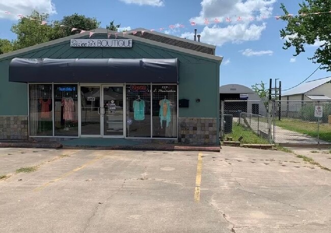
Property Record
157 E Plantation Dr, Clute, TX 77531

Property Detail
157 E Plantation Dr
Houston-Pasadena-The Woodlands, TX
SEABRON (A0049 A CALVIT DIV 14 (B C I C)(CLUTE) LOT 10-10A-20A-21A
7487-0005-000
Brazoria
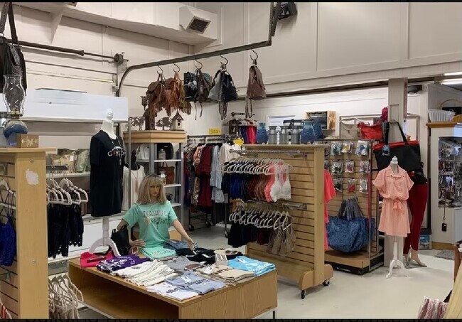
Commercialnec
Texas
B and X Area of moderate flood hazard, usually the area between the limits of the 100-year and 500-year floods.
10
2024
0.39 AC
2025
Far South
663900
Houston
4,800 SF
NEARBY LISTINGS FOR SALE OR LEASE
DEMOGRAPHICS near 157 E Plantation Dr
1 mile
3 mile
5 mile
2025 Total Population
7,658
34,987
64,020
2030 Population
8,631
38,831
71,119
Pop Growth 2025-2030
+ 12.71%
+ 10.99%
+ 11.09%
Average Age
36
37
38
2025 Total Households
2,812
13,251
24,306
HH Growth 2025-2030
+ 13.23%
+ 11.49%
+ 11.51%
Median Household Inc
$62,118
$75,514
$76,366
Avg Household Size
2.70
2.60
2.60
2025 Avg HH Vehicles
2.00
2.00
2.00
Median Home Value
$158,368
$229,439
$239,536
Median Year Built
1982
1981
1983
Nearby Places
Map Layers
Map Styles
 Street
 Aerial
Transit
 Traffic
 Biking
Places
Listings with unknown addresses are not visible on the map
- Restaurants
- Banks
- Shops
- Fitness
- Groceries
SALE & LEASE HISTORY
LISTING DATE
SALE/LEASE

Oct 19, 2023
For Sale
Oct 02, 2017
For Sale
May 08, 2019
For Sale
Jun 26, 2024
For Sale
Jun 09, 2023
For Sale
Nearby Properties
Address
Land Use
TOTAL SIZE
Lot Size
Zoning
Address
Land Use
TOTAL SIZE
Lot Size
Zoning
35.50 AC
8680
Address
Land Use
TOTAL SIZE
Lot Size
Zoning
Address
Land Use
TOTAL SIZE
Lot Size
Zoning
13.41 AC
Address
Land Use
TOTAL SIZE
Lot Size
Zoning
274,303 SF
15.11 AC
0004
Address
Land Use
TOTAL SIZE
Lot Size
Zoning
98.38 AC
0182
Address
Land Use
TOTAL SIZE
Lot Size
Zoning
205,161 SF
9.47 AC
Address
Land Use
TOTAL SIZE
Lot Size
Zoning
123,012 SF
13.36 AC
Address
Land Use
TOTAL SIZE
Lot Size
Zoning
172,426 SF
74.07 AC
0146
Address
Land Use
TOTAL SIZE
Lot Size
Zoning
90,104 SF
45.22 AC
0180
Address
Land Use
TOTAL SIZE
Lot Size
Zoning
161,170 SF
8.67 AC
Address
Land Use
TOTAL SIZE
Lot Size
Zoning
253,058 SF
12.07 AC
Address
Land Use
TOTAL SIZE
Lot Size
Zoning
102,425 SF
15.42 AC
Address
Land Use
TOTAL SIZE
Lot Size
Zoning
200,113 SF
10.07 AC
0033
Address
Land Use
TOTAL SIZE
Lot Size
Zoning
94,891 SF
13.94 AC
Address
Land Use
TOTAL SIZE
Lot Size
Zoning
200,711 SF
9.88 AC
0041
Address
Land Use
TOTAL SIZE
Lot Size
Zoning
70,468 SF
15.84 AC
0146A
Address
Land Use
TOTAL SIZE
Lot Size
Zoning
198,870 SF
10.09 AC
Address
Land Use
TOTAL SIZE
Lot Size
Zoning
145,222 SF
7.25 AC
0109
Address
Land Use
TOTAL SIZE
Lot Size
Zoning
216,802 SF
11.49 AC
Address
Land Use
TOTAL SIZE
Lot Size
Zoning
45,667 SF
66.18 AC
8500
Address
Land Use
TOTAL SIZE
Lot Size
Zoning
75.99 AC
0410
Address
Land Use
TOTAL SIZE
Lot Size
Zoning
Address
Land Use
TOTAL SIZE
Lot Size
Zoning
120,591 SF
7.70 AC
Address
Land Use
TOTAL SIZE
Lot Size
Zoning
197,319 SF
9.94 AC
Address
Land Use
TOTAL SIZE
Lot Size
Zoning
136,550 SF
8.97 AC
Address
Land Use
TOTAL SIZE
Lot Size
Zoning
164,368 SF
6.85 AC
Address
Land Use
TOTAL SIZE
Lot Size
Zoning
184,398 SF
11.89 AC
Address
Land Use
TOTAL SIZE
Lot Size
Zoning
197,510 SF
13.98 AC
Address
Land Use
TOTAL SIZE
Lot Size
Zoning
129,286 SF
6.14 AC
Address
Land Use
TOTAL SIZE
Lot Size
Zoning
155,435 SF
14.28 AC
0007
The World's #1 Commercial Real Estate Marketplace
Connect with us
© 2026 CoStar Group
The information above has been obtained from sources believed reliable. While we do not doubt its accuracy we have not verified it and make no guarantee, warranty or representation about it. It is your responsibility to independently confirm its accuracy and completeness. Any projections, opinions, assumptions, or estimates used are for example only and do not represent the current or future performance of the property. The value of this transaction to you depends on tax and other factors which should be evaluated by your tax, financial, and legal advisors. You and your advisors should conduct a careful, independent investigation of the property to determine to your satisfaction the suitability of the property for your needs.