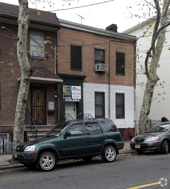
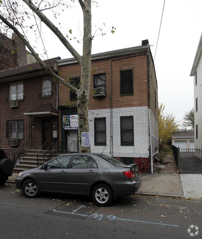
Property Record
157 Lafayette St, Newark, NJ 07105
NEARBY LISTINGS FOR SALE OR LEASE
-
-
-
-
-
-
No Photo
-
-
View all Newark listings for sale on LoopNet.com
Property Detail
157 Lafayette St
14-00194-0000-00022
24.3X110 R19
Commercialofficeresidentialmixeduse
Essex
X
New Jersey
34013C0156F
22
2023
0.06 AC
2025
Newark
007900
Northern New Jersey
1,858 SF
Newark, NJ-PA
DEMOGRAPHICS near 157 Lafayette St
1 Mile
3 Mile
5 Mile
2024 Total Population
62,226
299,859
779,112
2029 Population
60,793
288,946
751,724
Pop Growth 2024-2029
(2.30%)
(3.64%)
(3.52%)
Average Age
37
36
38
2024 Total Households
25,289
107,698
283,915
HH Growth 2024-2029
(2.06%)
(3.67%)
(3.66%)
Median Household Inc
$50,444
$44,847
$55,116
Avg Household Size
2.30
2.60
2.60
2024 Avg HH Vehicles
1.00
1.00
1.00
Median Home Value
$418,294
$325,404
$341,388
Median Year Built
1978
1967
1959
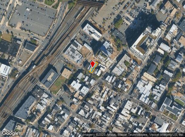
Nearby Places
Map Layers
Map Styles
 Street
 Aerial
- Restaurants
- Banks
- Shops
- Fitness
- Groceries
PUBLIC TRANSPORTATION
TRANSIT/SUBWAY
Military Park (Grove Street - Newark Penn Station - Newark Light Rail (Newark Light Rail))
DRIVE
WALK
Distance
Military Park (Grove Street - Newark Penn Station - Newark Light Rail (Newark Light Rail))
1 min
13 min
0.7 mi
Njpac/Center Street (Broad Street Station - Newark Penn Station - Newark Light Rail (Newark Light Rail))
DRIVE
WALK
Distance
Njpac/Center Street (Broad Street Station - Newark Penn Station - Newark Light Rail (Newark Light Rail))
2 min
13 min
0.7 mi
Washington Street (Grove Street - Newark Penn Station - Newark Light Rail (Newark Light Rail))
DRIVE
WALK
Distance
Washington Street (Grove Street - Newark Penn Station - Newark Light Rail (Newark Light Rail))
1 min
17 min
0.9 mi
COMMUTER RAIL
Newark Penn Station (Broad Street Station - Newark Penn Station - NJ Transit Commuter Rail (NJ Transit), Grove Street - Newark Penn Station - NJ Transit Commuter Rail (NJ Transit), Newark Penn Station-World Trade Center - NJ Transit Commuter Rail (NJ Transit), North Jersey Coast Line - NJ Transit Commuter Rail (NJ Transit), Northeast Corridor Line - NJ Transit Commuter Rail (NJ Transit), Raritan Valley Line - NJ Transit Commuter Rail (NJ Transit))
DRIVE
WALK
Distance
Newark Penn Station (Broad Street Station - Newark Penn Station - NJ Transit Commuter Rail (NJ Transit), Grove Street - Newark Penn Station - NJ Transit Commuter Rail (NJ Transit), Newark Penn Station-World Trade Center - NJ Transit Commuter Rail (NJ Transit), North Jersey Coast Line - NJ Transit Commuter Rail (NJ Transit), Northeast Corridor Line - NJ Transit Commuter Rail (NJ Transit), Raritan Valley Line - NJ Transit Commuter Rail (NJ Transit))
1 min
15 min
0.5 mi
Harrison (Newark Penn Station-World Trade Center - Port Authority Trans-Hudson (PATH))
DRIVE
WALK
Distance
Harrison (Newark Penn Station-World Trade Center - Port Authority Trans-Hudson (PATH))
3 min
1.4 mi
AIRPORT
Newark Liberty International
DRIVE
WALK
Distance
Newark Liberty International
8 min
5.1 mi
LaGuardia
DRIVE
WALK
Distance
LaGuardia
41 min
19.8 mi
John F Kennedy International
DRIVE
WALK
Distance
John F Kennedy International
50 min
30.5 mi
Freight Ports
Port Newark Container Terminal
DRIVE
WALK
Distance
Port Newark Container Terminal
10 min
4.4 mi
Nearby Properties
Address
Land Use
TOTAL SIZE
Lot Size
Zoning
Address
Land Use
TOTAL SIZE
Lot Size
Zoning
0.57 AC
Address
Land Use
TOTAL SIZE
Lot Size
Zoning
0.45 AC
Address
Land Use
TOTAL SIZE
Lot Size
Zoning
Address
Land Use
TOTAL SIZE
Lot Size
Zoning
31.86 AC
Address
Land Use
TOTAL SIZE
Lot Size
Zoning
25.69 AC
Address
Land Use
TOTAL SIZE
Lot Size
Zoning
Address
Land Use
TOTAL SIZE
Lot Size
Zoning
98.48 AC
Address
Land Use
TOTAL SIZE
Lot Size
Zoning
877 SF
7.25 AC
Address
Land Use
TOTAL SIZE
Lot Size
Zoning
1,136 SF
6.51 AC
Address
Land Use
TOTAL SIZE
Lot Size
Zoning
4.51 AC
Address
Land Use
TOTAL SIZE
Lot Size
Zoning
683 SF
9.59 AC
Address
Land Use
TOTAL SIZE
Lot Size
Zoning
2.01 AC
Address
Land Use
TOTAL SIZE
Lot Size
Zoning
3.42 AC
Address
Land Use
TOTAL SIZE
Lot Size
Zoning
320 SF
1.25 AC
Address
Land Use
TOTAL SIZE
Lot Size
Zoning
710 SF
39.32 AC
Address
Land Use
TOTAL SIZE
Lot Size
Zoning
9.77 AC
Address
Land Use
TOTAL SIZE
Lot Size
Zoning
877 SF
0.91 AC
Address
Land Use
TOTAL SIZE
Lot Size
Zoning
1.64 AC
Address
Land Use
TOTAL SIZE
Lot Size
Zoning
Address
Land Use
TOTAL SIZE
Lot Size
Zoning
1.63 AC
Address
Land Use
TOTAL SIZE
Lot Size
Zoning
Address
Land Use
TOTAL SIZE
Lot Size
Zoning
2.79 AC
Address
Land Use
TOTAL SIZE
Lot Size
Zoning
4.82 AC
Address
Land Use
TOTAL SIZE
Lot Size
Zoning
0.13 AC
Address
Land Use
TOTAL SIZE
Lot Size
Zoning
1,264 SF
3.20 AC
Address
Land Use
TOTAL SIZE
Lot Size
Zoning
Address
Land Use
TOTAL SIZE
Lot Size
Zoning
0.06 AC
Address
Land Use
TOTAL SIZE
Lot Size
Zoning
0.09 AC
Address
Land Use
TOTAL SIZE
Lot Size
Zoning
877 SF
1.95 AC
Address
Land Use
TOTAL SIZE
Lot Size
Zoning
877 SF
1.35 AC
The World's #1 Commercial Real Estate Marketplace
Connect with us
© 2025 CoStar Group
The information above has been obtained from sources believed reliable. While we do not doubt its accuracy we have not verified it and make no guarantee, warranty or representation about it. It is your responsibility to independently confirm its accuracy and completeness. Any projections, opinions, assumptions, or estimates used are for example only and do not represent the current or future performance of the property. The value of this transaction to you depends on tax and other factors which should be evaluated by your tax, financial, and legal advisors. You and your advisors should conduct a careful, independent investigation of the property to determine to your satisfaction the suitability of the property for your needs.