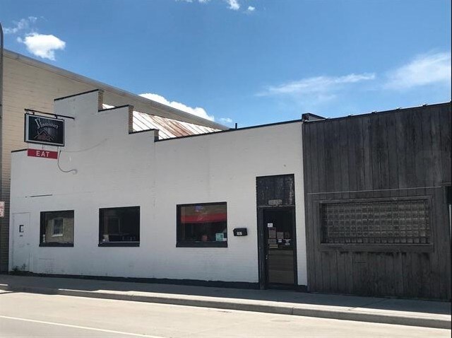
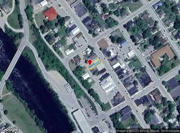
Property Record
157 N Main St, Oconto Falls, WI 54154
NEARBY LISTINGS FOR SALE OR LEASE
Property Detail
157 N Main St
Green Bay, WI
Volks Plat Of Oconto Falls
266-07-07-815-47-1
VOLKS PLAT. SE 28 FT. LOT 8 BLK 2 & SE 16 FT. OF NW 32 FT. OF LOT 8 BLK 2. 26614250171065
Commercialnec
Oconto
X
Wisconsin
55083C0569D
8
2024
85.17 AC
2024
Oconto County
101200
Green Bay
DEMOGRAPHICS near 157 N Main St
1 Mile
3 Mile
5 Mile
2024 Total Population
2,900
3,920
5,420
2029 Population
2,999
4,052
5,604
Pop Growth 2024-2029
+ 3.41%
+ 3.37%
+ 3.39%
Average Age
40
41
41
2024 Total Households
1,196
1,622
2,233
HH Growth 2024-2029
+ 3.01%
+ 3.02%
+ 3.05%
Median Household Inc
$55,505
$57,328
$61,786
Avg Household Size
2.30
2.30
2.40
2024 Avg HH Vehicles
2.00
2.00
2.00
Median Home Value
$170,156
$175,114
$182,451
Median Year Built
1968
1970
1973
Nearby Places
Map Layers
Map Styles
 Street
 Aerial
- Restaurants
- Banks
- Shops
- Fitness
- Groceries
PUBLIC TRANSPORTATION
AIRPORT
Green Bay/Austin Straubel International
DRIVE
WALK
Distance
Green Bay/Austin Straubel International
47 min
36.9 mi
Freight Ports
Port Milwaukee
DRIVE
WALK
Distance
Port Milwaukee
172 min
150.7 mi
SALE & LEASE HISTORY
LISTING DATE
SALE/LEASE

Jul 20, 2018
For Sale
Nearby Properties
Address
Land Use
TOTAL SIZE
Lot Size
Zoning
Address
Land Use
TOTAL SIZE
Lot Size
Zoning
5.47 AC
UNZN
Address
Land Use
TOTAL SIZE
Lot Size
Zoning
10 AC
UNZN
Address
Land Use
TOTAL SIZE
Lot Size
Zoning
9.55 AC
UNZN
Address
Land Use
TOTAL SIZE
Lot Size
Zoning
6.91 AC
UNZN
Address
Land Use
TOTAL SIZE
Lot Size
Zoning
10.61 AC
UNZN
Address
Land Use
TOTAL SIZE
Lot Size
Zoning
7.91 AC
UNZN
Address
Land Use
TOTAL SIZE
Lot Size
Zoning
4,040 AC
UNZN
Address
Land Use
TOTAL SIZE
Lot Size
Zoning
1.95 AC
UNZN
Address
Land Use
TOTAL SIZE
Lot Size
Zoning
6.80 AC
UNZN
Address
Land Use
TOTAL SIZE
Lot Size
Zoning
Address
Land Use
TOTAL SIZE
Lot Size
Zoning
6.04 AC
UNZN
Address
Land Use
TOTAL SIZE
Lot Size
Zoning
7.23 AC
UNZN
Address
Land Use
TOTAL SIZE
Lot Size
Zoning
0.70 AC
UNZN
Address
Land Use
TOTAL SIZE
Lot Size
Zoning
1.48 AC
UNZN
Address
Land Use
TOTAL SIZE
Lot Size
Zoning
1.88 AC
UNZN
Address
Land Use
TOTAL SIZE
Lot Size
Zoning
5.03 AC
GC
Address
Land Use
TOTAL SIZE
Lot Size
Zoning
2.62 AC
UNZN
Address
Land Use
TOTAL SIZE
Lot Size
Zoning
1.41 AC
UNZN
Address
Land Use
TOTAL SIZE
Lot Size
Zoning
3.31 AC
UNZN
Address
Land Use
TOTAL SIZE
Lot Size
Zoning
2.98 AC
UNZN
Address
Land Use
TOTAL SIZE
Lot Size
Zoning
2.12 AC
UNZN
Address
Land Use
TOTAL SIZE
Lot Size
Zoning
822.17 AC
UNZN
Address
Land Use
TOTAL SIZE
Lot Size
Zoning
1.10 AC
UNZN
Address
Land Use
TOTAL SIZE
Lot Size
Zoning
547.93 AC
UNZN
Address
Land Use
TOTAL SIZE
Lot Size
Zoning
2.85 AC
UNZN
Address
Land Use
TOTAL SIZE
Lot Size
Zoning
0.97 AC
UNZN
Address
Land Use
TOTAL SIZE
Lot Size
Zoning
667.88 AC
UNZN
Address
Land Use
TOTAL SIZE
Lot Size
Zoning
1.31 AC
UNZN
Address
Land Use
TOTAL SIZE
Lot Size
Zoning
1.15 AC
UNZN
Address
Land Use
TOTAL SIZE
Lot Size
Zoning
38.56 AC
AG
The World's #1 Commercial Real Estate Marketplace
Connect with us
© 2025 CoStar Group
The information above has been obtained from sources believed reliable. While we do not doubt its accuracy we have not verified it and make no guarantee, warranty or representation about it. It is your responsibility to independently confirm its accuracy and completeness. Any projections, opinions, assumptions, or estimates used are for example only and do not represent the current or future performance of the property. The value of this transaction to you depends on tax and other factors which should be evaluated by your tax, financial, and legal advisors. You and your advisors should conduct a careful, independent investigation of the property to determine to your satisfaction the suitability of the property for your needs.