Property Record
157 S Roosevelt Rd, Mesa, AZ 85202
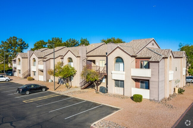


Property Detail
157 S Roosevelt Rd
134-34-024K
W2 NW4 SE4 SEC 19 EX S 33F & EX W 30F OF NW4 NW4 SE4 SD SEC & EX N 55F & EX BEG NE COR NW4 SE4 SD SEC TH W 660F TH S 50F TO TPOB TH W 306.93F TH S 279.97F TH E 152.41F N 50F TH E TO W LN OF E 660F NW4 SE4 SD SEC TH N TO TPOB & EX ANY PT LY E OF LN RU
Apartment
MARICOPA
M-M
Arizona
C and X Area of minimal flood hazard, usually depicted on FIRMs as above the 500-year flood level.
71
2025
15.94 AC
2025
Central Mesa
422225
Phoenix
268,076 SF
Phoenix-Mesa-Chandler, AZ
NEARBY LISTINGS FOR SALE OR LEASE
DEMOGRAPHICS near 157 S Roosevelt Rd
1 mile
3 mile
5 mile
2025 Total Population
24,337
157,346
386,531
2030 Population
25,272
163,360
401,506
Pop Growth 2025-2030
+ 3.84%
+ 3.82%
+ 3.87%
Average Age
35
35
36
2025 Total Households
10,593
64,728
155,725
HH Growth 2025-2030
+ 4.04%
+ 4.06%
+ 4.09%
Median Household Inc
$61,199
$62,555
$70,912
Avg Household Size
2.20
2.30
2.30
2025 Avg HH Vehicles
2.00
2.00
2.00
Median Home Value
$322,903
$391,031
$426,712
Median Year Built
1983
1981
1980
Nearby Places
Map Layers
Map Styles
 Street
 Aerial
Layers
 Traffic
 Biking
Places
Listings with unknown addresses are not visible on the map
- Restaurants
- Banks
- Shops
- Fitness
- Groceries
PUBLIC TRANSPORTATION
TRANSIT/SUBWAY
Price-101 Fwy/Apache Blvd (METRO Light Rail - Valley Metro (Phoenix Light Rail))
Drive
Walk
Distance
Price-101 Fwy/Apache Blvd (METRO Light Rail - Valley Metro (Phoenix Light Rail))
3 min
9 min
0.5 mi
Sycamore/Main Street (METRO Light Rail - Valley Metro (Phoenix Light Rail))
Drive
Walk
Distance
Sycamore/Main Street (METRO Light Rail - Valley Metro (Phoenix Light Rail))
1 min
12 min
0.6 mi
AIRPORT
Phoenix Sky Harbor International
Drive
Walk
Distance
Phoenix Sky Harbor International
17 min
10.4 mi
Phoenix-Mesa Gateway
Drive
Walk
Distance
Phoenix-Mesa Gateway
30 min
19.9 mi
Freight Ports
Port of San Diego
Drive
Walk
Distance
Port of San Diego
408 min
372.3 mi
Nearby Properties
Address
Land Use
TOTAL SIZE
Lot Size
Zoning
Address
Land Use
TOTAL SIZE
Lot Size
Zoning
439,211 SF
77.92 AC
C-G
Address
Land Use
TOTAL SIZE
Lot Size
Zoning
918,576 SF
22.96 AC
C-N
Address
Land Use
TOTAL SIZE
Lot Size
Zoning
1,227,029 SF
7.39 AC
R-6
Address
Land Use
TOTAL SIZE
Lot Size
Zoning
1,102,629 SF
12.33 AC
R-3
Address
Land Use
TOTAL SIZE
Lot Size
Zoning
2.54 AC
Address
Land Use
TOTAL SIZE
Lot Size
Zoning
805,814 SF
115.19 AC
C-G
Address
Land Use
TOTAL SIZE
Lot Size
Zoning
571,804 SF
0.98 AC
CSS
Address
Land Use
TOTAL SIZE
Lot Size
Zoning
8.79 AC
PF
Address
Land Use
TOTAL SIZE
Lot Size
Zoning
197,454 SF
18.97 AC
PF
Address
Land Use
TOTAL SIZE
Lot Size
Zoning
352,244 SF
5.55 AC
R-6
Address
Land Use
TOTAL SIZE
Lot Size
Zoning
368,727 SF
12.77 AC
R1-6
Address
Land Use
TOTAL SIZE
Lot Size
Zoning
401,437 SF
17.70 AC
C-R
Address
Land Use
TOTAL SIZE
Lot Size
Zoning
474,335 SF
9.54 AC
R-3
Address
Land Use
TOTAL SIZE
Lot Size
Zoning
377,442 SF
0.21 AC
C-DT
Address
Land Use
TOTAL SIZE
Lot Size
Zoning
683,623 SF
1.80 AC
PAD
Address
Land Use
TOTAL SIZE
Lot Size
Zoning
937,488 SF
40.63 AC
R-4
Address
Land Use
TOTAL SIZE
Lot Size
Zoning
420,534 SF
1.62 AC
PAD
Address
Land Use
TOTAL SIZE
Lot Size
Zoning
564,649 SF
7.19 AC
RCC
Address
Land Use
TOTAL SIZE
Lot Size
Zoning
448,308 SF
6.30 AC
GID
Address
Land Use
TOTAL SIZE
Lot Size
Zoning
1,107,057 SF
2.38 AC
PAD
Address
Land Use
TOTAL SIZE
Lot Size
Zoning
267,023 SF
19.58 AC
PEP
Address
Land Use
TOTAL SIZE
Lot Size
Zoning
573,715 SF
3.37 AC
MU4
Address
Land Use
TOTAL SIZE
Lot Size
Zoning
459,103 SF
13.27 AC
MU4
Address
Land Use
TOTAL SIZE
Lot Size
Zoning
562,356 SF
6.70 AC
MU4
Address
Land Use
TOTAL SIZE
Lot Size
Zoning
782,618 SF
6.70 AC
PAD
Address
Land Use
TOTAL SIZE
Lot Size
Zoning
485,625 SF
45.99 AC
PF
Address
Land Use
TOTAL SIZE
Lot Size
Zoning
256,185 SF
1.89 AC
CSS
Address
Land Use
TOTAL SIZE
Lot Size
Zoning
287,734 SF
0.42 AC
GID
Address
Land Use
TOTAL SIZE
Lot Size
Zoning
32,619 SF
2.40 AC
C-G
The World's #1 Commercial Real Estate Marketplace
Connect with us
© 2026 CoStar Group
The information above has been obtained from sources believed reliable. While we do not doubt its accuracy we have not verified it and make no guarantee, warranty or representation about it. It is your responsibility to independently confirm its accuracy and completeness. Any projections, opinions, assumptions, or estimates used are for example only and do not represent the current or future performance of the property. The value of this transaction to you depends on tax and other factors which should be evaluated by your tax, financial, and legal advisors. You and your advisors should conduct a careful, independent investigation of the property to determine to your satisfaction the suitability of the property for your needs.