Property Record
157 Stonebridge Blvd, Edmond, OK 73013

NEARBY LISTINGS FOR SALE OR LEASE
-
-
View all Edmond listings for sale on LoopNet.com
Property Detail
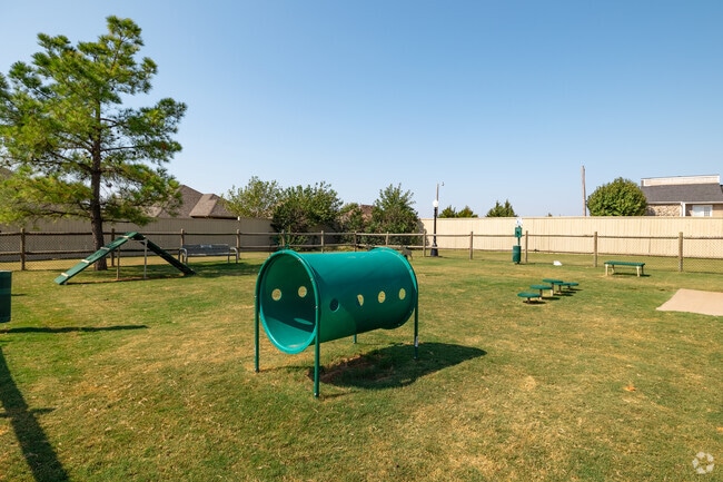
157 Stonebridge Blvd
205482170
The Villages At Stonebridge
Multifamilydwelling
THE VILLAGES AT STONEBRIDGE 012 000
X
Oklahoma
40109C0176J
Oklahoma
2023
14.07 AC
2024
Edmond
108319
Oklahoma City
240,132 SF
Oklahoma City, OK
DEMOGRAPHICS near 157 Stonebridge Blvd
1 Mile
3 Mile
5 Mile
2024 Total Population
8,842
60,007
153,970
2029 Population
8,947
60,996
157,235
Pop Growth 2024-2029
+ 1.19%
+ 1.65%
+ 2.12%
Average Age
36
37
38
2024 Total Households
3,668
24,552
62,840
HH Growth 2024-2029
+ 1.25%
+ 1.80%
+ 2.35%
Median Household Inc
$59,933
$69,543
$67,548
Avg Household Size
2.20
2.30
2.40
2024 Avg HH Vehicles
2.00
2.00
2.00
Median Home Value
$190,719
$223,187
$237,466
Median Year Built
1985
1987
1990
Nearby Places
Map Layers
Map Styles
 Street
 Aerial
- Restaurants
- Banks
- Shops
- Fitness
- Groceries
PUBLIC TRANSPORTATION
AIRPORT
Will Rogers World
DRIVE
WALK
Distance
Will Rogers World
35 min
21.0 mi
Freight Ports
Tulsa Port Of Catoosa
DRIVE
WALK
Distance
Tulsa Port Of Catoosa
128 min
117.2 mi
Nearby Properties
Address
Land Use
TOTAL SIZE
Lot Size
Zoning
Address
Land Use
TOTAL SIZE
Lot Size
Zoning
469,063 SF
71.44 AC
I-2
Address
Land Use
TOTAL SIZE
Lot Size
Zoning
280,581 SF
28.90 AC
Address
Land Use
TOTAL SIZE
Lot Size
Zoning
268,796 SF
45.68 AC
I-2
Address
Land Use
TOTAL SIZE
Lot Size
Zoning
399,688 SF
80.57 AC
PUD
Address
Land Use
TOTAL SIZE
Lot Size
Zoning
304,744 SF
21.61 AC
Address
Land Use
TOTAL SIZE
Lot Size
Zoning
371,968 SF
30.50 AC
Address
Land Use
TOTAL SIZE
Lot Size
Zoning
470,139 SF
80.39 AC
I-2
Address
Land Use
TOTAL SIZE
Lot Size
Zoning
285,136 SF
13.04 AC
PUD
Address
Land Use
TOTAL SIZE
Lot Size
Zoning
225,492 SF
11.86 AC
R-4
Address
Land Use
TOTAL SIZE
Lot Size
Zoning
13,101 SF
1.22 AC
PUD
Address
Land Use
TOTAL SIZE
Lot Size
Zoning
43,489 SF
14.86 AC
PUD
Address
Land Use
TOTAL SIZE
Lot Size
Zoning
402,880 SF
15.39 AC
Address
Land Use
TOTAL SIZE
Lot Size
Zoning
242,907 SF
I-2
Address
Land Use
TOTAL SIZE
Lot Size
Zoning
574,062 SF
57.69 AC
I-2
Address
Land Use
TOTAL SIZE
Lot Size
Zoning
265,194 SF
13.67 AC
Address
Land Use
TOTAL SIZE
Lot Size
Zoning
234,208 SF
8.61 AC
PUD
Address
Land Use
TOTAL SIZE
Lot Size
Zoning
82,162 SF
6.13 AC
Address
Land Use
TOTAL SIZE
Lot Size
Zoning
221,364 SF
12.09 AC
Address
Land Use
TOTAL SIZE
Lot Size
Zoning
167,664 SF
14.14 AC
Address
Land Use
TOTAL SIZE
Lot Size
Zoning
6,636 SF
0.18 AC
Address
Land Use
TOTAL SIZE
Lot Size
Zoning
113,781 SF
14.06 AC
Address
Land Use
TOTAL SIZE
Lot Size
Zoning
570,717 SF
44 AC
I-2
Address
Land Use
TOTAL SIZE
Lot Size
Zoning
68,548 SF
6.90 AC
I-2
Address
Land Use
TOTAL SIZE
Lot Size
Zoning
59,307 SF
3.75 AC
PUD
Address
Land Use
TOTAL SIZE
Lot Size
Zoning
174,247 SF
9.41 AC
I-2
Address
Land Use
TOTAL SIZE
Lot Size
Zoning
53,067 SF
5.55 AC
PUD
Address
Land Use
TOTAL SIZE
Lot Size
Zoning
148,620 SF
15.78 AC
PUD
Address
Land Use
TOTAL SIZE
Lot Size
Zoning
51,176 SF
23.24 AC
PUD
Address
Land Use
TOTAL SIZE
Lot Size
Zoning
154,716 SF
15.12 AC
PUD
The World's #1 Commercial Real Estate Marketplace
Connect with us
© 2025 CoStar Group
The information above has been obtained from sources believed reliable. While we do not doubt its accuracy we have not verified it and make no guarantee, warranty or representation about it. It is your responsibility to independently confirm its accuracy and completeness. Any projections, opinions, assumptions, or estimates used are for example only and do not represent the current or future performance of the property. The value of this transaction to you depends on tax and other factors which should be evaluated by your tax, financial, and legal advisors. You and your advisors should conduct a careful, independent investigation of the property to determine to your satisfaction the suitability of the property for your needs.