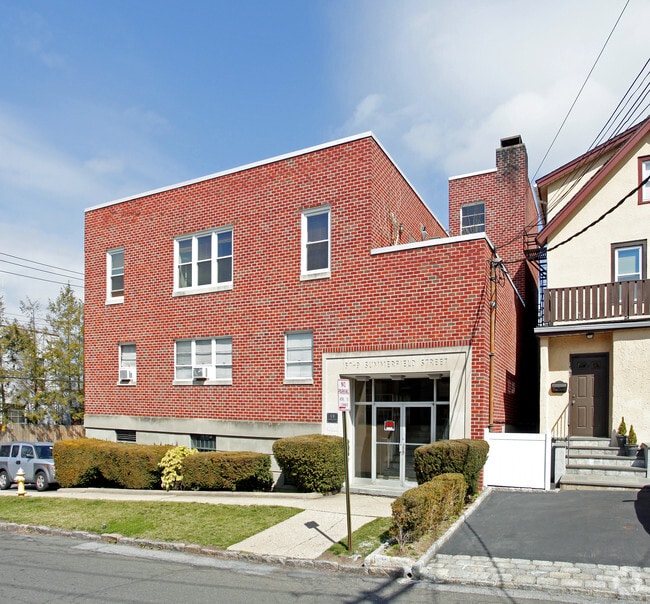
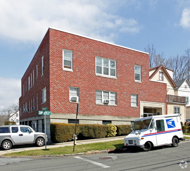
Property Record
157 Summerfield St, Scarsdale, NY 10583
NEARBY LISTINGS FOR SALE OR LEASE
Property Detail
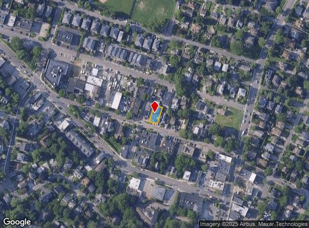
157 Summerfield St
2489-060-000-00003-000-0024
Westchester
Commercialofficeresidentialmixeduse
New York
X
24
36119C0331F
0.11 AC
2025
Southeast
2024
Westchester/So Connecticut
005001
New York-Jersey City-White Plains, NY-NJ
DEMOGRAPHICS near 157 Summerfield St
1 Mile
3 Mile
5 Mile
2024 Total Population
18,828
115,062
428,395
2029 Population
18,592
113,221
419,153
Pop Growth 2024-2029
(1.25%)
(1.60%)
(2.16%)
Average Age
43
43
42
2024 Total Households
6,981
42,132
161,619
HH Growth 2024-2029
(1.36%)
(1.74%)
(2.18%)
Median Household Inc
$173,351
$160,289
$119,474
Avg Household Size
2.70
2.70
2.50
2024 Avg HH Vehicles
2.00
2.00
2.00
Median Home Value
$714,709
$761,929
$661,940
Median Year Built
1949
1955
1954
Nearby Places
- Restaurants
- Banks
- Shops
- Fitness
- Groceries
PUBLIC TRANSPORTATION
COMMUTER RAIL
Scarsdale Station (Harlem Line - Metro-North Commuter Railroad Company (Metro-North))
DRIVE
WALK
Distance
Scarsdale Station (Harlem Line - Metro-North Commuter Railroad Company (Metro-North))
4 min
1.2 mi
Crestwood Station (Harlem Line - Metro-North Commuter Railroad Company (Metro-North))
DRIVE
WALK
Distance
Crestwood Station (Harlem Line - Metro-North Commuter Railroad Company (Metro-North))
5 min
2.2 mi
AIRPORT
Westchester County
DRIVE
WALK
Distance
Westchester County
22 min
11.8 mi
LaGuardia
DRIVE
WALK
Distance
LaGuardia
33 min
18.9 mi
John F Kennedy International
DRIVE
WALK
Distance
John F Kennedy International
42 min
26.5 mi
Freight Ports
NY - Red Hook Container Terminal
DRIVE
WALK
Distance
NY - Red Hook Container Terminal
49 min
29.5 mi
SALE & LEASE HISTORY
LISTING DATE
SALE/LEASE

Mar 12, 2020
For Lease
Jun 20, 2018
For Lease
Dec 17, 2021
For Lease
Nearby Properties
Address
Land Use
TOTAL SIZE
Lot Size
Zoning
Address
Land Use
TOTAL SIZE
Lot Size
Zoning
18,000 SF
13.85 AC
A
Address
Land Use
TOTAL SIZE
Lot Size
Zoning
Address
Land Use
TOTAL SIZE
Lot Size
Zoning
201,590 SF
4.13 AC
BA
Address
Land Use
TOTAL SIZE
Lot Size
Zoning
381,836 SF
16.68 AC
A3
Address
Land Use
TOTAL SIZE
Lot Size
Zoning
66 AC
R-20
Address
Land Use
TOTAL SIZE
Lot Size
Zoning
237,313 SF
22.67 AC
A1
Address
Land Use
TOTAL SIZE
Lot Size
Zoning
13.22 AC
CA
Address
Land Use
TOTAL SIZE
Lot Size
Zoning
29.81 AC
Address
Land Use
TOTAL SIZE
Lot Size
Zoning
77.52 AC
A3
Address
Land Use
TOTAL SIZE
Lot Size
Zoning
82,895 SF
23.03 AC
A2
Address
Land Use
TOTAL SIZE
Lot Size
Zoning
5,170 SF
9.08 AC
B
Address
Land Use
TOTAL SIZE
Lot Size
Zoning
48,499 SF
8.52 AC
A2/A3
Address
Land Use
TOTAL SIZE
Lot Size
Zoning
61,606 SF
19.99 AC
A4/A3
Address
Land Use
TOTAL SIZE
Lot Size
Zoning
98,910 SF
0.91 AC
VCR-0
Address
Land Use
TOTAL SIZE
Lot Size
Zoning
48,267 SF
11.04 AC
A2 A
Address
Land Use
TOTAL SIZE
Lot Size
Zoning
11.21 AC
R-20
Address
Land Use
TOTAL SIZE
Lot Size
Zoning
67,917 SF
6.79 AC
A4
Address
Land Use
TOTAL SIZE
Lot Size
Zoning
1,451 SF
6.97 AC
CA
Address
Land Use
TOTAL SIZE
Lot Size
Zoning
34,454 SF
216.47 AC
Address
Land Use
TOTAL SIZE
Lot Size
Zoning
58,450 SF
0.38 AC
VCR-2
Address
Land Use
TOTAL SIZE
Lot Size
Zoning
2,100 SF
24.12 AC
A3
Address
Land Use
TOTAL SIZE
Lot Size
Zoning
121.29 AC
Address
Land Use
TOTAL SIZE
Lot Size
Zoning
26,138 SF
0.33 AC
PUD-1
Address
Land Use
TOTAL SIZE
Lot Size
Zoning
2.26 AC
CA
Address
Land Use
TOTAL SIZE
Lot Size
Zoning
13.56 AC
R-15
Address
Land Use
TOTAL SIZE
Lot Size
Zoning
3.46 AC
CA
Address
Land Use
TOTAL SIZE
Lot Size
Zoning
67,572 SF
0.46 AC
VCO-2
Address
Land Use
TOTAL SIZE
Lot Size
Zoning
50,302 SF
0.59 AC
VCR-2
Address
Land Use
TOTAL SIZE
Lot Size
Zoning
21,524 SF
11.06 AC
A2 A
Address
Land Use
TOTAL SIZE
Lot Size
Zoning
69.90 AC
R-20
The World's #1 Commercial Real Estate Marketplace
Connect with us
© 2025 CoStar Group
The information above has been obtained from sources believed reliable. While we do not doubt its accuracy we have not verified it and make no guarantee, warranty or representation about it. It is your responsibility to independently confirm its accuracy and completeness. Any projections, opinions, assumptions, or estimates used are for example only and do not represent the current or future performance of the property. The value of this transaction to you depends on tax and other factors which should be evaluated by your tax, financial, and legal advisors. You and your advisors should conduct a careful, independent investigation of the property to determine to your satisfaction the suitability of the property for your needs.