Property Record
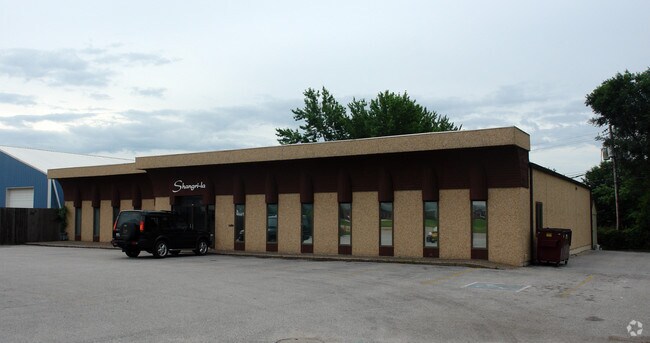
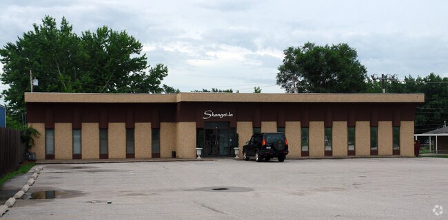
1570 36Th Ave, Moline, IL 61265

Property Detail
1570 36Th Ave
17-09-300-001
SUPVR ASST MAP LOT 304 SHEET 22
Commercialnec
Rock Island
MOL
Illinois
B and X Area of moderate flood hazard, usually the area between the limits of the 100-year and 500-year floods.
304
2025
0.57 AC
2024
Greater Moline
021900
Davenport/Moline/Rock Island
6,222 SF
Davenport-Moline-Rock Island, IA-IL
NEARBY LISTINGS FOR SALE OR LEASE
DEMOGRAPHICS near 1570 36Th Ave
1 mile
3 mile
5 mile
2025 Total Population
5,724
58,390
134,248
2030 Population
5,683
58,110
134,677
Pop Growth 2025-2030
(0.72%)
(0.48%)
+ 0.32%
Average Age
43
41
41
2025 Total Households
2,490
24,623
57,757
HH Growth 2025-2030
(0.64%)
(0.52%)
+ 0.39%
Median Household Inc
$70,855
$63,501
$62,782
Avg Household Size
2.30
2.20
2.20
2025 Avg HH Vehicles
2.00
2.00
2.00
Median Home Value
$158,387
$151,730
$158,540
Median Year Built
1954
1953
1956
Nearby Places
Map Layers
Map Styles
 Street
 Aerial
Layers
 Traffic
 Biking
Places
Listings with unknown addresses are not visible on the map
- Restaurants
- Banks
- Shops
- Fitness
- Groceries
PUBLIC TRANSPORTATION
AIRPORT
Quad Cities International
Drive
Walk
Distance
Quad Cities International
9 min
3.1 mi
Nearby Properties
Address
Land Use
TOTAL SIZE
Lot Size
Zoning
Address
Land Use
TOTAL SIZE
Lot Size
Zoning
2,595,576 SF
185.35 AC
MIL
Address
Land Use
TOTAL SIZE
Lot Size
Zoning
7.86 AC
Address
Land Use
TOTAL SIZE
Lot Size
Zoning
108,500 SF
2.41 AC
MOL
Address
Land Use
TOTAL SIZE
Lot Size
Zoning
8.16 AC
MOL
Address
Land Use
TOTAL SIZE
Lot Size
Zoning
100,500 SF
0.94 AC
MOL
Address
Land Use
TOTAL SIZE
Lot Size
Zoning
1,287,769 SF
53.54 AC
MOL
Address
Land Use
TOTAL SIZE
Lot Size
Zoning
250,875 SF
11.92 AC
MOL
Address
Land Use
TOTAL SIZE
Lot Size
Zoning
369,922 SF
3.14 AC
RI
Address
Land Use
TOTAL SIZE
Lot Size
Zoning
6.53 AC
MOL
Address
Land Use
TOTAL SIZE
Lot Size
Zoning
19.69 AC
MOL
Address
Land Use
TOTAL SIZE
Lot Size
Zoning
194,267 SF
23.16 AC
MOL
Address
Land Use
TOTAL SIZE
Lot Size
Zoning
47,060 SF
3.23 AC
MOL
Address
Land Use
TOTAL SIZE
Lot Size
Zoning
110,101 SF
3.62 AC
MOL
Address
Land Use
TOTAL SIZE
Lot Size
Zoning
244,440 SF
13.25 AC
MOL
Address
Land Use
TOTAL SIZE
Lot Size
Zoning
10.75 AC
MOL
Address
Land Use
TOTAL SIZE
Lot Size
Zoning
142,836 SF
14.60 AC
MOL
Address
Land Use
TOTAL SIZE
Lot Size
Zoning
66.76 AC
MOL
Address
Land Use
TOTAL SIZE
Lot Size
Zoning
73,065 SF
12.67 AC
I2
Address
Land Use
TOTAL SIZE
Lot Size
Zoning
47,578 SF
23.65 AC
MOL
Address
Land Use
TOTAL SIZE
Lot Size
Zoning
9.42 AC
I2
Address
Land Use
TOTAL SIZE
Lot Size
Zoning
116,800 SF
9.30 AC
MOL
Address
Land Use
TOTAL SIZE
Lot Size
Zoning
1.02 AC
Address
Land Use
TOTAL SIZE
Lot Size
Zoning
121,420 SF
3.17 AC
MOL
Address
Land Use
TOTAL SIZE
Lot Size
Zoning
89,649 SF
0.70 AC
MOL
Address
Land Use
TOTAL SIZE
Lot Size
Zoning
96,352 SF
9.77 AC
MOL
Address
Land Use
TOTAL SIZE
Lot Size
Zoning
85,400 SF
0.36 AC
MOL
Address
Land Use
TOTAL SIZE
Lot Size
Zoning
75,651 SF
7.29 AC
RI
Address
Land Use
TOTAL SIZE
Lot Size
Zoning
9.18 AC
MOL
Address
Land Use
TOTAL SIZE
Lot Size
Zoning
53,897 SF
3.13 AC
MOL
Address
Land Use
TOTAL SIZE
Lot Size
Zoning
144,306 SF
16.90 AC
EM
The World's #1 Commercial Real Estate Marketplace
Connect with us
© 2026 CoStar Group
The information above has been obtained from sources believed reliable. While we do not doubt its accuracy we have not verified it and make no guarantee, warranty or representation about it. It is your responsibility to independently confirm its accuracy and completeness. Any projections, opinions, assumptions, or estimates used are for example only and do not represent the current or future performance of the property. The value of this transaction to you depends on tax and other factors which should be evaluated by your tax, financial, and legal advisors. You and your advisors should conduct a careful, independent investigation of the property to determine to your satisfaction the suitability of the property for your needs.