Property Record
1570 Brittain Rd, Akron, OH 44310
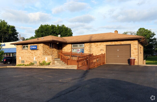
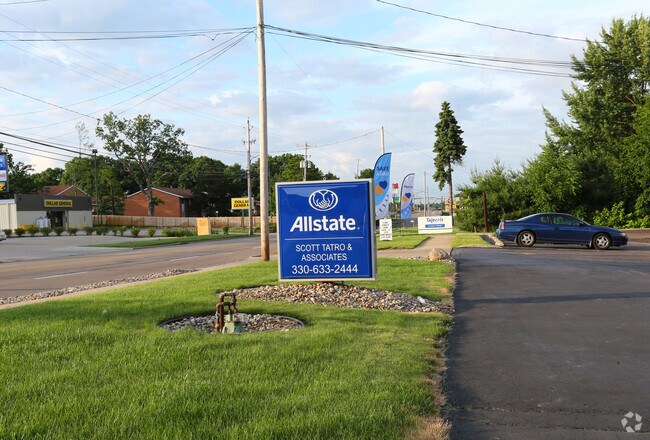
Property Detail
1570 Brittain Rd
Akron, OH
TR 5 LOT 6 PAR #45 BRITTAIN .530A
68-10255
Summit
Officebuilding
Ohio
B and X Area of moderate flood hazard, usually the area between the limits of the 100-year and 500-year floods.
6
2023
0.53 AC
2025
Akron
502102
Cleveland
1,739 SF
NEARBY LISTINGS FOR SALE OR LEASE
DEMOGRAPHICS near 1570 Brittain Rd
1 mile
3 mile
5 mile
2024 Total Population
7,750
89,233
214,113
2029 Population
7,764
89,091
214,472
Pop Growth 2024-2029
+ 0.18%
(0.16%)
+ 0.17%
Average Age
40
40
40
2024 Total Households
3,407
37,902
92,955
HH Growth 2024-2029
+ 0.15%
(0.21%)
+ 0.13%
Median Household Inc
$37,783
$54,284
$56,806
Avg Household Size
2.20
2.20
2.20
2024 Avg HH Vehicles
1.00
2.00
2.00
Median Home Value
$150,261
$149,681
$162,462
Median Year Built
1967
1955
1957
Nearby Places
Map Layers
Map Styles
 Street
 Aerial
Transit
 Traffic
 Biking
Places
Listings with unknown addresses are not visible on the map
- Restaurants
- Banks
- Shops
- Fitness
- Groceries
PUBLIC TRANSPORTATION
COMMUTER RAIL
Drive
Walk
Distance
10 min
3.9 mi
Drive
Walk
Distance
15 min
6.1 mi
AIRPORT
Akron-Canton Regional
Drive
Walk
Distance
Akron-Canton Regional
25 min
17.0 mi
Cleveland-Hopkins International
Drive
Walk
Distance
Cleveland-Hopkins International
56 min
39.2 mi
Nearby Properties
Address
Land Use
TOTAL SIZE
Lot Size
Zoning
Address
Land Use
TOTAL SIZE
Lot Size
Zoning
1,811,279 SF
38.71 AC
Address
Land Use
TOTAL SIZE
Lot Size
Zoning
194,492 SF
37.82 AC
Address
Land Use
TOTAL SIZE
Lot Size
Zoning
176,533 SF
62.50 AC
Address
Land Use
TOTAL SIZE
Lot Size
Zoning
314,622 SF
15.59 AC
Address
Land Use
TOTAL SIZE
Lot Size
Zoning
3.15 AC
Address
Land Use
TOTAL SIZE
Lot Size
Zoning
229,392 SF
12.31 AC
Address
Land Use
TOTAL SIZE
Lot Size
Zoning
66,302 SF
10.87 AC
Address
Land Use
TOTAL SIZE
Lot Size
Zoning
311,197 SF
10.78 AC
Address
Land Use
TOTAL SIZE
Lot Size
Zoning
72,382 SF
4.70 AC
Address
Land Use
TOTAL SIZE
Lot Size
Zoning
245,911 SF
14.48 AC
Address
Land Use
TOTAL SIZE
Lot Size
Zoning
169,260 SF
9.95 AC
Address
Land Use
TOTAL SIZE
Lot Size
Zoning
Address
Land Use
TOTAL SIZE
Lot Size
Zoning
115,567 SF
9.06 AC
Address
Land Use
TOTAL SIZE
Lot Size
Zoning
52,949 SF
2.35 AC
Address
Land Use
TOTAL SIZE
Lot Size
Zoning
131,788 SF
13.99 AC
Address
Land Use
TOTAL SIZE
Lot Size
Zoning
Address
Land Use
TOTAL SIZE
Lot Size
Zoning
Address
Land Use
TOTAL SIZE
Lot Size
Zoning
139,910 SF
3.43 AC
Address
Land Use
TOTAL SIZE
Lot Size
Zoning
220,324 SF
21.06 AC
Address
Land Use
TOTAL SIZE
Lot Size
Zoning
226,050 SF
24.49 AC
Address
Land Use
TOTAL SIZE
Lot Size
Zoning
119,896 SF
3.19 AC
Address
Land Use
TOTAL SIZE
Lot Size
Zoning
538,138 SF
37.59 AC
Address
Land Use
TOTAL SIZE
Lot Size
Zoning
117,240 SF
11.55 AC
Address
Land Use
TOTAL SIZE
Lot Size
Zoning
90,014 SF
5.84 AC
Address
Land Use
TOTAL SIZE
Lot Size
Zoning
95,696 SF
8.29 AC
Address
Land Use
TOTAL SIZE
Lot Size
Zoning
Address
Land Use
TOTAL SIZE
Lot Size
Zoning
154,690 SF
4.13 AC
Address
Land Use
TOTAL SIZE
Lot Size
Zoning
5.84 AC
Address
Land Use
TOTAL SIZE
Lot Size
Zoning
61,929 SF
3 AC
Address
Land Use
TOTAL SIZE
Lot Size
Zoning
119,778 SF
1.09 AC
The World's #1 Commercial Real Estate Marketplace
Connect with us
© 2026 CoStar Group
The information above has been obtained from sources believed reliable. While we do not doubt its accuracy we have not verified it and make no guarantee, warranty or representation about it. It is your responsibility to independently confirm its accuracy and completeness. Any projections, opinions, assumptions, or estimates used are for example only and do not represent the current or future performance of the property. The value of this transaction to you depends on tax and other factors which should be evaluated by your tax, financial, and legal advisors. You and your advisors should conduct a careful, independent investigation of the property to determine to your satisfaction the suitability of the property for your needs.