Property Record
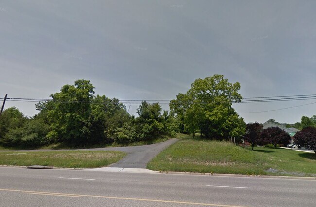
1570 Commerce Rd, Staunton, VA 24401

Property Detail
1570 Commerce Rd
Staunton-Stuarts Draft, VA
(LOT 45) SPLIT PARCEL-132.46 ACS SPLIT ON RECORDED PLAT 210001632
10429
STAUNTON CITY
Commercialnec
Virginia
B2
45
B and X Area of moderate flood hazard, usually the area between the limits of the 100-year and 500-year floods.
132.47 AC
2025
Staunton & Harrisonburg
2025
Other Market Areas
000402
NEARBY LISTINGS FOR SALE OR LEASE
DEMOGRAPHICS near 1570 Commerce Rd
1 mile
3 mile
5 mile
2025 Total Population
373
12,291
35,133
2030 Population
388
12,542
35,976
Pop Growth 2025-2030
+ 4.02%
+ 2.04%
+ 2.40%
Average Age
46
44
43
2025 Total Households
141
4,858
14,951
HH Growth 2025-2030
+ 4.96%
+ 2.31%
+ 2.63%
Median Household Inc
$98,213
$70,664
$64,445
Avg Household Size
2.20
2.20
2.20
2025 Avg HH Vehicles
2.00
2.00
2.00
Median Home Value
$312,500
$289,964
$266,424
Median Year Built
1966
1971
1968
Nearby Places
Map Layers
Map Styles
 Street
 Aerial
Layers
 Traffic
 Biking
Places
Listings with unknown addresses are not visible on the map
- Restaurants
- Banks
- Shops
- Fitness
- Groceries
PUBLIC TRANSPORTATION
COMMUTER RAIL
Staunton Amtrak Station (Cardinal - Amtrak)
Drive
Walk
Distance
Staunton Amtrak Station (Cardinal - Amtrak)
8 min
4.8 mi
Freight Ports
Virginia Port Authority - Richmond
Drive
Walk
Distance
Virginia Port Authority - Richmond
137 min
117.3 mi
Nearby Properties
Address
Land Use
TOTAL SIZE
Lot Size
Zoning
Address
Land Use
TOTAL SIZE
Lot Size
Zoning
262,369 SF
24.50 AC
GENERAL BU
Address
Land Use
TOTAL SIZE
Lot Size
Zoning
132,832 SF
50.44 AC
GENERAL BU
Address
Land Use
TOTAL SIZE
Lot Size
Zoning
218,331 SF
40 AC
PLANNED CO
Address
Land Use
TOTAL SIZE
Lot Size
Zoning
700,000 SF
46.55 AC
I2
Address
Land Use
TOTAL SIZE
Lot Size
Zoning
515,766 SF
81.76 AC
GENERAL IN
Address
Land Use
TOTAL SIZE
Lot Size
Zoning
101,384 SF
11.77 AC
R3
Address
Land Use
TOTAL SIZE
Lot Size
Zoning
222,668 SF
34.23 AC
I2
Address
Land Use
TOTAL SIZE
Lot Size
Zoning
38,772 SF
8.58 AC
GENERAL BU
Address
Land Use
TOTAL SIZE
Lot Size
Zoning
303,307 SF
146.93 AC
GENERAL IN
Address
Land Use
TOTAL SIZE
Lot Size
Zoning
158,300 SF
30 AC
R2
Address
Land Use
TOTAL SIZE
Lot Size
Zoning
61,798 SF
8.52 AC
R2
Address
Land Use
TOTAL SIZE
Lot Size
Zoning
48,904 SF
5.17 AC
P1
Address
Land Use
TOTAL SIZE
Lot Size
Zoning
107,455 SF
5.82 AC
P1
Address
Land Use
TOTAL SIZE
Lot Size
Zoning
174,284 SF
10.35 AC
GENERAL BU
Address
Land Use
TOTAL SIZE
Lot Size
Zoning
111,992 SF
7.13 AC
PLANNED CO
Address
Land Use
TOTAL SIZE
Lot Size
Zoning
101,604 SF
6.61 AC
R3
Address
Land Use
TOTAL SIZE
Lot Size
Zoning
107,814 SF
6.21 AC
R4
Address
Land Use
TOTAL SIZE
Lot Size
Zoning
41,954 SF
3.40 AC
R1
Address
Land Use
TOTAL SIZE
Lot Size
Zoning
43,502 SF
15.61 AC
I2
Address
Land Use
TOTAL SIZE
Lot Size
Zoning
40,626 SF
8.51 AC
R3
Address
Land Use
TOTAL SIZE
Lot Size
Zoning
77,592 SF
9.49 AC
GENERAL BU
Address
Land Use
TOTAL SIZE
Lot Size
Zoning
65,080 SF
3.76 AC
R4
Address
Land Use
TOTAL SIZE
Lot Size
Zoning
20,858 SF
12.73 AC
GENERAL BU
Address
Land Use
TOTAL SIZE
Lot Size
Zoning
9,097 SF
5.18 AC
MULTI-FAMI
Address
Land Use
TOTAL SIZE
Lot Size
Zoning
56,375 SF
4.69 AC
PLANNED CO
Address
Land Use
TOTAL SIZE
Lot Size
Zoning
10,845 SF
18.20 AC
SINGLE FAM
Address
Land Use
TOTAL SIZE
Lot Size
Zoning
46,074 SF
2.98 AC
R2
Address
Land Use
TOTAL SIZE
Lot Size
Zoning
85,840 SF
22.95 AC
GENERAL IN
Address
Land Use
TOTAL SIZE
Lot Size
Zoning
40,146 SF
14.70 AC
R1
Address
Land Use
TOTAL SIZE
Lot Size
Zoning
12,388 SF
135.06 AC
PLANNED UN
The World's #1 Commercial Real Estate Marketplace
Connect with us
© 2026 CoStar Group
The information above has been obtained from sources believed reliable. While we do not doubt its accuracy we have not verified it and make no guarantee, warranty or representation about it. It is your responsibility to independently confirm its accuracy and completeness. Any projections, opinions, assumptions, or estimates used are for example only and do not represent the current or future performance of the property. The value of this transaction to you depends on tax and other factors which should be evaluated by your tax, financial, and legal advisors. You and your advisors should conduct a careful, independent investigation of the property to determine to your satisfaction the suitability of the property for your needs.