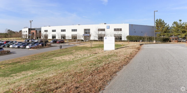
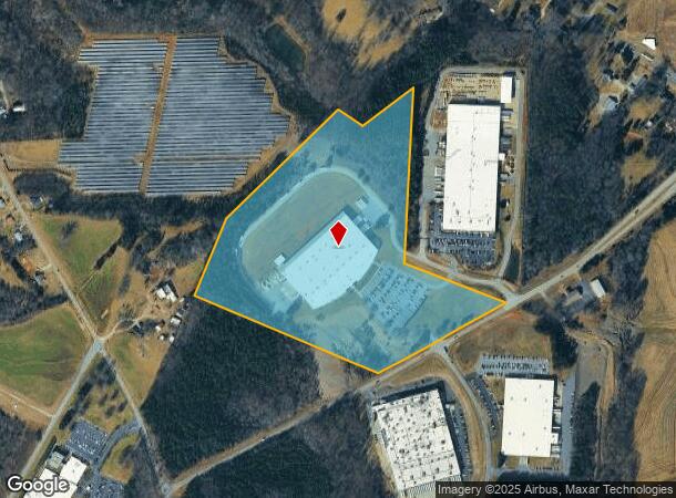
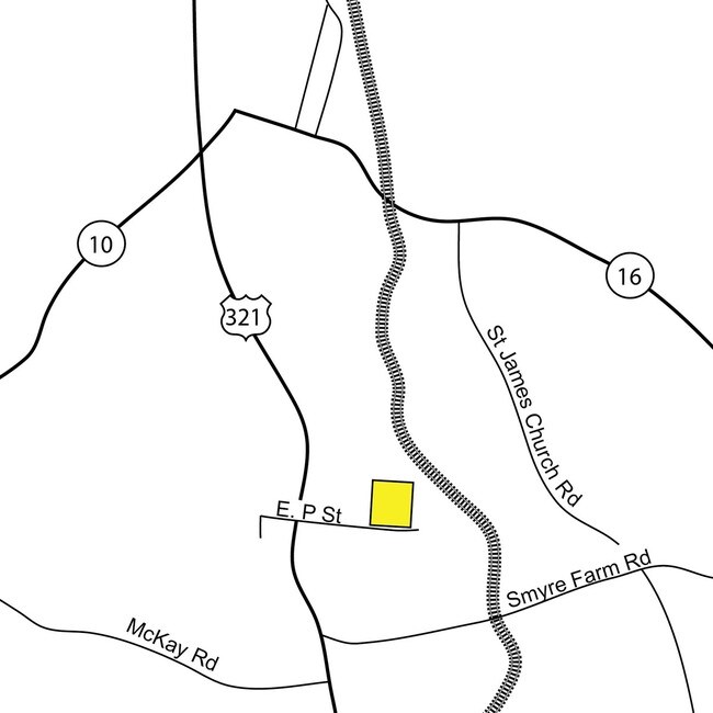
Property Record
1570 E P Street Ext, Newton, NC 28658
NEARBY LISTINGS FOR SALE OR LEASE
-
-
View all Newton listings for sale on LoopNet.com
Property Detail
1570 E P Street Ext
Hickory-Lenoir-Morganton, NC
Anna M Danner
3649075727190000
LOT 2 & ADJ PL 20-254
Manufacturinglight
Catawba
X
North Carolina
3710364900J
2
2024
32.34 AC
2025
Catawba County
011300
Charlotte
188,250 SF
DEMOGRAPHICS near 1570 E P Street Ext
1 Mile
3 Mile
5 Mile
2024 Total Population
1,728
17,569
35,841
2029 Population
1,812
18,421
37,488
Pop Growth 2024-2029
+ 4.86%
+ 4.85%
+ 4.60%
Average Age
39
40
41
2024 Total Households
683
6,801
14,056
HH Growth 2024-2029
+ 4.83%
+ 4.85%
+ 4.55%
Median Household Inc
$48,961
$56,469
$58,797
Avg Household Size
2.50
2.50
2.40
2024 Avg HH Vehicles
2.00
2.00
2.00
Median Home Value
$155,528
$153,162
$180,541
Median Year Built
1979
1978
1982
Nearby Places
Map Layers
Map Styles
 Street
 Aerial
- Restaurants
- Banks
- Shops
- Fitness
- Groceries
SALE & LEASE HISTORY
LISTING DATE
SALE/LEASE

Sep 23, 2016
For Sale
Nearby Properties
Address
Land Use
TOTAL SIZE
Lot Size
Zoning
Address
Land Use
TOTAL SIZE
Lot Size
Zoning
125,462 SF
18.74 AC
PD-O&I
Address
Land Use
TOTAL SIZE
Lot Size
Zoning
6,751 SF
85.40 AC
PD-CCRC
Address
Land Use
TOTAL SIZE
Lot Size
Zoning
1,937 SF
62 AC
PD-CCRC
Address
Land Use
TOTAL SIZE
Lot Size
Zoning
222,605 SF
20.66 AC
EM-1
Address
Land Use
TOTAL SIZE
Lot Size
Zoning
218,009 SF
90.48 AC
M-1
Address
Land Use
TOTAL SIZE
Lot Size
Zoning
174,666 SF
50.07 AC
M-1
Address
Land Use
TOTAL SIZE
Lot Size
Zoning
103,090 SF
36.13 AC
R-9
Address
Land Use
TOTAL SIZE
Lot Size
Zoning
124,940 SF
33.32 AC
M-1
Address
Land Use
TOTAL SIZE
Lot Size
Zoning
222,635 SF
55.70 AC
M-1
Address
Land Use
TOTAL SIZE
Lot Size
Zoning
270,125 SF
19.98 AC
EM-1
Address
Land Use
TOTAL SIZE
Lot Size
Zoning
222,786 SF
14.02 AC
EM-1
Address
Land Use
TOTAL SIZE
Lot Size
Zoning
226,704 SF
24.60 AC
EM-1
Address
Land Use
TOTAL SIZE
Lot Size
Zoning
20.90 AC
M-1
Address
Land Use
TOTAL SIZE
Lot Size
Zoning
234,094 SF
15.22 AC
EM-1
Address
Land Use
TOTAL SIZE
Lot Size
Zoning
156,161 SF
17.22 AC
M-1
Address
Land Use
TOTAL SIZE
Lot Size
Zoning
136,903 SF
43.43 AC
EM-1
Address
Land Use
TOTAL SIZE
Lot Size
Zoning
10.85 AC
R-7
Address
Land Use
TOTAL SIZE
Lot Size
Zoning
129,433 SF
15.57 AC
EM-1
Address
Land Use
TOTAL SIZE
Lot Size
Zoning
6,706 SF
10.58 AC
PD-H
Address
Land Use
TOTAL SIZE
Lot Size
Zoning
47.79 AC
R-20A
Address
Land Use
TOTAL SIZE
Lot Size
Zoning
178,270 SF
21.29 AC
PD-IP
Address
Land Use
TOTAL SIZE
Lot Size
Zoning
51,237 SF
4.52 AC
B-4
Address
Land Use
TOTAL SIZE
Lot Size
Zoning
13,088 SF
4.17 AC
PD-H
Address
Land Use
TOTAL SIZE
Lot Size
Zoning
128,840 SF
9.13 AC
EM-1
Address
Land Use
TOTAL SIZE
Lot Size
Zoning
62,794 SF
3.18 AC
R-11
Address
Land Use
TOTAL SIZE
Lot Size
Zoning
33,324 SF
3.42 AC
M-1
Address
Land Use
TOTAL SIZE
Lot Size
Zoning
18,269 SF
2.02 AC
R-11
Address
Land Use
TOTAL SIZE
Lot Size
Zoning
84,847 SF
7.12 AC
M-1
Address
Land Use
TOTAL SIZE
Lot Size
Zoning
123,000 SF
13.56 AC
EM-1
The World's #1 Commercial Real Estate Marketplace
Connect with us
© 2026 CoStar Group
The information above has been obtained from sources believed reliable. While we do not doubt its accuracy we have not verified it and make no guarantee, warranty or representation about it. It is your responsibility to independently confirm its accuracy and completeness. Any projections, opinions, assumptions, or estimates used are for example only and do not represent the current or future performance of the property. The value of this transaction to you depends on tax and other factors which should be evaluated by your tax, financial, and legal advisors. You and your advisors should conduct a careful, independent investigation of the property to determine to your satisfaction the suitability of the property for your needs.