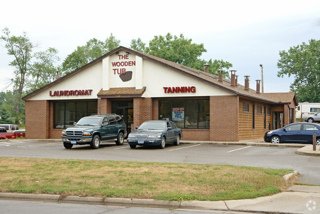
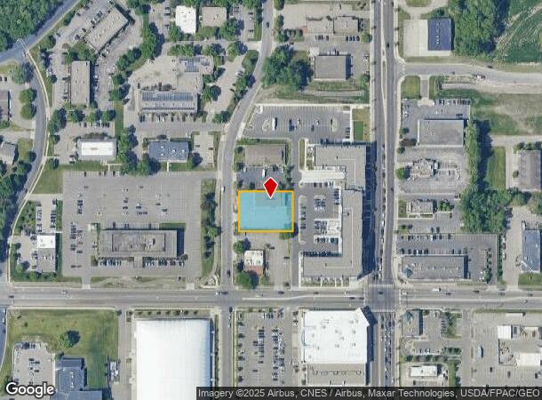
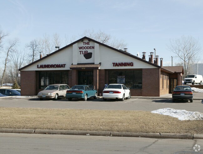
Property Record
1570 Livingston Ave, Saint Paul, MN 55118
NEARBY LISTINGS FOR SALE OR LEASE
Property Detail
1570 Livingston Ave
Minneapolis-St. Paul-Bloomington, MN-WI
City Center Addition
42-17800-01-094
8 1 S 13 FT OF LOT 5 BLK 1 EX E 253.01 FT THEREOF ALSO PT OF W 40.08 FT OF LOT 7 BLK 1 LYING N OF S 175.00 FT & LOT 8 BLK 1 EX S 175 FT THEREOF CITY CENTER ADDITION
Commercialnec
Dakota
X
Minnesota
27037C0040E
5
2024
0.49 AC
2024
West St Paul
060104
Minneapolis/St Paul
4,213 SF
DEMOGRAPHICS near 1570 Livingston Ave
1 Mile
3 Mile
5 Mile
2024 Total Population
12,912
77,232
237,551
2029 Population
13,348
78,102
236,105
Pop Growth 2024-2029
+ 3.38%
+ 1.13%
(0.61%)
Average Age
42
40
39
2024 Total Households
6,005
32,328
97,505
HH Growth 2024-2029
+ 3.68%
+ 1.24%
(0.59%)
Median Household Inc
$55,353
$72,676
$69,326
Avg Household Size
2.10
2.30
2.30
2024 Avg HH Vehicles
1.00
2.00
2.00
Median Home Value
$262,466
$276,577
$291,087
Median Year Built
1974
1969
1964
Nearby Places
Map Layers
Map Styles
 Street
 Aerial
- Restaurants
- Banks
- Shops
- Fitness
- Groceries
PUBLIC TRANSPORTATION
COMMUTER RAIL
St. Paul-Minneapolis (Empire Builder - Amtrak)
DRIVE
WALK
Distance
St. Paul-Minneapolis (Empire Builder - Amtrak)
9 min
3.9 mi
AIRPORT
Minneapolis-St Paul International/Wold-Chamberlain
DRIVE
WALK
Distance
Minneapolis-St Paul International/Wold-Chamberlain
17 min
9.1 mi
Freight Ports
Port Milwaukee
DRIVE
WALK
Distance
Port Milwaukee
368 min
333.1 mi
SALE & LEASE HISTORY
LISTING DATE
SALE/LEASE

May 30, 2024
For Sale
May 15, 2023
For Sale
Jun 22, 2023
For Lease
Nearby Properties
Address
Land Use
TOTAL SIZE
Lot Size
Zoning
Address
Land Use
TOTAL SIZE
Lot Size
Zoning
63.12 AC
Address
Land Use
TOTAL SIZE
Lot Size
Zoning
Address
Land Use
TOTAL SIZE
Lot Size
Zoning
146,085 SF
46.83 AC
Address
Land Use
TOTAL SIZE
Lot Size
Zoning
329,070 SF
5.75 AC
Address
Land Use
TOTAL SIZE
Lot Size
Zoning
445,437 SF
7.80 AC
Address
Land Use
TOTAL SIZE
Lot Size
Zoning
265,736 SF
6.67 AC
Address
Land Use
TOTAL SIZE
Lot Size
Zoning
3.13 AC
Address
Land Use
TOTAL SIZE
Lot Size
Zoning
247,470 SF
2.21 AC
Address
Land Use
TOTAL SIZE
Lot Size
Zoning
279,247 SF
1.65 AC
Address
Land Use
TOTAL SIZE
Lot Size
Zoning
233,578 SF
9.56 AC
Address
Land Use
TOTAL SIZE
Lot Size
Zoning
217,703 SF
3.51 AC
Address
Land Use
TOTAL SIZE
Lot Size
Zoning
293,970 SF
31.92 AC
Address
Land Use
TOTAL SIZE
Lot Size
Zoning
381,158 SF
11.86 AC
Address
Land Use
TOTAL SIZE
Lot Size
Zoning
278,172 SF
1.97 AC
Address
Land Use
TOTAL SIZE
Lot Size
Zoning
282,178 SF
1.86 AC
Address
Land Use
TOTAL SIZE
Lot Size
Zoning
224,944 SF
3.15 AC
Address
Land Use
TOTAL SIZE
Lot Size
Zoning
37,846 SF
2.86 AC
Address
Land Use
TOTAL SIZE
Lot Size
Zoning
222,299 SF
1.61 AC
Address
Land Use
TOTAL SIZE
Lot Size
Zoning
228,050 SF
0.32 AC
Address
Land Use
TOTAL SIZE
Lot Size
Zoning
243,847 SF
5.24 AC
Address
Land Use
TOTAL SIZE
Lot Size
Zoning
245,570 SF
2.85 AC
Address
Land Use
TOTAL SIZE
Lot Size
Zoning
210,540 SF
5.35 AC
Address
Land Use
TOTAL SIZE
Lot Size
Zoning
156,636 SF
0.77 AC
Address
Land Use
TOTAL SIZE
Lot Size
Zoning
Address
Land Use
TOTAL SIZE
Lot Size
Zoning
163,985 SF
7.06 AC
Address
Land Use
TOTAL SIZE
Lot Size
Zoning
381,395 SF
15.31 AC
Address
Land Use
TOTAL SIZE
Lot Size
Zoning
163,561 SF
41.09 AC
Address
Land Use
TOTAL SIZE
Lot Size
Zoning
293,717 SF
33.30 AC
Address
Land Use
TOTAL SIZE
Lot Size
Zoning
482,008 SF
23.78 AC
Address
Land Use
TOTAL SIZE
Lot Size
Zoning
452,836 SF
17.81 AC
The World's #1 Commercial Real Estate Marketplace
Connect with us
© 2025 CoStar Group
The information above has been obtained from sources believed reliable. While we do not doubt its accuracy we have not verified it and make no guarantee, warranty or representation about it. It is your responsibility to independently confirm its accuracy and completeness. Any projections, opinions, assumptions, or estimates used are for example only and do not represent the current or future performance of the property. The value of this transaction to you depends on tax and other factors which should be evaluated by your tax, financial, and legal advisors. You and your advisors should conduct a careful, independent investigation of the property to determine to your satisfaction the suitability of the property for your needs.