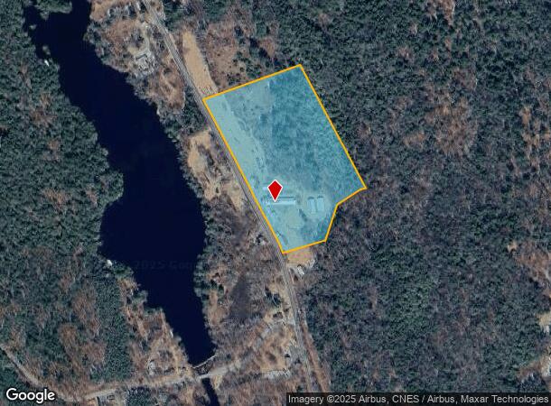
Property Record
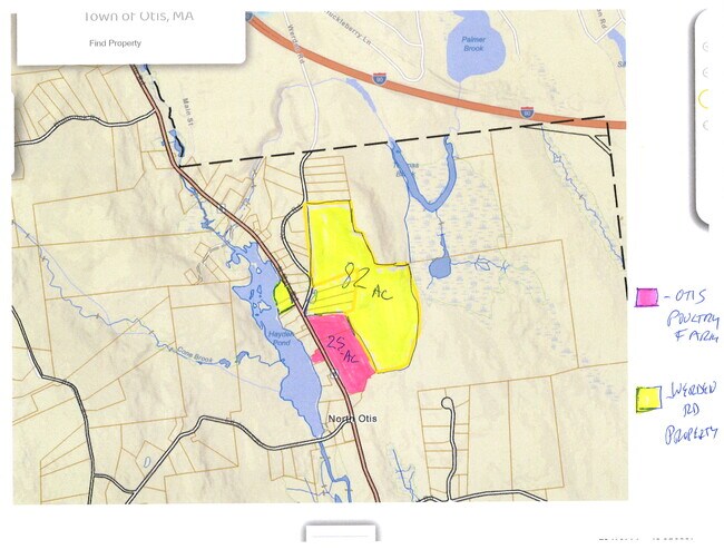
1570 N Main Rd, Otis, MA 01253

NEARBY LISTINGS FOR SALE OR LEASE
-
-
View all Otis listings for sale on LoopNet.com
Property Detail
1570 N Main Rd
Pittsfield, MA
Berkshire
OTIS-000002-000000-000074
Massachusetts
Agriculturalnec
74
2025
23.79 AC
2025
Massachusetts North/West Area
933400
Other Market Areas
1,600 SF
DEMOGRAPHICS near 1570 N Main Rd
1 Mile
3 Mile
5 Mile
2024 Total Population
80
1,558
3,013
2029 Population
80
1,592
3,037
Pop Growth 2024-2029
0.00%
+ 2.18%
+ 0.80%
Average Age
52
49
50
2024 Total Households
37
713
1,371
HH Growth 2024-2029
0.00%
+ 2.10%
+ 0.58%
Median Household Inc
$89,583
$63,047
$69,307
Avg Household Size
2.20
2.20
2.20
2024 Avg HH Vehicles
2.00
2.00
2.00
Median Home Value
$299,999
$310,846
$314,893
Median Year Built
1980
1978
1977
Nearby Places
Map Layers
Map Styles
 Street
 Aerial
- Restaurants
- Banks
- Shops
- Fitness
- Groceries
PUBLIC TRANSPORTATION
AIRPORT
Bradley International
DRIVE
WALK
Distance
Bradley International
77 min
41.0 mi
Freight Ports
Albany, NY Port
DRIVE
WALK
Distance
Albany, NY Port
70 min
53.6 mi
SALE & LEASE HISTORY
LISTING DATE
SALE/LEASE

Sep 23, 2016
For Sale
Jun 09, 2024
For Sale
Nearby Properties
Address
Land Use
TOTAL SIZE
Lot Size
Zoning
Address
Land Use
TOTAL SIZE
Lot Size
Zoning
48,738 SF
38.08 AC
R40
Address
Land Use
TOTAL SIZE
Lot Size
Zoning
4,207 SF
47.92 AC
R1
Address
Land Use
TOTAL SIZE
Lot Size
Zoning
2,827 SF
52 AC
C
Address
Land Use
TOTAL SIZE
Lot Size
Zoning
208.62 AC
R40
Address
Land Use
TOTAL SIZE
Lot Size
Zoning
15,432 SF
1.60 AC
V-1
Address
Land Use
TOTAL SIZE
Lot Size
Zoning
19.99 AC
R40
Address
Land Use
TOTAL SIZE
Lot Size
Zoning
39.13 AC
Address
Land Use
TOTAL SIZE
Lot Size
Zoning
2.64 AC
V-1
Address
Land Use
TOTAL SIZE
Lot Size
Zoning
32.56 AC
Address
Land Use
TOTAL SIZE
Lot Size
Zoning
2,732 SF
0.68 AC
R1
Address
Land Use
TOTAL SIZE
Lot Size
Zoning
2,556 SF
26 AC
R1
Address
Land Use
TOTAL SIZE
Lot Size
Zoning
2,450 SF
2.90 AC
R1
Address
Land Use
TOTAL SIZE
Lot Size
Zoning
5.68 AC
V-1
Address
Land Use
TOTAL SIZE
Lot Size
Zoning
1.13 AC
V-1
Address
Land Use
TOTAL SIZE
Lot Size
Zoning
303.81 AC
R40
Address
Land Use
TOTAL SIZE
Lot Size
Zoning
4,506 SF
3.20 AC
V-1
Address
Land Use
TOTAL SIZE
Lot Size
Zoning
356 AC
R40
Address
Land Use
TOTAL SIZE
Lot Size
Zoning
29.53 AC
R40
Address
Land Use
TOTAL SIZE
Lot Size
Zoning
3,864 SF
0.85 AC
V-1
Address
Land Use
TOTAL SIZE
Lot Size
Zoning
2,744 SF
17 AC
R1
Address
Land Use
TOTAL SIZE
Lot Size
Zoning
34.80 AC
R40
Address
Land Use
TOTAL SIZE
Lot Size
Zoning
111.75 AC
R40
Address
Land Use
TOTAL SIZE
Lot Size
Zoning
5,884 SF
2.59 AC
V-1
Address
Land Use
TOTAL SIZE
Lot Size
Zoning
2.01 AC
R1
Address
Land Use
TOTAL SIZE
Lot Size
Zoning
5,456 SF
0.99 AC
V-1
Address
Land Use
TOTAL SIZE
Lot Size
Zoning
876 SF
19.90 AC
R1
Address
Land Use
TOTAL SIZE
Lot Size
Zoning
106.31 AC
R40
Address
Land Use
TOTAL SIZE
Lot Size
Zoning
1,596 SF
5.63 AC
R1
Address
Land Use
TOTAL SIZE
Lot Size
Zoning
58 AC
R40
The World's #1 Commercial Real Estate Marketplace
Connect with us
© 2026 CoStar Group
The information above has been obtained from sources believed reliable. While we do not doubt its accuracy we have not verified it and make no guarantee, warranty or representation about it. It is your responsibility to independently confirm its accuracy and completeness. Any projections, opinions, assumptions, or estimates used are for example only and do not represent the current or future performance of the property. The value of this transaction to you depends on tax and other factors which should be evaluated by your tax, financial, and legal advisors. You and your advisors should conduct a careful, independent investigation of the property to determine to your satisfaction the suitability of the property for your needs.