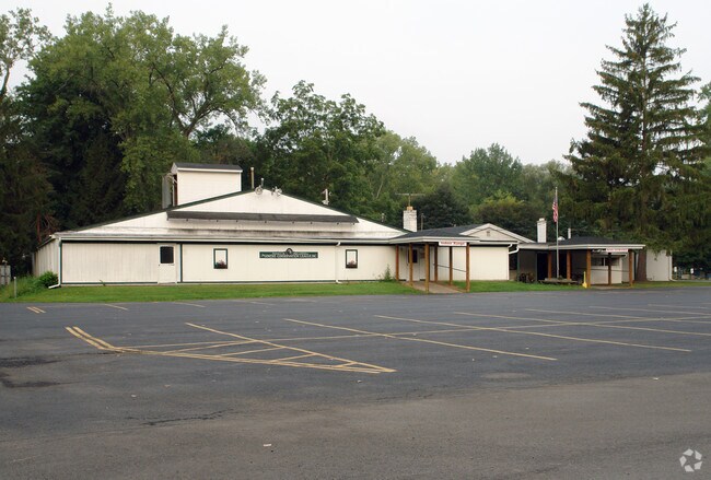
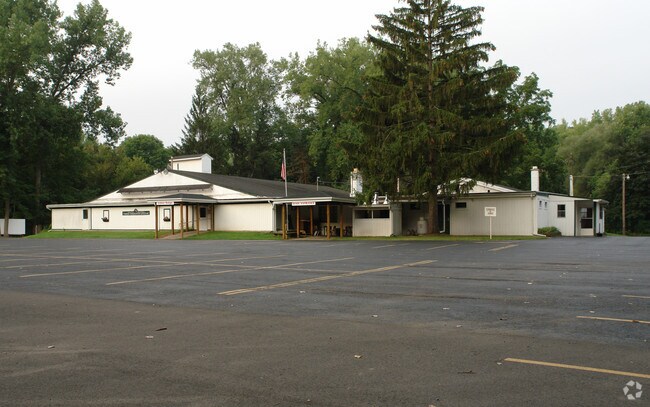
Property Record
1570 Old Penfield Rd, Rochester, NY 14625
NEARBY LISTINGS FOR SALE OR LEASE
Property Detail
1570 Old Penfield Rd
264200-123-200-0002-001-100
Monroe
Recreationalentertainmentgeneral
New York
AE
1.100
36055C0238G
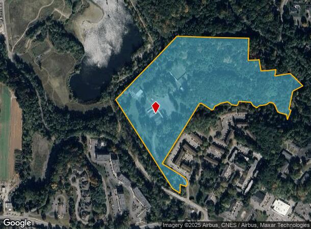
33.79 AC
2025
Northeast
2024
Rochester
011604
Rochester, NY
14,236 SF
DEMOGRAPHICS near 1570 Old Penfield Rd
1 Mile
3 Mile
5 Mile
2024 Total Population
4,521
55,304
188,799
2029 Population
4,498
54,574
185,873
Pop Growth 2024-2029
(0.51%)
(1.32%)
(1.55%)
Average Age
47
43
42
2024 Total Households
2,245
23,703
84,483
HH Growth 2024-2029
(0.58%)
(1.40%)
(1.66%)
Median Household Inc
$83,274
$81,344
$73,072
Avg Household Size
2.00
2.20
2.10
2024 Avg HH Vehicles
2.00
2.00
2.00
Median Home Value
$219,601
$227,631
$215,629
Median Year Built
1969
1961
1959
Nearby Places
Map Layers
Map Styles
 Street
 Aerial
- Restaurants
- Banks
- Shops
- Fitness
- Groceries
PUBLIC TRANSPORTATION
COMMUTER RAIL
DRIVE
WALK
Distance
14 min
7.2 mi
AIRPORT
Frederick Douglass/Greater Rochester International
DRIVE
WALK
Distance
Frederick Douglass/Greater Rochester International
20 min
10.3 mi
Nearby Properties
Address
Land Use
TOTAL SIZE
Lot Size
Zoning
Address
Land Use
TOTAL SIZE
Lot Size
Zoning
65,745 SF
154.98 AC
Address
Land Use
TOTAL SIZE
Lot Size
Zoning
7.15 AC
Address
Land Use
TOTAL SIZE
Lot Size
Zoning
70,683 SF
53.22 AC
Address
Land Use
TOTAL SIZE
Lot Size
Zoning
640 SF
84.10 AC
RA-2
Address
Land Use
TOTAL SIZE
Lot Size
Zoning
160,758 SF
20.95 AC
02 - SINGL
Address
Land Use
TOTAL SIZE
Lot Size
Zoning
408,790 SF
31.90 AC
02 - SINGL
Address
Land Use
TOTAL SIZE
Lot Size
Zoning
198,655 SF
31.05 AC
02 - SINGL
Address
Land Use
TOTAL SIZE
Lot Size
Zoning
155,517 SF
45.77 AC
Address
Land Use
TOTAL SIZE
Lot Size
Zoning
251,359 SF
46.83 AC
GB
Address
Land Use
TOTAL SIZE
Lot Size
Zoning
364,800 SF
28.40 AC
R-1-15
Address
Land Use
TOTAL SIZE
Lot Size
Zoning
283,456 SF
40.76 AC
R-1-20
Address
Land Use
TOTAL SIZE
Lot Size
Zoning
62,200 SF
17.92 AC
Address
Land Use
TOTAL SIZE
Lot Size
Zoning
52,716 SF
10.72 AC
LLD
Address
Land Use
TOTAL SIZE
Lot Size
Zoning
1,878 SF
56.60 AC
MHP
Address
Land Use
TOTAL SIZE
Lot Size
Zoning
74,490 SF
16.20 AC
MIXED USE
Address
Land Use
TOTAL SIZE
Lot Size
Zoning
8,064 SF
17.42 AC
Address
Land Use
TOTAL SIZE
Lot Size
Zoning
90,684 SF
20.51 AC
LI
Address
Land Use
TOTAL SIZE
Lot Size
Zoning
52,080 SF
21.10 AC
Address
Land Use
TOTAL SIZE
Lot Size
Zoning
38,776 SF
10.33 AC
MR
Address
Land Use
TOTAL SIZE
Lot Size
Zoning
247,668 SF
36.68 AC
GB
Address
Land Use
TOTAL SIZE
Lot Size
Zoning
293,504 SF
3.86 AC
03 - MULTI
Address
Land Use
TOTAL SIZE
Lot Size
Zoning
50,387 SF
4.10 AC
02 - SINGL
Address
Land Use
TOTAL SIZE
Lot Size
Zoning
70,468 SF
318.95 AC
Address
Land Use
TOTAL SIZE
Lot Size
Zoning
31,378 SF
16.90 AC
03 - MULTI
Address
Land Use
TOTAL SIZE
Lot Size
Zoning
52,716 SF
7.57 AC
LLD
Address
Land Use
TOTAL SIZE
Lot Size
Zoning
12,024 SF
17 AC
MR
Address
Land Use
TOTAL SIZE
Lot Size
Zoning
121,828 SF
2.74 AC
05 - COMME
Address
Land Use
TOTAL SIZE
Lot Size
Zoning
182,943 SF
15.83 AC
LI
Address
Land Use
TOTAL SIZE
Lot Size
Zoning
49,500 SF
8.60 AC
LI
Address
Land Use
TOTAL SIZE
Lot Size
Zoning
123,630 SF
11.72 AC
GB
The World's #1 Commercial Real Estate Marketplace
Connect with us
© 2025 CoStar Group
The information above has been obtained from sources believed reliable. While we do not doubt its accuracy we have not verified it and make no guarantee, warranty or representation about it. It is your responsibility to independently confirm its accuracy and completeness. Any projections, opinions, assumptions, or estimates used are for example only and do not represent the current or future performance of the property. The value of this transaction to you depends on tax and other factors which should be evaluated by your tax, financial, and legal advisors. You and your advisors should conduct a careful, independent investigation of the property to determine to your satisfaction the suitability of the property for your needs.