Property Record
1570 W 43Rd St, Loveland, CO 80538
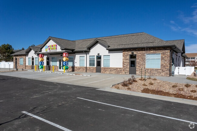

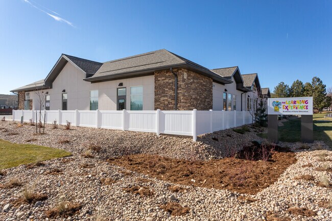
Property Detail
1570 W 43Rd St
Fort Collins-Loveland, CO
LOT 1, SHAMROCK WEST FOURTH SUB, LOV (20220002174)
95031-87-001
LARIMER
Commercialnec
Colorado
2024
1
2025
1.81 AC
001810
Fort Collins
10,368 SF
Denver
NEARBY LISTINGS FOR SALE OR LEASE
DEMOGRAPHICS near 1570 W 43Rd St
1 mile
3 mile
5 mile
2024 Total Population
11,950
46,790
97,335
2029 Population
12,196
47,764
99,894
Pop Growth 2024-2029
+ 2.06%
+ 2.08%
+ 2.63%
Average Age
44
43
43
2024 Total Households
4,830
19,404
40,061
HH Growth 2024-2029
+ 2.22%
+ 2.15%
+ 2.71%
Median Household Inc
$96,747
$84,010
$86,122
Avg Household Size
2.40
2.40
2.40
2024 Avg HH Vehicles
2.00
2.00
2.00
Median Home Value
$481,984
$482,118
$496,154
Median Year Built
1995
1985
1992
Nearby Places
Map Layers
Map Styles
 Street
 Aerial
Transit
 Traffic
 Biking
Places
Listings with unknown addresses are not visible on the map
- Restaurants
- Banks
- Shops
- Fitness
- Groceries
Nearby Properties
Address
Land Use
TOTAL SIZE
Lot Size
Zoning
Address
Land Use
TOTAL SIZE
Lot Size
Zoning
366,684 SF
29.44 AC
R3
Address
Land Use
TOTAL SIZE
Lot Size
Zoning
201,500 SF
28.43 AC
R1E
Address
Land Use
TOTAL SIZE
Lot Size
Zoning
573.74 AC
FA1
Address
Land Use
TOTAL SIZE
Lot Size
Zoning
117,434 SF
29.34 AC
R1
Address
Land Use
TOTAL SIZE
Lot Size
Zoning
137,225 SF
25.76 AC
R1
Address
Land Use
TOTAL SIZE
Lot Size
Zoning
222,636 SF
26.89 AC
P65
Address
Land Use
TOTAL SIZE
Lot Size
Zoning
96,723 SF
9.16 AC
I
Address
Land Use
TOTAL SIZE
Lot Size
Zoning
101,362 SF
4.80 AC
Address
Land Use
TOTAL SIZE
Lot Size
Zoning
117,157 SF
117.61 AC
Address
Land Use
TOTAL SIZE
Lot Size
Zoning
123,130 SF
4.17 AC
Address
Land Use
TOTAL SIZE
Lot Size
Zoning
59.21 AC
FA
Address
Land Use
TOTAL SIZE
Lot Size
Zoning
137,432 SF
12.89 AC
B
Address
Land Use
TOTAL SIZE
Lot Size
Zoning
75,000 SF
2.96 AC
B
Address
Land Use
TOTAL SIZE
Lot Size
Zoning
162,703 SF
14.92 AC
B
Address
Land Use
TOTAL SIZE
Lot Size
Zoning
117,496 SF
6.24 AC
Address
Land Use
TOTAL SIZE
Lot Size
Zoning
332,645 SF
14.16 AC
BUD
Address
Land Use
TOTAL SIZE
Lot Size
Zoning
118,788 SF
14.01 AC
B
Address
Land Use
TOTAL SIZE
Lot Size
Zoning
125,250 SF
9.55 AC
P93
Address
Land Use
TOTAL SIZE
Lot Size
Zoning
87,518 SF
8.02 AC
Address
Land Use
TOTAL SIZE
Lot Size
Zoning
82,749 SF
25.54 AC
R2
Address
Land Use
TOTAL SIZE
Lot Size
Zoning
97,225 SF
4.60 AC
P55
Address
Land Use
TOTAL SIZE
Lot Size
Zoning
41,580 SF
1.83 AC
B
Address
Land Use
TOTAL SIZE
Lot Size
Zoning
80,000 SF
3.69 AC
R3
Address
Land Use
TOTAL SIZE
Lot Size
Zoning
43,646 SF
2.01 AC
Address
Land Use
TOTAL SIZE
Lot Size
Zoning
34,430 SF
2.59 AC
B
Address
Land Use
TOTAL SIZE
Lot Size
Zoning
51,209 SF
4.23 AC
P7
Address
Land Use
TOTAL SIZE
Lot Size
Zoning
387,075 SF
17.61 AC
Address
Land Use
TOTAL SIZE
Lot Size
Zoning
48,000 SF
10 AC
P58
Address
Land Use
TOTAL SIZE
Lot Size
Zoning
54,300 SF
4.05 AC
FA1
Address
Land Use
TOTAL SIZE
Lot Size
Zoning
50,098 SF
4.49 AC
B
The World's #1 Commercial Real Estate Marketplace
Connect with us
© 2026 CoStar Group
The information above has been obtained from sources believed reliable. While we do not doubt its accuracy we have not verified it and make no guarantee, warranty or representation about it. It is your responsibility to independently confirm its accuracy and completeness. Any projections, opinions, assumptions, or estimates used are for example only and do not represent the current or future performance of the property. The value of this transaction to you depends on tax and other factors which should be evaluated by your tax, financial, and legal advisors. You and your advisors should conduct a careful, independent investigation of the property to determine to your satisfaction the suitability of the property for your needs.