Property Record
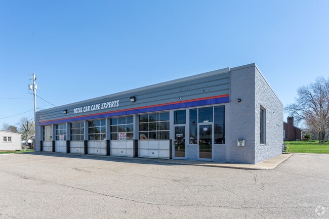
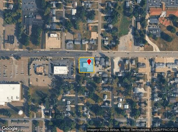
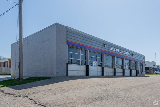
1570 W State St, Alliance, OH 44601
NEARBY LISTINGS FOR SALE OR LEASE
Property Detail
1570 W State St
00113028
Alliance
Vehiclerentalsvehiclesales
9917-IRR SE;9918,9919 WH EA
X
Stark
39151C0119E
Ohio
0
0.51 AC
2025
Stark County
710600
Cleveland
3,528 SF
Canton-Massillon, OH
DEMOGRAPHICS near 1570 W State St
1 Mile
3 Mile
5 Mile
2024 Total Population
6,837
28,437
33,768
2029 Population
6,794
28,400
33,631
Pop Growth 2024-2029
(0.63%)
(0.13%)
(0.41%)
Average Age
44
41
41
2024 Total Households
2,785
11,471
13,574
HH Growth 2024-2029
(0.57%)
(0.13%)
(0.39%)
Median Household Inc
$70,240
$50,535
$53,285
Avg Household Size
2.20
2.30
2.30
2024 Avg HH Vehicles
2.00
2.00
2.00
Median Home Value
$154,884
$122,110
$132,745
Median Year Built
1962
1954
1954
Nearby Places
Map Layers
Map Styles
 Street
 Aerial
- Restaurants
- Banks
- Shops
- Fitness
- Groceries
PUBLIC TRANSPORTATION
COMMUTER RAIL
DRIVE
WALK
Distance
8 min
3.4 mi
AIRPORT
Akron-Canton Regional
DRIVE
WALK
Distance
Akron-Canton Regional
30 min
18.1 mi
SALE & LEASE HISTORY
LISTING DATE
SALE/LEASE

May 02, 2018
For Lease
Nearby Properties
Address
Land Use
TOTAL SIZE
Lot Size
Zoning
Address
Land Use
TOTAL SIZE
Lot Size
Zoning
1,015,253 SF
83.25 AC
Address
Land Use
TOTAL SIZE
Lot Size
Zoning
294,532 SF
7.73 AC
Address
Land Use
TOTAL SIZE
Lot Size
Zoning
121,669 SF
27.80 AC
Address
Land Use
TOTAL SIZE
Lot Size
Zoning
275,422 SF
10 AC
Address
Land Use
TOTAL SIZE
Lot Size
Zoning
402,113 SF
25.10 AC
Address
Land Use
TOTAL SIZE
Lot Size
Zoning
157,090 SF
22.75 AC
Address
Land Use
TOTAL SIZE
Lot Size
Zoning
93,477 SF
8.21 AC
Address
Land Use
TOTAL SIZE
Lot Size
Zoning
295,254 SF
29.02 AC
Address
Land Use
TOTAL SIZE
Lot Size
Zoning
79,700 SF
1.80 AC
Address
Land Use
TOTAL SIZE
Lot Size
Zoning
120,552 SF
10.37 AC
Address
Land Use
TOTAL SIZE
Lot Size
Zoning
69,467 SF
18.25 AC
Address
Land Use
TOTAL SIZE
Lot Size
Zoning
60,037 SF
6.38 AC
Address
Land Use
TOTAL SIZE
Lot Size
Zoning
398,637 SF
60.59 AC
Address
Land Use
TOTAL SIZE
Lot Size
Zoning
206,576 SF
18.65 AC
Address
Land Use
TOTAL SIZE
Lot Size
Zoning
73,853 SF
3.83 AC
Address
Land Use
TOTAL SIZE
Lot Size
Zoning
80,163 SF
6.99 AC
Address
Land Use
TOTAL SIZE
Lot Size
Zoning
75,318 SF
4.59 AC
Address
Land Use
TOTAL SIZE
Lot Size
Zoning
56,112 SF
6.37 AC
Address
Land Use
TOTAL SIZE
Lot Size
Zoning
114,969 SF
14.57 AC
Address
Land Use
TOTAL SIZE
Lot Size
Zoning
134,368 SF
10.30 AC
Address
Land Use
TOTAL SIZE
Lot Size
Zoning
73,764 SF
1.52 AC
Address
Land Use
TOTAL SIZE
Lot Size
Zoning
29,455 SF
8 AC
Address
Land Use
TOTAL SIZE
Lot Size
Zoning
62,767 SF
2.85 AC
Address
Land Use
TOTAL SIZE
Lot Size
Zoning
106,914 SF
11.10 AC
Address
Land Use
TOTAL SIZE
Lot Size
Zoning
189,096 SF
21.15 AC
Address
Land Use
TOTAL SIZE
Lot Size
Zoning
130,339 SF
10.28 AC
Address
Land Use
TOTAL SIZE
Lot Size
Zoning
53,959 SF
3.58 AC
Address
Land Use
TOTAL SIZE
Lot Size
Zoning
49,226 SF
10.57 AC
Address
Land Use
TOTAL SIZE
Lot Size
Zoning
37,660 SF
2.97 AC
Address
Land Use
TOTAL SIZE
Lot Size
Zoning
52,644 SF
1.03 AC
The World's #1 Commercial Real Estate Marketplace
Connect with us
© 2026 CoStar Group
The information above has been obtained from sources believed reliable. While we do not doubt its accuracy we have not verified it and make no guarantee, warranty or representation about it. It is your responsibility to independently confirm its accuracy and completeness. Any projections, opinions, assumptions, or estimates used are for example only and do not represent the current or future performance of the property. The value of this transaction to you depends on tax and other factors which should be evaluated by your tax, financial, and legal advisors. You and your advisors should conduct a careful, independent investigation of the property to determine to your satisfaction the suitability of the property for your needs.