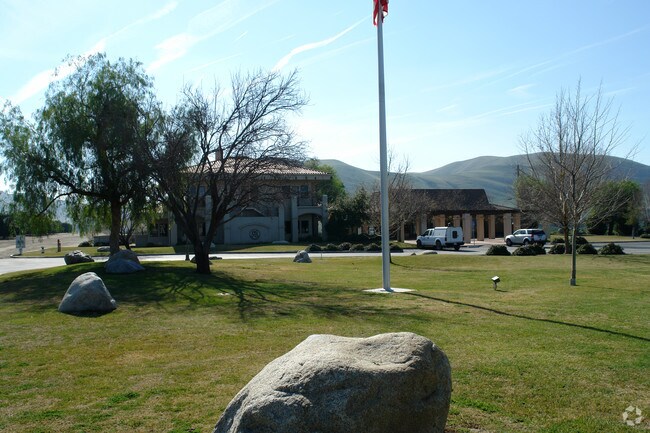
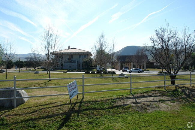
Property Record
15701 Highway 178, Bakersfield, CA 93306

Property Detail
15701 Highway 178
386-060-18-00-4
PARCEL MAP 10459 , LOT 1
Commercialnec
KERN
C2 PCD
California
B and X Area of moderate flood hazard, usually the area between the limits of the 100-year and 500-year floods.
1
2024
12.97 AC
2025
NE Outlying Kern County
005104
Bakersfield
3,000 SF
Bakersfield-Delano, CA
NEARBY LISTINGS FOR SALE OR LEASE
-
-
View all Bakersfield listings for sale on LoopNet.com
DEMOGRAPHICS near 15701 Highway 178
1 mile
3 mile
5 mile
2025 Total Population
45
4,329
11,404
2030 Population
44
4,439
11,759
Pop Growth 2025-2030
(2.22%)
+ 2.54%
+ 3.11%
Average Age
48
48
42
2025 Total Households
17
1,744
4,018
HH Growth 2025-2030
0.00%
+ 2.47%
+ 2.86%
Median Household Inc
$77,500
$120,178
$116,597
Avg Household Size
2.40
2.50
2.80
2025 Avg HH Vehicles
2.00
2.00
2.00
Median Home Value
$399,999
$428,113
$408,975
Median Year Built
1980
2004
2006
Nearby Places
Map Layers
Map Styles
 Street
 Aerial
Layers
 Traffic
 Biking
Places
Listings with unknown addresses are not visible on the map
- Restaurants
- Banks
- Shops
- Fitness
- Groceries
PUBLIC TRANSPORTATION
AIRPORT
Meadows Field
Drive
Walk
Distance
Meadows Field
29 min
17.7 mi
Nearby Properties
Address
Land Use
TOTAL SIZE
Lot Size
Zoning
Address
Land Use
TOTAL SIZE
Lot Size
Zoning
398.60 AC
A
Address
Land Use
TOTAL SIZE
Lot Size
Zoning
198.29 AC
A
Address
Land Use
TOTAL SIZE
Lot Size
Zoning
81.08 AC
A
Address
Land Use
TOTAL SIZE
Lot Size
Zoning
18,010 SF
176.09 AC
OS
Address
Land Use
TOTAL SIZE
Lot Size
Zoning
15.46 AC
C-2
Address
Land Use
TOTAL SIZE
Lot Size
Zoning
6,329 SF
0.90 AC
C-1
Address
Land Use
TOTAL SIZE
Lot Size
Zoning
19.07 AC
R2
Address
Land Use
TOTAL SIZE
Lot Size
Zoning
11.37 AC
C-0
Address
Land Use
TOTAL SIZE
Lot Size
Zoning
457.74 AC
A
Address
Land Use
TOTAL SIZE
Lot Size
Zoning
4,102 SF
0.80 AC
C-1
Address
Land Use
TOTAL SIZE
Lot Size
Zoning
161.83 AC
A
Address
Land Use
TOTAL SIZE
Lot Size
Zoning
2,100 SF
0.59 AC
C-1
Address
Land Use
TOTAL SIZE
Lot Size
Zoning
213.15 AC
A
Address
Land Use
TOTAL SIZE
Lot Size
Zoning
7,344 SF
13.97 AC
R-1
Address
Land Use
TOTAL SIZE
Lot Size
Zoning
0.63 AC
R-1
Address
Land Use
TOTAL SIZE
Lot Size
Zoning
1,525 SF
88.65 AC
Address
Land Use
TOTAL SIZE
Lot Size
Zoning
13,296 SF
3.34 AC
C-O
Address
Land Use
TOTAL SIZE
Lot Size
Zoning
2,880 SF
0.91 AC
C2
Address
Land Use
TOTAL SIZE
Lot Size
Zoning
46.24 AC
R1
Address
Land Use
TOTAL SIZE
Lot Size
Zoning
3.04 AC
C1
Address
Land Use
TOTAL SIZE
Lot Size
Zoning
120.41 AC
R1 HD
Address
Land Use
TOTAL SIZE
Lot Size
Zoning
Address
Land Use
TOTAL SIZE
Lot Size
Zoning
375.63 AC
A
Address
Land Use
TOTAL SIZE
Lot Size
Zoning
105.35 AC
A
Address
Land Use
TOTAL SIZE
Lot Size
Zoning
Address
Land Use
TOTAL SIZE
Lot Size
Zoning
83.18 AC
A
Address
Land Use
TOTAL SIZE
Lot Size
Zoning
Address
Land Use
TOTAL SIZE
Lot Size
Zoning
39.51 AC
A
The World's #1 Commercial Real Estate Marketplace
Connect with us
© 2026 CoStar Group
The information above has been obtained from sources believed reliable. While we do not doubt its accuracy we have not verified it and make no guarantee, warranty or representation about it. It is your responsibility to independently confirm its accuracy and completeness. Any projections, opinions, assumptions, or estimates used are for example only and do not represent the current or future performance of the property. The value of this transaction to you depends on tax and other factors which should be evaluated by your tax, financial, and legal advisors. You and your advisors should conduct a careful, independent investigation of the property to determine to your satisfaction the suitability of the property for your needs.