Property Record
15709 Impact Way, Pflugerville, TX 78660
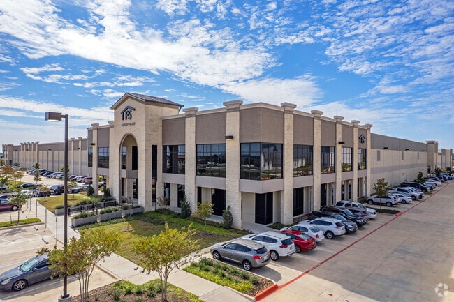

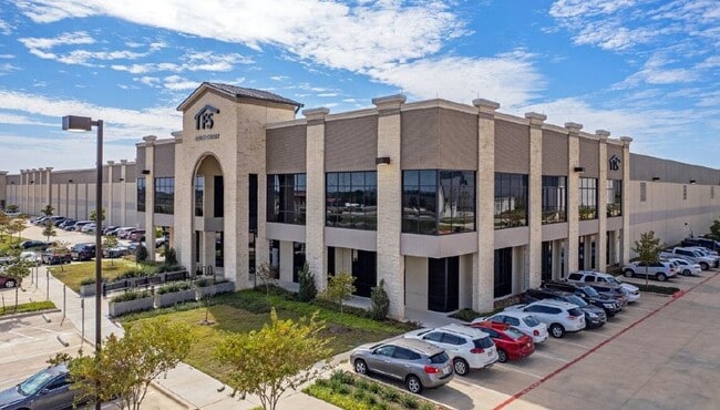
Property Detail
15709 Impact Way
Austin-Round Rock-San Marcos, TX
LOT 3E RENEWABLE ENERGY PARK REPLAT OF LOT 3C
837594
Travis
Industrialgeneral
Texas
B and X Area of moderate flood hazard, usually the area between the limits of the 100-year and 500-year floods.
3e,3c
2025
14.23 AC
2025
Far Northeast
044800
Austin
284,250 SF
NEARBY LISTINGS FOR SALE OR LEASE
DEMOGRAPHICS near 15709 Impact Way
1 mile
3 mile
5 mile
2025 Total Population
1,016
39,437
156,774
2030 Population
1,084
41,888
164,909
Pop Growth 2025-2030
+ 6.69%
+ 6.21%
+ 5.19%
Average Age
35
37
37
2025 Total Households
332
13,046
55,574
HH Growth 2025-2030
+ 7.53%
+ 6.80%
+ 5.65%
Median Household Inc
$87,500
$106,823
$103,144
Avg Household Size
3.10
2.90
2.80
2025 Avg HH Vehicles
2.00
2.00
2.00
Median Home Value
$90,573
$392,098
$400,543
Median Year Built
2010
2010
2010
Nearby Places
Map Layers
Map Styles
 Street
 Aerial
Layers
 Traffic
 Biking
Places
Listings with unknown addresses are not visible on the map
- Restaurants
- Banks
- Shops
- Fitness
- Groceries
PUBLIC TRANSPORTATION
AIRPORT
Austin-Bergstrom International
Drive
Walk
Distance
Austin-Bergstrom International
35 min
24.2 mi
Freight Ports
Calhoun Port
Drive
Walk
Distance
Calhoun Port
195 min
167.2 mi
SALE & LEASE HISTORY
LISTING DATE
SALE/LEASE

May 02, 2024
For Lease
Jun 27, 2019
For Lease
Nearby Properties
Address
Land Use
TOTAL SIZE
Lot Size
Zoning
Address
Land Use
TOTAL SIZE
Lot Size
Zoning
3,842,019 SF
92.55 AC
Address
Land Use
TOTAL SIZE
Lot Size
Zoning
721,940 SF
140.82 AC
Address
Land Use
TOTAL SIZE
Lot Size
Zoning
4,355 SF
263.17 AC
Address
Land Use
TOTAL SIZE
Lot Size
Zoning
393,550 SF
29.76 AC
Address
Land Use
TOTAL SIZE
Lot Size
Zoning
381,495 SF
13.54 AC
Address
Land Use
TOTAL SIZE
Lot Size
Zoning
237,600 SF
14.10 AC
Address
Land Use
TOTAL SIZE
Lot Size
Zoning
272,250 SF
15.31 AC
Address
Land Use
TOTAL SIZE
Lot Size
Zoning
297,000 SF
16.01 AC
Address
Land Use
TOTAL SIZE
Lot Size
Zoning
307,910 SF
20 AC
Address
Land Use
TOTAL SIZE
Lot Size
Zoning
261,000 SF
17 AC
Address
Land Use
TOTAL SIZE
Lot Size
Zoning
154,420 SF
26.39 AC
Address
Land Use
TOTAL SIZE
Lot Size
Zoning
366,300 SF
29.88 AC
Address
Land Use
TOTAL SIZE
Lot Size
Zoning
343,200 SF
21.79 AC
Address
Land Use
TOTAL SIZE
Lot Size
Zoning
240,888 SF
15.39 AC
Address
Land Use
TOTAL SIZE
Lot Size
Zoning
2,160 SF
180.43 AC
Address
Land Use
TOTAL SIZE
Lot Size
Zoning
210,724 SF
33.42 AC
Address
Land Use
TOTAL SIZE
Lot Size
Zoning
212,748 SF
12.28 AC
Address
Land Use
TOTAL SIZE
Lot Size
Zoning
240,000 SF
15.56 AC
Address
Land Use
TOTAL SIZE
Lot Size
Zoning
54,040 SF
22 AC
Address
Land Use
TOTAL SIZE
Lot Size
Zoning
325,000 SF
11.03 AC
Address
Land Use
TOTAL SIZE
Lot Size
Zoning
197,980 SF
14.53 AC
Address
Land Use
TOTAL SIZE
Lot Size
Zoning
170,100 SF
11.95 AC
Address
Land Use
TOTAL SIZE
Lot Size
Zoning
170,100 SF
9.32 AC
Address
Land Use
TOTAL SIZE
Lot Size
Zoning
170,100 SF
9.53 AC
Address
Land Use
TOTAL SIZE
Lot Size
Zoning
129,360 SF
7.95 AC
Address
Land Use
TOTAL SIZE
Lot Size
Zoning
154,800 SF
18.13 AC
Address
Land Use
TOTAL SIZE
Lot Size
Zoning
140,280 SF
9.35 AC
Address
Land Use
TOTAL SIZE
Lot Size
Zoning
170,100 SF
10.19 AC
Address
Land Use
TOTAL SIZE
Lot Size
Zoning
170,100 SF
8.87 AC
The World's #1 Commercial Real Estate Marketplace
Connect with us
© 2026 CoStar Group
The information above has been obtained from sources believed reliable. While we do not doubt its accuracy we have not verified it and make no guarantee, warranty or representation about it. It is your responsibility to independently confirm its accuracy and completeness. Any projections, opinions, assumptions, or estimates used are for example only and do not represent the current or future performance of the property. The value of this transaction to you depends on tax and other factors which should be evaluated by your tax, financial, and legal advisors. You and your advisors should conduct a careful, independent investigation of the property to determine to your satisfaction the suitability of the property for your needs.