Property Record
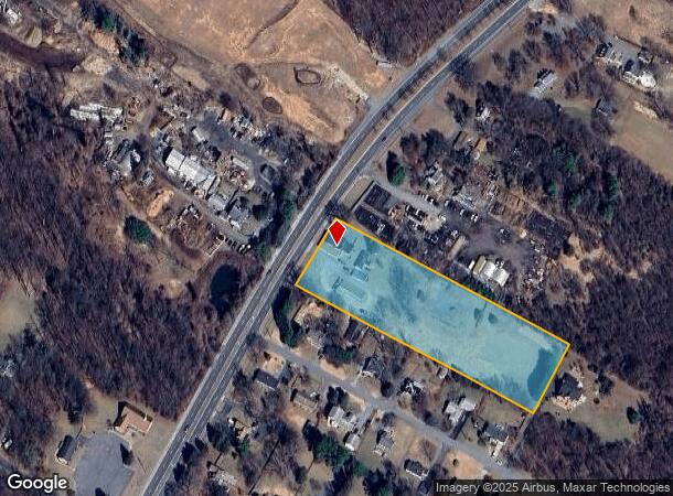
15711 New Hampshire Ave, Silver Spring, MD 20905


NEARBY LISTINGS FOR SALE OR LEASE
-
-
View all Silver Spring listings for sale on LoopNet.com
Property Detail
15711 New Hampshire Ave
05-00262598
Bealls Manor
Storebuilding
SNOWDENS MANOR ENL
X
Montgomery
24033C0030E
Maryland
2024
3.60 AC
2025
North Silver Spring/Rt 29
701408
Washington, DC
3,184 SF
Washington-Arlington-Alexandria, DC-VA-MD-WV
DEMOGRAPHICS near 15711 New Hampshire Ave
1 Mile
3 Mile
5 Mile
2024 Total Population
3,264
35,252
178,356
2029 Population
3,204
34,824
176,548
Pop Growth 2024-2029
(1.84%)
(1.21%)
(1.01%)
Average Age
43
44
43
2024 Total Households
1,012
11,380
63,302
HH Growth 2024-2029
(2.08%)
(1.41%)
(1.00%)
Median Household Inc
$114,728
$135,765
$102,404
Avg Household Size
3.10
3.00
2.70
2024 Avg HH Vehicles
3.00
2.00
2.00
Median Home Value
$668,658
$652,645
$484,730
Median Year Built
1976
1980
1982
Nearby Places
Map Layers
Map Styles
 Street
 Aerial
- Restaurants
- Banks
- Shops
- Fitness
- Groceries
PUBLIC TRANSPORTATION
AIRPORT
Ronald Reagan Washington Ntl
DRIVE
WALK
Distance
Ronald Reagan Washington Ntl
37 min
21.5 mi
Baltimore/Washington International Thurgood Marshall
DRIVE
WALK
Distance
Baltimore/Washington International Thurgood Marshall
36 min
25.4 mi
Washington Dulles International
DRIVE
WALK
Distance
Washington Dulles International
58 min
35.5 mi
Freight Ports
Port of Baltimore
DRIVE
WALK
Distance
Port of Baltimore
41 min
28.2 mi
SALE & LEASE HISTORY
LISTING DATE
SALE/LEASE

Sep 23, 2016
For Sale
Nearby Properties
Address
Land Use
TOTAL SIZE
Lot Size
Zoning
Address
Land Use
TOTAL SIZE
Lot Size
Zoning
251,862 SF
91.09 AC
RE2C
Address
Land Use
TOTAL SIZE
Lot Size
Zoning
235,762 SF
139.24 AC
RE2
Address
Land Use
TOTAL SIZE
Lot Size
Zoning
289,712 SF
19.79 AC
RNC
Address
Land Use
TOTAL SIZE
Lot Size
Zoning
143,000 SF
20.01 AC
RC
Address
Land Use
TOTAL SIZE
Lot Size
Zoning
99,491 SF
5.97 AC
R200
Address
Land Use
TOTAL SIZE
Lot Size
Zoning
115,000 SF
10.14 AC
RE1
Address
Land Use
TOTAL SIZE
Lot Size
Zoning
124,099 SF
10.95 AC
RE2
Address
Land Use
TOTAL SIZE
Lot Size
Zoning
94,545 SF
30.85 AC
RC
Address
Land Use
TOTAL SIZE
Lot Size
Zoning
93,796 SF
6.80 AC
NR0.7
Address
Land Use
TOTAL SIZE
Lot Size
Zoning
130,577 SF
4.45 AC
R200
Address
Land Use
TOTAL SIZE
Lot Size
Zoning
92,227 SF
6.51 AC
R200
Address
Land Use
TOTAL SIZE
Lot Size
Zoning
73,975 SF
12 AC
RE2C
Address
Land Use
TOTAL SIZE
Lot Size
Zoning
93,514 SF
9.57 AC
R90
Address
Land Use
TOTAL SIZE
Lot Size
Zoning
61,508 SF
10.05 AC
RE1
Address
Land Use
TOTAL SIZE
Lot Size
Zoning
67,999 SF
12.67 AC
RE2
Address
Land Use
TOTAL SIZE
Lot Size
Zoning
46,490 SF
19.96 AC
R200
Address
Land Use
TOTAL SIZE
Lot Size
Zoning
55,972 SF
49.25 AC
Address
Land Use
TOTAL SIZE
Lot Size
Zoning
20,992 SF
4.56 AC
R200
Address
Land Use
TOTAL SIZE
Lot Size
Zoning
45,000 SF
3.63 AC
NR0.7
Address
Land Use
TOTAL SIZE
Lot Size
Zoning
41.04 AC
RE2C
Address
Land Use
TOTAL SIZE
Lot Size
Zoning
40,425 SF
7.02 AC
RE2C
Address
Land Use
TOTAL SIZE
Lot Size
Zoning
48,750 SF
3.94 AC
RE2
Address
Land Use
TOTAL SIZE
Lot Size
Zoning
2,275 SF
78.18 AC
RC
Address
Land Use
TOTAL SIZE
Lot Size
Zoning
48,000 SF
2.17 AC
NR0.7
Address
Land Use
TOTAL SIZE
Lot Size
Zoning
47,821 SF
2.67 AC
CRN07
Address
Land Use
TOTAL SIZE
Lot Size
Zoning
4,108 SF
28.54 AC
RE1
Address
Land Use
TOTAL SIZE
Lot Size
Zoning
14,000 SF
1.25 AC
CRT07
Address
Land Use
TOTAL SIZE
Lot Size
Zoning
49,444 SF
4.74 AC
R200
Address
Land Use
TOTAL SIZE
Lot Size
Zoning
42,861 SF
6.57 AC
RE1
Address
Land Use
TOTAL SIZE
Lot Size
Zoning
20,000 SF
2.53 AC
PD5
The World's #1 Commercial Real Estate Marketplace
Connect with us
© 2025 CoStar Group
The information above has been obtained from sources believed reliable. While we do not doubt its accuracy we have not verified it and make no guarantee, warranty or representation about it. It is your responsibility to independently confirm its accuracy and completeness. Any projections, opinions, assumptions, or estimates used are for example only and do not represent the current or future performance of the property. The value of this transaction to you depends on tax and other factors which should be evaluated by your tax, financial, and legal advisors. You and your advisors should conduct a careful, independent investigation of the property to determine to your satisfaction the suitability of the property for your needs.