Property Record
1572 Heights Dr, Logandale, NV 89021

Save to a Folder
{{folder.Name}}
{{folder.ListingIds.length}} Properties
{{folder.ListingIds.length}} Property
Create a New Folder
Property Detail
1572 Heights Dr
Las Vegas-Henderson-North Las Vegas, NV
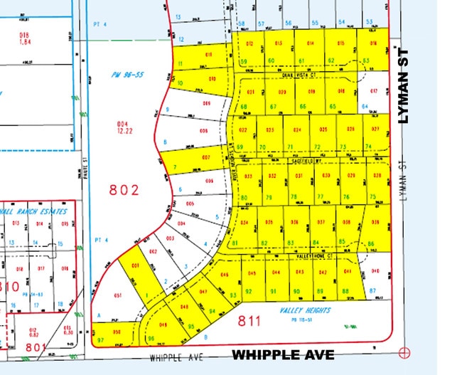
VALLEY HGTS PLAT BOOK 115 PAGE 51 LOT 83
041-22-710-013
CLARK
Vacantlandnec
Nevada
RE
83
B and X Area of moderate flood hazard, usually the area between the limits of the 100-year and 500-year floods.
0.46 AC
2026
Outlying NE Clark County
2026
Las Vegas
005613
NEARBY LISTINGS FOR SALE OR LEASE
DEMOGRAPHICS near 1572 Heights Dr
1 mile
3 mile
5 mile
2025 Total Population
1,106
2,999
4,126
2030 Population
1,082
2,933
4,036
Pop Growth 2025-2030
(2.17%)
(2.20%)
(2.18%)
Average Age
37
38
39
2025 Total Households
327
946
1,375
HH Growth 2025-2030
(1.83%)
(2.22%)
(2.11%)
Median Household Inc
$132,939
$114,038
$101,786
Avg Household Size
3.20
3.10
2.90
2025 Avg HH Vehicles
3.00
3.00
3.00
Median Home Value
$484,166
$489,767
$475,536
Median Year Built
1997
1993
1991
Nearby Places
Map Layers
Map Styles
 Street
 Aerial
Layers
 Traffic
 Biking
Places
Listings with unknown addresses are not visible on the map
- Restaurants
- Banks
- Shops
- Fitness
- Groceries
Nearby Properties
Address
Land Use
TOTAL SIZE
Lot Size
Zoning
Address
Land Use
TOTAL SIZE
Lot Size
Zoning
19,274 SF
6.67 AC
Address
Land Use
TOTAL SIZE
Lot Size
Zoning
2.15 AC
RU
Address
Land Use
TOTAL SIZE
Lot Size
Zoning
59,754 SF
53.71 AC
PF
Address
Land Use
TOTAL SIZE
Lot Size
Zoning
9,926 SF
6.31 AC
RU
Address
Land Use
TOTAL SIZE
Lot Size
Zoning
4.86 AC
RU
Address
Land Use
TOTAL SIZE
Lot Size
Zoning
6,316 SF
4.38 AC
RU
Address
Land Use
TOTAL SIZE
Lot Size
Zoning
7,548 SF
2 AC
C2
Address
Land Use
TOTAL SIZE
Lot Size
Zoning
1,528 SF
40 AC
PF
Address
Land Use
TOTAL SIZE
Lot Size
Zoning
12,530 SF
3 AC
PF
Address
Land Use
TOTAL SIZE
Lot Size
Zoning
4,216 SF
18.48 AC
RU
Address
Land Use
TOTAL SIZE
Lot Size
Zoning
8.53 AC
RU
Address
Land Use
TOTAL SIZE
Lot Size
Zoning
7,200 SF
640 AC
RU
Address
Land Use
TOTAL SIZE
Lot Size
Zoning
640 AC
RU
Address
Land Use
TOTAL SIZE
Lot Size
Zoning
16,000 SF
7.96 AC
M1
Address
Land Use
TOTAL SIZE
Lot Size
Zoning
12,000 SF
3.20 AC
C2
Address
Land Use
TOTAL SIZE
Lot Size
Zoning
4,680 SF
10 AC
PF
Address
Land Use
TOTAL SIZE
Lot Size
Zoning
39.41 AC
RU
Address
Land Use
TOTAL SIZE
Lot Size
Zoning
5,085 SF
2.76 AC
RU
Address
Land Use
TOTAL SIZE
Lot Size
Zoning
2,840 SF
40 AC
RU
Address
Land Use
TOTAL SIZE
Lot Size
Zoning
4.59 AC
PF
Address
Land Use
TOTAL SIZE
Lot Size
Zoning
37.07 AC
RU
Address
Land Use
TOTAL SIZE
Lot Size
Zoning
2,229 SF
9.92 AC
RU
Address
Land Use
TOTAL SIZE
Lot Size
Zoning
41.39 AC
RU
Address
Land Use
TOTAL SIZE
Lot Size
Zoning
53.73 AC
RU
Address
Land Use
TOTAL SIZE
Lot Size
Zoning
6,429 SF
2.22 AC
C2
Address
Land Use
TOTAL SIZE
Lot Size
Zoning
4,366 SF
1.06 AC
C2
Address
Land Use
TOTAL SIZE
Lot Size
Zoning
37.12 AC
RU
Address
Land Use
TOTAL SIZE
Lot Size
Zoning
2,443 SF
0.72 AC
C1
Address
Land Use
TOTAL SIZE
Lot Size
Zoning
23.72 AC
RU
The World's #1 Commercial Real Estate Marketplace
Connect with us
© 2026 CoStar Group
The information above has been obtained from sources believed reliable. While we do not doubt its accuracy we have not verified it and make no guarantee, warranty or representation about it. It is your responsibility to independently confirm its accuracy and completeness. Any projections, opinions, assumptions, or estimates used are for example only and do not represent the current or future performance of the property. The value of this transaction to you depends on tax and other factors which should be evaluated by your tax, financial, and legal advisors. You and your advisors should conduct a careful, independent investigation of the property to determine to your satisfaction the suitability of the property for your needs.