Property Record
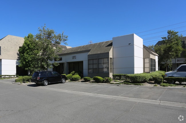
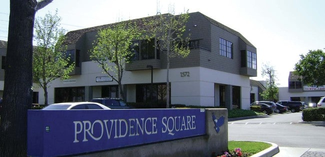
1572 N Batavia St, Orange, CA 92867
This Property Is For Sale
Property Detail
1572 N Batavia St
Anaheim-Santa Ana-Irvine, CA
P BK 193 PG 5 PAR 1 UN C-02 P M 193-05 PAR 1 UNIT C-02 OF PROJECT LOCATED
930-521-82
Orange
Industrialgeneral
California
2024
1
2025
Orange
076204
Orange County (California)
4,544 SF
NEARBY LISTINGS FOR SALE OR LEASE
DEMOGRAPHICS near 1572 N Batavia St
1 mile
3 mile
5 mile
2024 Total Population
7,687
199,962
587,521
2029 Population
7,662
200,278
587,337
Pop Growth 2024-2029
(0.33%)
+ 0.16%
(0.03%)
Average Age
37
38
38
2024 Total Households
2,253
62,707
174,537
HH Growth 2024-2029
(0.53%)
+ 0.11%
(0.13%)
Median Household Inc
$104,654
$98,659
$96,278
Avg Household Size
3.20
3.00
3.20
2024 Avg HH Vehicles
2.00
2.00
2.00
Median Home Value
$714,546
$794,428
$811,879
Median Year Built
1969
1970
1970
Nearby Places
Map Layers
Map Styles
 Street
 Aerial
Transit
 Traffic
 Biking
Places
Listings with unknown addresses are not visible on the map
- Restaurants
- Banks
- Shops
- Fitness
- Groceries
PUBLIC TRANSPORTATION
COMMUTER RAIL
Anaheim (Pacific Surfliner - Amtrak)
Drive
Walk
Distance
Anaheim (Pacific Surfliner - Amtrak)
4 min
1.5 mi
Anaheim-Artic Metrolink Station (Metrolink Orange County Line - Metrolink Trains)
Drive
Walk
Distance
Anaheim-Artic Metrolink Station (Metrolink Orange County Line - Metrolink Trains)
4 min
1.6 mi
AIRPORT
John Wayne/Orange County
Drive
Walk
Distance
John Wayne/Orange County
17 min
12.9 mi
Long Beach (Daugherty Field)
Drive
Walk
Distance
Long Beach (Daugherty Field)
28 min
22.3 mi
Ontario International
Drive
Walk
Distance
Ontario International
40 min
31.2 mi
Freight Ports
Port of Long Beach
Drive
Walk
Distance
Port of Long Beach
33 min
21.9 mi
Nearby Properties
Address
Land Use
TOTAL SIZE
Lot Size
Zoning
Address
Land Use
TOTAL SIZE
Lot Size
Zoning
26.08 AC
Address
Land Use
TOTAL SIZE
Lot Size
Zoning
31.01 AC
Address
Land Use
TOTAL SIZE
Lot Size
Zoning
2.60 AC
Address
Land Use
TOTAL SIZE
Lot Size
Zoning
41.12 AC
Address
Land Use
TOTAL SIZE
Lot Size
Zoning
5.07 AC
Address
Land Use
TOTAL SIZE
Lot Size
Zoning
4.89 AC
Address
Land Use
TOTAL SIZE
Lot Size
Zoning
4.13 AC
Address
Land Use
TOTAL SIZE
Lot Size
Zoning
12.20 AC
Address
Land Use
TOTAL SIZE
Lot Size
Zoning
6.60 AC
Address
Land Use
TOTAL SIZE
Lot Size
Zoning
Address
Land Use
TOTAL SIZE
Lot Size
Zoning
Address
Land Use
TOTAL SIZE
Lot Size
Zoning
4.71 AC
Address
Land Use
TOTAL SIZE
Lot Size
Zoning
11.61 AC
Address
Land Use
TOTAL SIZE
Lot Size
Zoning
52.51 AC
Address
Land Use
TOTAL SIZE
Lot Size
Zoning
Address
Land Use
TOTAL SIZE
Lot Size
Zoning
Address
Land Use
TOTAL SIZE
Lot Size
Zoning
3.47 AC
Address
Land Use
TOTAL SIZE
Lot Size
Zoning
Address
Land Use
TOTAL SIZE
Lot Size
Zoning
Address
Land Use
TOTAL SIZE
Lot Size
Zoning
40.76 AC
Address
Land Use
TOTAL SIZE
Lot Size
Zoning
Address
Land Use
TOTAL SIZE
Lot Size
Zoning
Address
Land Use
TOTAL SIZE
Lot Size
Zoning
Address
Land Use
TOTAL SIZE
Lot Size
Zoning
Address
Land Use
TOTAL SIZE
Lot Size
Zoning
126,979 SF
6.42 AC
Address
Land Use
TOTAL SIZE
Lot Size
Zoning
Address
Land Use
TOTAL SIZE
Lot Size
Zoning
8.44 AC
Address
Land Use
TOTAL SIZE
Lot Size
Zoning
4.94 AC
Address
Land Use
TOTAL SIZE
Lot Size
Zoning
Address
Land Use
TOTAL SIZE
Lot Size
Zoning
The World's #1 Commercial Real Estate Marketplace
Connect with us
© 2026 CoStar Group
The information above has been obtained from sources believed reliable. While we do not doubt its accuracy we have not verified it and make no guarantee, warranty or representation about it. It is your responsibility to independently confirm its accuracy and completeness. Any projections, opinions, assumptions, or estimates used are for example only and do not represent the current or future performance of the property. The value of this transaction to you depends on tax and other factors which should be evaluated by your tax, financial, and legal advisors. You and your advisors should conduct a careful, independent investigation of the property to determine to your satisfaction the suitability of the property for your needs.