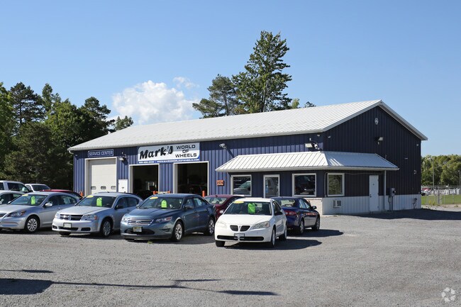
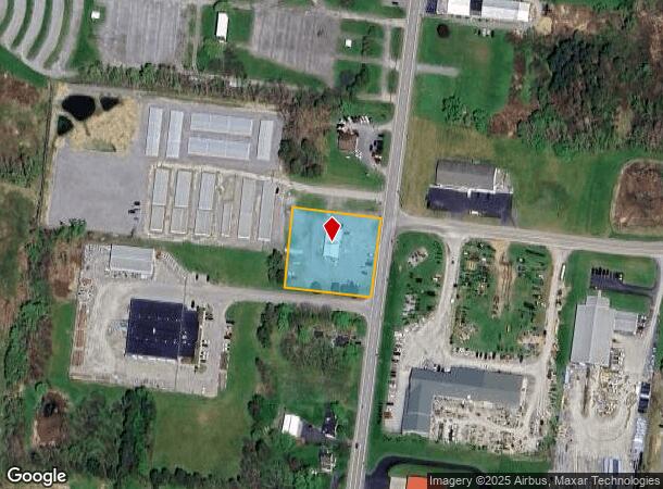
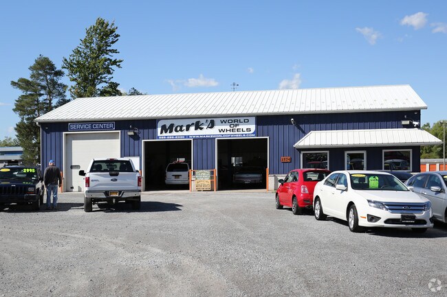
Property Record
1574 W Henrietta Rd, Avon, NY 14414
NEARBY LISTINGS FOR SALE OR LEASE
Property Detail
1574 W Henrietta Rd
Rochester, NY
Livingston
242089-035-000-0001-008-111-0000
New York
Vehiclerentalsvehiclesales
8.111
2025
1.12 AC
2024
Livingston County
030204
Rochester
2,484 SF
DEMOGRAPHICS near 1574 W Henrietta Rd
1 Mile
3 Mile
5 Mile
2024 Total Population
611
6,301
11,179
2029 Population
600
6,208
11,057
Pop Growth 2024-2029
(1.80%)
(1.48%)
(1.09%)
Average Age
43
43
43
2024 Total Households
250
2,667
4,638
HH Growth 2024-2029
(1.60%)
(1.61%)
(1.19%)
Median Household Inc
$56,481
$69,221
$70,781
Avg Household Size
2.40
2.30
2.30
2024 Avg HH Vehicles
2.00
2.00
2.00
Median Home Value
$160,679
$161,802
$168,207
Median Year Built
1973
1967
1972
Nearby Places
- Restaurants
- Banks
- Shops
- Fitness
- Groceries
PUBLIC TRANSPORTATION
AIRPORT
Frederick Douglass/Greater Rochester International
DRIVE
WALK
Distance
Frederick Douglass/Greater Rochester International
26 min
19.4 mi
Freight Ports
Albany, NY Port
DRIVE
WALK
Distance
Albany, NY Port
276 min
235.8 mi
Nearby Properties
Address
Land Use
TOTAL SIZE
Lot Size
Zoning
Address
Land Use
TOTAL SIZE
Lot Size
Zoning
Address
Land Use
TOTAL SIZE
Lot Size
Zoning
324,408 SF
49.37 AC
06 - INDUS
Address
Land Use
TOTAL SIZE
Lot Size
Zoning
1,952 SF
194.63 AC
02 - SINGL
Address
Land Use
TOTAL SIZE
Lot Size
Zoning
415,233 SF
65.80 AC
06 - INDUS
Address
Land Use
TOTAL SIZE
Lot Size
Zoning
89.40 AC
05 - COMME
Address
Land Use
TOTAL SIZE
Lot Size
Zoning
27.30 AC
05 - COMME
Address
Land Use
TOTAL SIZE
Lot Size
Zoning
Address
Land Use
TOTAL SIZE
Lot Size
Zoning
7,550 SF
4.95 AC
03 - MULTI
Address
Land Use
TOTAL SIZE
Lot Size
Zoning
Address
Land Use
TOTAL SIZE
Lot Size
Zoning
78.80 AC
04 - FARM
Address
Land Use
TOTAL SIZE
Lot Size
Zoning
66,192 SF
7.62 AC
B2
Address
Land Use
TOTAL SIZE
Lot Size
Zoning
10,672 SF
0.14 AC
05 - COMME
Address
Land Use
TOTAL SIZE
Lot Size
Zoning
656.10 AC
04 - FARM
Address
Land Use
TOTAL SIZE
Lot Size
Zoning
29,960 SF
4.60 AC
05 - COMME
Address
Land Use
TOTAL SIZE
Lot Size
Zoning
38,760 SF
5.84 AC
05 - COMME
Address
Land Use
TOTAL SIZE
Lot Size
Zoning
33.70 AC
05 - COMME
Address
Land Use
TOTAL SIZE
Lot Size
Zoning
Address
Land Use
TOTAL SIZE
Lot Size
Zoning
28 AC
05 - COMME
Address
Land Use
TOTAL SIZE
Lot Size
Zoning
9,870 SF
5.50 AC
05 - COMME
Address
Land Use
TOTAL SIZE
Lot Size
Zoning
29 AC
04 - FARM
Address
Land Use
TOTAL SIZE
Lot Size
Zoning
33.80 AC
04 - FARM
Address
Land Use
TOTAL SIZE
Lot Size
Zoning
Address
Land Use
TOTAL SIZE
Lot Size
Zoning
107,159 SF
14.92 AC
05 - COMME
Address
Land Use
TOTAL SIZE
Lot Size
Zoning
Address
Land Use
TOTAL SIZE
Lot Size
Zoning
4,752 SF
68.74 AC
04 - FARM
Address
Land Use
TOTAL SIZE
Lot Size
Zoning
94,146 SF
9.50 AC
06 - INDUS
Address
Land Use
TOTAL SIZE
Lot Size
Zoning
Address
Land Use
TOTAL SIZE
Lot Size
Zoning
9,328 SF
28.69 AC
05 - COMME
Address
Land Use
TOTAL SIZE
Lot Size
Zoning
4,500 SF
6.41 AC
04 - FARM
Address
Land Use
TOTAL SIZE
Lot Size
Zoning
1,440 SF
5.74 AC
05 - COMME
The World's #1 Commercial Real Estate Marketplace
Connect with us
© 2025 CoStar Group
The information above has been obtained from sources believed reliable. While we do not doubt its accuracy we have not verified it and make no guarantee, warranty or representation about it. It is your responsibility to independently confirm its accuracy and completeness. Any projections, opinions, assumptions, or estimates used are for example only and do not represent the current or future performance of the property. The value of this transaction to you depends on tax and other factors which should be evaluated by your tax, financial, and legal advisors. You and your advisors should conduct a careful, independent investigation of the property to determine to your satisfaction the suitability of the property for your needs.