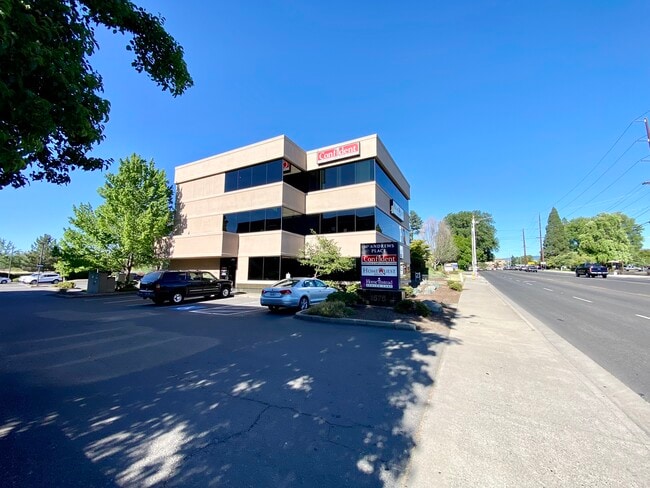
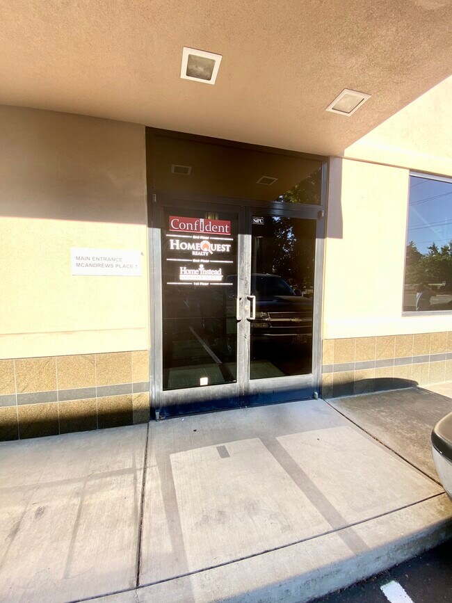
Property Record
1575 E Mcandrews Rd, Medford, OR 97504

Current Lease Availabilities
Property Detail
1575 E Mcandrews Rd
10326427
Jackson
Commercialbuilding
Oregon
C-S/P
16
B and X Area of moderate flood hazard, usually the area between the limits of the 100-year and 500-year floods.
0.54 AC
2025
Medford/Grants Pass
2026
Other Market Areas
000405
Medford, OR
9,699 SF
NEARBY LISTINGS FOR SALE OR LEASE
DEMOGRAPHICS near 1575 E Mcandrews Rd
1 mile
3 mile
5 mile
2025 Total Population
14,991
81,220
115,250
2030 Population
14,733
79,580
112,948
Pop Growth 2025-2030
(1.72%)
(2.02%)
(2.00%)
Average Age
40
41
41
2025 Total Households
6,254
31,992
45,376
HH Growth 2025-2030
(1.85%)
(2.17%)
(2.15%)
Median Household Inc
$54,681
$69,478
$73,314
Avg Household Size
2.20
2.40
2.40
2025 Avg HH Vehicles
2.00
2.00
2.00
Median Home Value
$371,103
$389,821
$404,650
Median Year Built
1975
1981
1984
Nearby Places
Map Layers
Map Styles
 Street
 Aerial
Layers
 Traffic
 Biking
Places
Listings with unknown addresses are not visible on the map
- Restaurants
- Banks
- Shops
- Fitness
- Groceries
PUBLIC TRANSPORTATION
AIRPORT
Rogue Valley International - Medford
Drive
Walk
Distance
Rogue Valley International - Medford
9 min
3.1 mi
Freight Ports
Port of Coos Bay, OR
Drive
Walk
Distance
Port of Coos Bay, OR
1 min
98.5 mi
Nearby Properties
Address
Land Use
TOTAL SIZE
Lot Size
Zoning
Address
Land Use
TOTAL SIZE
Lot Size
Zoning
674,760 SF
104.26 AC
SFR-4
Address
Land Use
TOTAL SIZE
Lot Size
Zoning
37.16 AC
RR-5
Address
Land Use
TOTAL SIZE
Lot Size
Zoning
762,720 SF
16.25 AC
C-S/P
Address
Land Use
TOTAL SIZE
Lot Size
Zoning
36,606 SF
2.20 AC
C-S/P
Address
Land Use
TOTAL SIZE
Lot Size
Zoning
290.83 AC
I-L
Address
Land Use
TOTAL SIZE
Lot Size
Zoning
249,867 SF
61.31 AC
SFR-4
Address
Land Use
TOTAL SIZE
Lot Size
Zoning
22.07 AC
GI
Address
Land Use
TOTAL SIZE
Lot Size
Zoning
196,384 SF
4.80 AC
C-S/P
Address
Land Use
TOTAL SIZE
Lot Size
Zoning
600,000 SF
18.27 AC
M-1
Address
Land Use
TOTAL SIZE
Lot Size
Zoning
Address
Land Use
TOTAL SIZE
Lot Size
Zoning
77,354 SF
8.28 AC
SFR-4
Address
Land Use
TOTAL SIZE
Lot Size
Zoning
531,599 SF
26.34 AC
C-R
Address
Land Use
TOTAL SIZE
Lot Size
Zoning
153,140 SF
14.93 AC
SFR-10
Address
Land Use
TOTAL SIZE
Lot Size
Zoning
31.96 AC
GI
Address
Land Use
TOTAL SIZE
Lot Size
Zoning
177,106 SF
16.28 AC
C-C
Address
Land Use
TOTAL SIZE
Lot Size
Zoning
147,839 SF
15.43 AC
C-R
Address
Land Use
TOTAL SIZE
Lot Size
Zoning
176,910 SF
17.78 AC
C-R
Address
Land Use
TOTAL SIZE
Lot Size
Zoning
43.71 AC
GI
Address
Land Use
TOTAL SIZE
Lot Size
Zoning
11,180 SF
1.58 AC
MFR-20
Address
Land Use
TOTAL SIZE
Lot Size
Zoning
2,762 SF
6.81 AC
C-S/P
Address
Land Use
TOTAL SIZE
Lot Size
Zoning
85,610 SF
1.78 AC
C-C
Address
Land Use
TOTAL SIZE
Lot Size
Zoning
81.70 AC
LI
Address
Land Use
TOTAL SIZE
Lot Size
Zoning
12,544 SF
16.70 AC
C-R
Address
Land Use
TOTAL SIZE
Lot Size
Zoning
1,126 SF
4.89 AC
SFR-4
Address
Land Use
TOTAL SIZE
Lot Size
Zoning
88,434 SF
12.10 AC
I-L
Address
Land Use
TOTAL SIZE
Lot Size
Zoning
31,338 SF
4.41 AC
C-R
Address
Land Use
TOTAL SIZE
Lot Size
Zoning
212,477 SF
13.74 AC
I-L
Address
Land Use
TOTAL SIZE
Lot Size
Zoning
125,910 SF
14.29 AC
C-R
Address
Land Use
TOTAL SIZE
Lot Size
Zoning
3.54 AC
MFR-20
Address
Land Use
TOTAL SIZE
Lot Size
Zoning
5.22 AC
MFR-30
The World's #1 Commercial Real Estate Marketplace
Connect with us
© 2026 CoStar Group
The information above has been obtained from sources believed reliable. While we do not doubt its accuracy we have not verified it and make no guarantee, warranty or representation about it. It is your responsibility to independently confirm its accuracy and completeness. Any projections, opinions, assumptions, or estimates used are for example only and do not represent the current or future performance of the property. The value of this transaction to you depends on tax and other factors which should be evaluated by your tax, financial, and legal advisors. You and your advisors should conduct a careful, independent investigation of the property to determine to your satisfaction the suitability of the property for your needs.