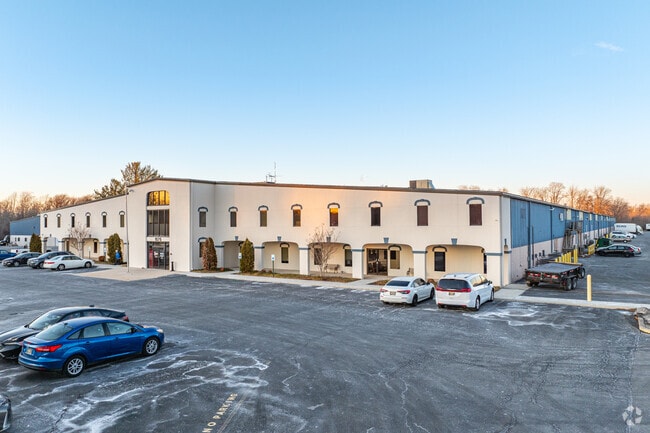
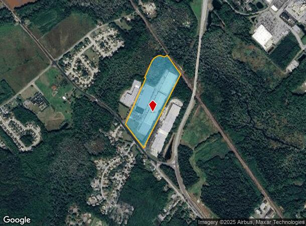
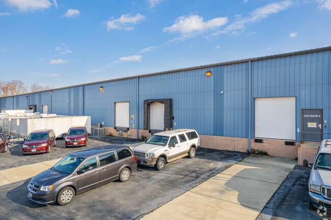
Property Record
1565 Mckee Rd, Dover, DE 19904
Current Lease Availabilities
NEARBY LISTINGS FOR SALE OR LEASE
Property Detail
1565 Mckee Rd
2-05-05700-02-0104-000
N.E. SD. CO. RD. #156, 30.0046 A.
Commercialnec
Kent
AE
Delaware
10001C0154H
30 AC
2025
Kent County
2025
Philadelphia
043300
Dover, DE
210,400 SF
DEMOGRAPHICS near 1565 Mckee Rd
1 mile
3 mile
5 mile
2024 Total Population
3,757
37,947
68,494
2029 Population
3,999
40,831
73,740
Pop Growth 2024-2029
+ 6.44%
+ 7.60%
+ 7.66%
Average Age
36
39
39
2024 Total Households
1,016
14,342
26,067
HH Growth 2024-2029
+ 6.59%
+ 7.90%
+ 7.90%
Median Household Inc
$76,792
$57,353
$58,970
Avg Household Size
2.40
2.40
2.50
2024 Avg HH Vehicles
2.00
2.00
2.00
Median Home Value
$271,249
$243,470
$249,802
Median Year Built
1988
1989
1988
Nearby Places
Map Layers
Map Styles
 Street
 Aerial
Transit
 Traffic
 Biking
Places
Listings with unknown addresses are not visible on the map
- Restaurants
- Banks
- Shops
- Fitness
- Groceries
Nearby Properties
Address
Land Use
TOTAL SIZE
Lot Size
Zoning
Address
Land Use
TOTAL SIZE
Lot Size
Zoning
231,470 SF
213.60 AC
IO
Address
Land Use
TOTAL SIZE
Lot Size
Zoning
864,325 SF
69.60 AC
RC
Address
Land Use
TOTAL SIZE
Lot Size
Zoning
308,750 SF
102.10 AC
R10
Address
Land Use
TOTAL SIZE
Lot Size
Zoning
247,145 SF
43.71 AC
CPO
Address
Land Use
TOTAL SIZE
Lot Size
Zoning
1,120 SF
181.50 AC
RC
Address
Land Use
TOTAL SIZE
Lot Size
Zoning
81,711 SF
93.70 AC
IO
Address
Land Use
TOTAL SIZE
Lot Size
Zoning
95,706 SF
22.94 AC
R10
Address
Land Use
TOTAL SIZE
Lot Size
Zoning
105,846 SF
15.79 AC
SC2
Address
Land Use
TOTAL SIZE
Lot Size
Zoning
567,080 SF
30.22 AC
IPM
Address
Land Use
TOTAL SIZE
Lot Size
Zoning
179,601 SF
42.90 AC
IO
Address
Land Use
TOTAL SIZE
Lot Size
Zoning
93,186 SF
89.27 AC
IPM
Address
Land Use
TOTAL SIZE
Lot Size
Zoning
531,236 SF
84.10 AC
IPM
Address
Land Use
TOTAL SIZE
Lot Size
Zoning
129,471 SF
TND
Address
Land Use
TOTAL SIZE
Lot Size
Zoning
379,358 SF
67.30 AC
SC3
Address
Land Use
TOTAL SIZE
Lot Size
Zoning
189,000 SF
13.40 AC
RG2
Address
Land Use
TOTAL SIZE
Lot Size
Zoning
55,456 SF
43.90 AC
IO
Address
Land Use
TOTAL SIZE
Lot Size
Zoning
60,324 SF
6.70 AC
IO
Address
Land Use
TOTAL SIZE
Lot Size
Zoning
44,560 SF
8.10 AC
IO
Address
Land Use
TOTAL SIZE
Lot Size
Zoning
421,941 SF
23.70 AC
IPM
Address
Land Use
TOTAL SIZE
Lot Size
Zoning
111,744 SF
11.47 AC
RG2
Address
Land Use
TOTAL SIZE
Lot Size
Zoning
188,100 SF
9.70 AC
RG2
Address
Land Use
TOTAL SIZE
Lot Size
Zoning
97,248 SF
9 AC
RG2
Address
Land Use
TOTAL SIZE
Lot Size
Zoning
69,228 SF
16.90 AC
RG5
Address
Land Use
TOTAL SIZE
Lot Size
Zoning
113,226 SF
2.50 AC
IO
Address
Land Use
TOTAL SIZE
Lot Size
Zoning
105,470 SF
6.90 AC
IO
Address
Land Use
TOTAL SIZE
Lot Size
Zoning
98,669 SF
12.40 AC
C4
Address
Land Use
TOTAL SIZE
Lot Size
Zoning
1,292 SF
65.25 AC
RMH
Address
Land Use
TOTAL SIZE
Lot Size
Zoning
136,440 SF
6.60 AC
RM1
Address
Land Use
TOTAL SIZE
Lot Size
Zoning
168,550 SF
22.40 AC
IO
The World's #1 Commercial Real Estate Marketplace
Connect with us
© 2026 CoStar Group
The information above has been obtained from sources believed reliable. While we do not doubt its accuracy we have not verified it and make no guarantee, warranty or representation about it. It is your responsibility to independently confirm its accuracy and completeness. Any projections, opinions, assumptions, or estimates used are for example only and do not represent the current or future performance of the property. The value of this transaction to you depends on tax and other factors which should be evaluated by your tax, financial, and legal advisors. You and your advisors should conduct a careful, independent investigation of the property to determine to your satisfaction the suitability of the property for your needs.