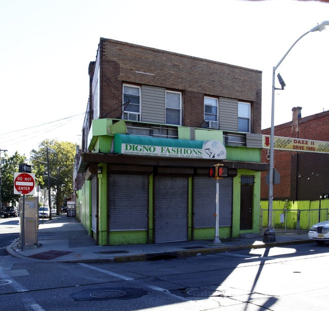
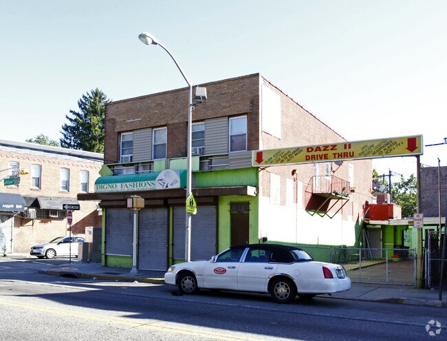
Property Record
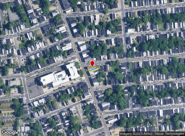
1576 Mount Ephraim Ave, Camden, NJ 08104
NEARBY LISTINGS FOR SALE OR LEASE
Property Detail
1576 Mount Ephraim Ave
08-01352-0000-00044
Camden
Commercialnec
New Jersey
X
44
34007C0036F
0.13 AC
2024
North Camden County
2025
Philadelphia
601500
Philadelphia-Camden-Wilmington, PA-NJ-DE-MD
2,186 SF
DEMOGRAPHICS near 1576 Mount Ephraim Ave
1 Mile
3 Mile
5 Mile
2024 Total Population
29,063
208,276
661,553
2029 Population
29,850
206,626
652,438
Pop Growth 2024-2029
+ 2.71%
(0.79%)
(1.38%)
Average Age
35
38
38
2024 Total Households
10,436
82,910
281,925
HH Growth 2024-2029
+ 2.78%
(1.08%)
(1.72%)
Median Household Inc
$30,564
$66,778
$72,167
Avg Household Size
2.70
2.40
2.20
2024 Avg HH Vehicles
1.00
1.00
1.00
Median Home Value
$92,247
$254,621
$290,760
Median Year Built
1951
1948
1950
Nearby Places
Map Layers
Map Styles
 Street
 Aerial
- Restaurants
- Banks
- Shops
- Fitness
- Groceries
PUBLIC TRANSPORTATION
TRANSIT/SUBWAY
Ferry Avenue (PATCO Speedline - Port Authority Transit Corporation Speedline (PATCO Speedline))
DRIVE
WALK
Distance
Ferry Avenue (PATCO Speedline - Port Authority Transit Corporation Speedline (PATCO Speedline))
3 min
16 min
0.9 mi
COMMUTER RAIL
Market East (R1 - Southeastern Pennsylvania Transportation Authority Regional Rail (SEPTA Regional Rail), R2 - Southeastern Pennsylvania Transportation Authority Regional Rail (SEPTA Regional Rail), R3 - Southeastern Pennsylvania Transportation Authority Regional Rail (SEPTA Regional Rail), R5 - Southeastern Pennsylvania Transportation Authority Regional Rail (SEPTA Regional Rail), R6 - Southeastern Pennsylvania Transportation Authority Regional Rail (SEPTA Regional Rail), R7 - Southeastern Pennsylvania Transportation Authority Regional Rail (SEPTA Regional Rail), R8 - Southeastern Pennsylvania Transportation Authority Regional Rail (SEPTA Regional Rail))
DRIVE
WALK
Distance
Market East (R1 - Southeastern Pennsylvania Transportation Authority Regional Rail (SEPTA Regional Rail), R2 - Southeastern Pennsylvania Transportation Authority Regional Rail (SEPTA Regional Rail), R3 - Southeastern Pennsylvania Transportation Authority Regional Rail (SEPTA Regional Rail), R5 - Southeastern Pennsylvania Transportation Authority Regional Rail (SEPTA Regional Rail), R6 - Southeastern Pennsylvania Transportation Authority Regional Rail (SEPTA Regional Rail), R7 - Southeastern Pennsylvania Transportation Authority Regional Rail (SEPTA Regional Rail), R8 - Southeastern Pennsylvania Transportation Authority Regional Rail (SEPTA Regional Rail))
8 min
4.4 mi
Cherry Hill (Atlantic City Line - NJ Transit Commuter Rail (NJ Transit))
DRIVE
WALK
Distance
Cherry Hill (Atlantic City Line - NJ Transit Commuter Rail (NJ Transit))
8 min
4.9 mi
AIRPORT
Philadelphia International
DRIVE
WALK
Distance
Philadelphia International
23 min
12.5 mi
Trenton Mercer
DRIVE
WALK
Distance
Trenton Mercer
52 min
36.5 mi
Freight Ports
Broadway Terminal - Pier 5
DRIVE
WALK
Distance
Broadway Terminal - Pier 5
5 min
2.4 mi
Nearby Properties
Address
Land Use
TOTAL SIZE
Lot Size
Zoning
Address
Land Use
TOTAL SIZE
Lot Size
Zoning
1.17 AC
Address
Land Use
TOTAL SIZE
Lot Size
Zoning
7.17 AC
Address
Land Use
TOTAL SIZE
Lot Size
Zoning
1,102,992 SF
2.14 AC
CMX5
Address
Land Use
TOTAL SIZE
Lot Size
Zoning
665,742 SF
0.98 AC
CMX4
Address
Land Use
TOTAL SIZE
Lot Size
Zoning
124.13 AC
Address
Land Use
TOTAL SIZE
Lot Size
Zoning
Address
Land Use
TOTAL SIZE
Lot Size
Zoning
80,064 SF
51.52 AC
I3
Address
Land Use
TOTAL SIZE
Lot Size
Zoning
12.53 AC
Address
Land Use
TOTAL SIZE
Lot Size
Zoning
322,000 SF
7.44 AC
CMX3
Address
Land Use
TOTAL SIZE
Lot Size
Zoning
1.62 AC
Address
Land Use
TOTAL SIZE
Lot Size
Zoning
986,960 SF
1.61 AC
CMX4
Address
Land Use
TOTAL SIZE
Lot Size
Zoning
Address
Land Use
TOTAL SIZE
Lot Size
Zoning
11.06 AC
CMX3
Address
Land Use
TOTAL SIZE
Lot Size
Zoning
289,664 SF
0.22 AC
CMX3
Address
Land Use
TOTAL SIZE
Lot Size
Zoning
289,664 SF
0.22 AC
CMX3
Address
Land Use
TOTAL SIZE
Lot Size
Zoning
500,000 SF
2 AC
CMX4
Address
Land Use
TOTAL SIZE
Lot Size
Zoning
2.32 AC
Address
Land Use
TOTAL SIZE
Lot Size
Zoning
404,118 SF
1.53 AC
CMX5
Address
Land Use
TOTAL SIZE
Lot Size
Zoning
7.11 AC
Address
Land Use
TOTAL SIZE
Lot Size
Zoning
8.50 AC
Address
Land Use
TOTAL SIZE
Lot Size
Zoning
441,600 SF
1.68 AC
CMX4
Address
Land Use
TOTAL SIZE
Lot Size
Zoning
256,280 SF
2.54 AC
CMX3
Address
Land Use
TOTAL SIZE
Lot Size
Zoning
210,222 SF
1.26 AC
CMX4
Address
Land Use
TOTAL SIZE
Lot Size
Zoning
15,786 SF
43.30 AC
CMX4
Address
Land Use
TOTAL SIZE
Lot Size
Zoning
6.74 AC
SPPOA
Address
Land Use
TOTAL SIZE
Lot Size
Zoning
1.88 AC
Address
Land Use
TOTAL SIZE
Lot Size
Zoning
1.68 AC
Address
Land Use
TOTAL SIZE
Lot Size
Zoning
152,715 SF
1.06 AC
CMX3
Address
Land Use
TOTAL SIZE
Lot Size
Zoning
375,396 SF
1.01 AC
CMX5
Address
Land Use
TOTAL SIZE
Lot Size
Zoning
714,498 SF
5.12 AC
CMX4
The World's #1 Commercial Real Estate Marketplace
Connect with us
© 2025 CoStar Group
The information above has been obtained from sources believed reliable. While we do not doubt its accuracy we have not verified it and make no guarantee, warranty or representation about it. It is your responsibility to independently confirm its accuracy and completeness. Any projections, opinions, assumptions, or estimates used are for example only and do not represent the current or future performance of the property. The value of this transaction to you depends on tax and other factors which should be evaluated by your tax, financial, and legal advisors. You and your advisors should conduct a careful, independent investigation of the property to determine to your satisfaction the suitability of the property for your needs.