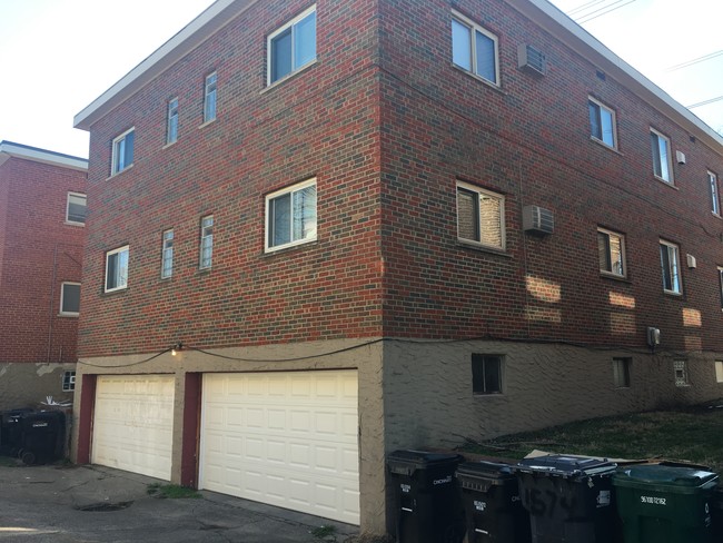
Property Record
1578 Crest Hill Ave, Cincinnati, OH 45237


NEARBY LISTINGS FOR SALE OR LEASE
Property Detail
1578 Crest Hill Ave
Cincinnati, OH-KY-IN
Dawn Hills Sub
117-0015-0250
CREST HILL AV 45.57 X 106.32 IRR-PT LOTS 4-5 DAWN HILLS SUB BLK B
Apartment
Hamilton
X
Ohio
39061C0229E
4-5
2024
0.11 AC
2024
Roselawn
011000
Cincinnati/Dayton
3,432 SF
DEMOGRAPHICS near 1578 Crest Hill Ave
1 Mile
3 Mile
5 Mile
2024 Total Population
11,238
86,748
246,682
2029 Population
11,177
85,755
244,587
Pop Growth 2024-2029
(0.54%)
(1.14%)
(0.85%)
Average Age
41
40
40
2024 Total Households
5,193
38,024
108,374
HH Growth 2024-2029
(0.42%)
(1.21%)
(0.99%)
Median Household Inc
$49,382
$59,020
$62,102
Avg Household Size
2.10
2.20
2.20
2024 Avg HH Vehicles
2.00
2.00
2.00
Median Home Value
$130,858
$179,954
$194,366
Median Year Built
1953
1952
1953
Nearby Places
Map Layers
Map Styles
 Street
 Aerial
- Restaurants
- Banks
- Shops
- Fitness
- Groceries
PUBLIC TRANSPORTATION
COMMUTER RAIL
Cincinnati Union Terminal (Cardinal - Amtrak)
DRIVE
WALK
Distance
Cincinnati Union Terminal (Cardinal - Amtrak)
16 min
9.8 mi
AIRPORT
Cincinnati/Northern Kentucky International
DRIVE
WALK
Distance
Cincinnati/Northern Kentucky International
41 min
23.8 mi
Freight Ports
Port of Toledo
DRIVE
WALK
Distance
Port of Toledo
231 min
197.2 mi
SALE & LEASE HISTORY
LISTING DATE
SALE/LEASE

Oct 15, 2019
For Sale
Mar 30, 2017
For Sale
Feb 18, 2020
For Sale
Nearby Properties
Address
Land Use
TOTAL SIZE
Lot Size
Zoning
Address
Land Use
TOTAL SIZE
Lot Size
Zoning
21.34 AC
Address
Land Use
TOTAL SIZE
Lot Size
Zoning
2.49 AC
DD
Address
Land Use
TOTAL SIZE
Lot Size
Zoning
1,238 SF
14.03 AC
Address
Land Use
TOTAL SIZE
Lot Size
Zoning
29.67 AC
RM20
Address
Land Use
TOTAL SIZE
Lot Size
Zoning
11,639 SF
7.87 AC
R2
Address
Land Use
TOTAL SIZE
Lot Size
Zoning
14.15 AC
Address
Land Use
TOTAL SIZE
Lot Size
Zoning
23.45 AC
Address
Land Use
TOTAL SIZE
Lot Size
Zoning
15.61 AC
Address
Land Use
TOTAL SIZE
Lot Size
Zoning
8,964 SF
11.61 AC
Address
Land Use
TOTAL SIZE
Lot Size
Zoning
330,335 SF
0.80 AC
R3
Address
Land Use
TOTAL SIZE
Lot Size
Zoning
42.41 AC
Address
Land Use
TOTAL SIZE
Lot Size
Zoning
344,923 SF
18.47 AC
RM20
Address
Land Use
TOTAL SIZE
Lot Size
Zoning
Address
Land Use
TOTAL SIZE
Lot Size
Zoning
210,743 SF
0.35 AC
DD
Address
Land Use
TOTAL SIZE
Lot Size
Zoning
Address
Land Use
TOTAL SIZE
Lot Size
Zoning
2.22 AC
Address
Land Use
TOTAL SIZE
Lot Size
Zoning
4.14 AC
M2PUD
Address
Land Use
TOTAL SIZE
Lot Size
Zoning
Address
Land Use
TOTAL SIZE
Lot Size
Zoning
88.15 AC
ML
Address
Land Use
TOTAL SIZE
Lot Size
Zoning
Address
Land Use
TOTAL SIZE
Lot Size
Zoning
17,758 SF
7 AC
RM20
Address
Land Use
TOTAL SIZE
Lot Size
Zoning
8,720 SF
33.28 AC
R3
Address
Land Use
TOTAL SIZE
Lot Size
Zoning
Address
Land Use
TOTAL SIZE
Lot Size
Zoning
4.06 AC
M2PUD
Address
Land Use
TOTAL SIZE
Lot Size
Zoning
4.64 AC
SF20
Address
Land Use
TOTAL SIZE
Lot Size
Zoning
31.98 AC
Address
Land Use
TOTAL SIZE
Lot Size
Zoning
38,680 SF
7.07 AC
RM20
Address
Land Use
TOTAL SIZE
Lot Size
Zoning
25.26 AC
Address
Land Use
TOTAL SIZE
Lot Size
Zoning
9.74 AC
PD
Address
Land Use
TOTAL SIZE
Lot Size
Zoning
49,338 SF
2.81 AC
PD
The World's #1 Commercial Real Estate Marketplace
Connect with us
© 2025 CoStar Group
The information above has been obtained from sources believed reliable. While we do not doubt its accuracy we have not verified it and make no guarantee, warranty or representation about it. It is your responsibility to independently confirm its accuracy and completeness. Any projections, opinions, assumptions, or estimates used are for example only and do not represent the current or future performance of the property. The value of this transaction to you depends on tax and other factors which should be evaluated by your tax, financial, and legal advisors. You and your advisors should conduct a careful, independent investigation of the property to determine to your satisfaction the suitability of the property for your needs.