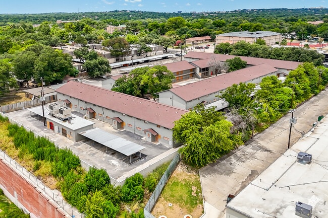
Property Record
158 De Chantle Rd, San Antonio, TX 78201

NEARBY LISTINGS FOR SALE OR LEASE
Property Detail
158 De Chantle Rd
San Antonio-New Braunfels, TX
Conv A/S Code
08406-000-0293
NCB 8406 BLK LOT E IRRG 275.34 FT OF 29 2025 RSVY ACCOUNT 414970 TO 2.60 AC PER DEED 20240224077 (CR 68352)/
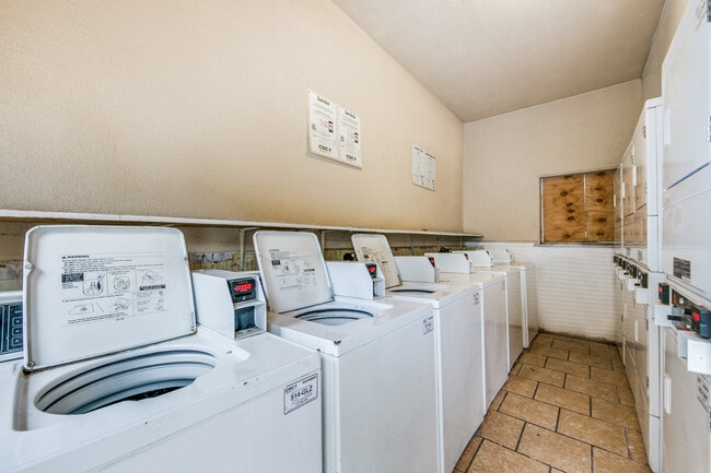
Multifamilydwelling
Bexar
X
Texas
48029C0381H
293
2024
2.60 AC
2025
Maverick
180202
San Antonio
63,790 SF
DEMOGRAPHICS near 158 De Chantle Rd
1 Mile
3 Mile
5 Mile
2024 Total Population
17,462
148,327
398,971
2029 Population
18,595
156,910
424,454
Pop Growth 2024-2029
+ 6.49%
+ 5.79%
+ 6.39%
Average Age
41
38
38
2024 Total Households
7,438
57,838
159,584
HH Growth 2024-2029
+ 6.82%
+ 6.07%
+ 6.79%
Median Household Inc
$34,016
$42,747
$45,878
Avg Household Size
2.20
2.50
2.40
2024 Avg HH Vehicles
1.00
2.00
2.00
Median Home Value
$165,735
$161,787
$175,527
Median Year Built
1965
1962
1972
Nearby Places
Map Layers
Map Styles
 Street
 Aerial
- Restaurants
- Banks
- Shops
- Fitness
- Groceries
PUBLIC TRANSPORTATION
COMMUTER RAIL
San Antonio Amtrak Station (Sunset Limited - Amtrak, Texas Eagle - Amtrak)
DRIVE
WALK
Distance
San Antonio Amtrak Station (Sunset Limited - Amtrak, Texas Eagle - Amtrak)
14 min
7.5 mi
AIRPORT
San Antonio International
DRIVE
WALK
Distance
San Antonio International
12 min
7.3 mi
Freight Ports
Calhoun Port
DRIVE
WALK
Distance
Calhoun Port
190 min
154.9 mi
SALE & LEASE HISTORY
LISTING DATE
SALE/LEASE

Sep 16, 2025
For Sale
Nov 17, 2020
For Sale
Nearby Properties
Address
Land Use
TOTAL SIZE
Lot Size
Zoning
Address
Land Use
TOTAL SIZE
Lot Size
Zoning
1,414,945 SF
16.77 AC
Address
Land Use
TOTAL SIZE
Lot Size
Zoning
429,561 SF
25.70 AC
Address
Land Use
TOTAL SIZE
Lot Size
Zoning
97.47 AC
Address
Land Use
TOTAL SIZE
Lot Size
Zoning
278,352 SF
10 AC
Address
Land Use
TOTAL SIZE
Lot Size
Zoning
482,412 SF
22.97 AC
Address
Land Use
TOTAL SIZE
Lot Size
Zoning
506,058 SF
25.23 AC
Address
Land Use
TOTAL SIZE
Lot Size
Zoning
137,036 SF
4.73 AC
Address
Land Use
TOTAL SIZE
Lot Size
Zoning
356,368 SF
18.58 AC
Address
Land Use
TOTAL SIZE
Lot Size
Zoning
122,292 SF
12.83 AC
Address
Land Use
TOTAL SIZE
Lot Size
Zoning
293,420 SF
9.24 AC
Address
Land Use
TOTAL SIZE
Lot Size
Zoning
256,678 SF
4.42 AC
Address
Land Use
TOTAL SIZE
Lot Size
Zoning
86,576 SF
7.84 AC
Address
Land Use
TOTAL SIZE
Lot Size
Zoning
138,674 SF
11.14 AC
Address
Land Use
TOTAL SIZE
Lot Size
Zoning
302,836 SF
15.96 AC
Address
Land Use
TOTAL SIZE
Lot Size
Zoning
207,445 SF
9.55 AC
Address
Land Use
TOTAL SIZE
Lot Size
Zoning
Address
Land Use
TOTAL SIZE
Lot Size
Zoning
97,800 SF
0.85 AC
Address
Land Use
TOTAL SIZE
Lot Size
Zoning
279,112 SF
10.62 AC
Address
Land Use
TOTAL SIZE
Lot Size
Zoning
206,623 SF
2.70 AC
Address
Land Use
TOTAL SIZE
Lot Size
Zoning
184,262 SF
6.13 AC
Address
Land Use
TOTAL SIZE
Lot Size
Zoning
181,290 SF
5.57 AC
Address
Land Use
TOTAL SIZE
Lot Size
Zoning
217,700 SF
11.90 AC
Address
Land Use
TOTAL SIZE
Lot Size
Zoning
134,802 SF
8.02 AC
Address
Land Use
TOTAL SIZE
Lot Size
Zoning
195,411 SF
5.15 AC
Address
Land Use
TOTAL SIZE
Lot Size
Zoning
175,347 SF
4.71 AC
Address
Land Use
TOTAL SIZE
Lot Size
Zoning
Address
Land Use
TOTAL SIZE
Lot Size
Zoning
97,280 SF
3 AC
Address
Land Use
TOTAL SIZE
Lot Size
Zoning
168,619 SF
8.38 AC
Address
Land Use
TOTAL SIZE
Lot Size
Zoning
173,363 SF
10.29 AC
Address
Land Use
TOTAL SIZE
Lot Size
Zoning
286,747 SF
12.53 AC
The World's #1 Commercial Real Estate Marketplace
Connect with us
© 2025 CoStar Group
The information above has been obtained from sources believed reliable. While we do not doubt its accuracy we have not verified it and make no guarantee, warranty or representation about it. It is your responsibility to independently confirm its accuracy and completeness. Any projections, opinions, assumptions, or estimates used are for example only and do not represent the current or future performance of the property. The value of this transaction to you depends on tax and other factors which should be evaluated by your tax, financial, and legal advisors. You and your advisors should conduct a careful, independent investigation of the property to determine to your satisfaction the suitability of the property for your needs.