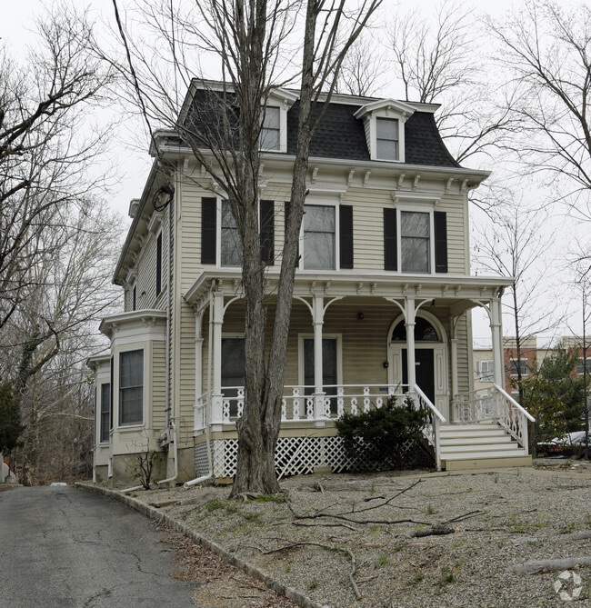
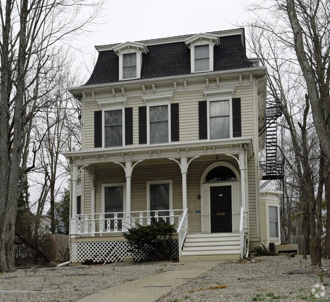
Property Record
158 Morris St, Morristown, NJ 07960

NEARBY LISTINGS FOR SALE OR LEASE
Property Detail
158 Morris St
Newark, NJ
FACILITY NAME: ADMINISTRATIVE BLDG.
24-03601-0000-00010
Morris
Commercialnec
New Jersey
2024
10
2025
0.45 AC
007402
Morristown Region
4,272 SF
Northern New Jersey
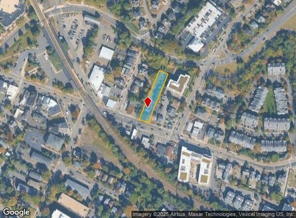
DEMOGRAPHICS near 158 Morris St
1 mile
3 mile
5 mile
2024 Total Population
19,454
58,932
125,875
2029 Population
19,547
59,060
125,869
Pop Growth 2024-2029
+ 0.48%
+ 0.22%
0.00%
Average Age
38
41
41
2024 Total Households
8,498
23,235
46,867
HH Growth 2024-2029
+ 0.74%
+ 0.38%
+ 0.08%
Median Household Inc
$106,616
$137,803
$143,935
Avg Household Size
2.20
2.40
2.50
2024 Avg HH Vehicles
2.00
2.00
2.00
Median Home Value
$541,877
$648,921
$668,419
Median Year Built
1966
1968
1968
Nearby Places
Map Layers
Map Styles
 Street
 Aerial
Transit
 Traffic
 Biking
Places
Listings with unknown addresses are not visible on the map
- Restaurants
- Banks
- Shops
- Fitness
- Groceries
PUBLIC TRANSPORTATION
TRANSIT/SUBWAY
Morristown (Morris & Essex Morristown Line - NJ Transit Commuter Rail (NJ Transit))
Drive
Walk
Distance
Morristown (Morris & Essex Morristown Line - NJ Transit Commuter Rail (NJ Transit))
0 min
2 min
0.1 mi
COMMUTER RAIL
Morristown (Morris & Essex Morristown Line - NJ Transit Commuter Rail (NJ Transit))
Drive
Walk
Distance
Morristown (Morris & Essex Morristown Line - NJ Transit Commuter Rail (NJ Transit))
0 min
2 min
0.1 mi
Morris Plains (Morris & Essex Morristown Line - NJ Transit Commuter Rail (NJ Transit))
Drive
Walk
Distance
Morris Plains (Morris & Essex Morristown Line - NJ Transit Commuter Rail (NJ Transit))
6 min
2.6 mi
AIRPORT
Newark Liberty International
Drive
Walk
Distance
Newark Liberty International
27 min
21.3 mi
LaGuardia
Drive
Walk
Distance
LaGuardia
61 min
45.4 mi
Freight Ports
Maher Terminal
Drive
Walk
Distance
Maher Terminal
32 min
21.9 mi
SALE & LEASE HISTORY
LISTING DATE
SALE/LEASE

Sep 25, 2016
For Lease
Apr 17, 2018
For Lease
Nearby Properties
Address
Land Use
TOTAL SIZE
Lot Size
Zoning
Address
Land Use
TOTAL SIZE
Lot Size
Zoning
596 SF
64.81 AC
OBRL
Address
Land Use
TOTAL SIZE
Lot Size
Zoning
23.01 AC
R-2
Address
Land Use
TOTAL SIZE
Lot Size
Zoning
64.80 AC
C-4
Address
Land Use
TOTAL SIZE
Lot Size
Zoning
72,698 SF
133.64 AC
U
Address
Land Use
TOTAL SIZE
Lot Size
Zoning
1.55 AC
Address
Land Use
TOTAL SIZE
Lot Size
Zoning
2.82 AC
Address
Land Use
TOTAL SIZE
Lot Size
Zoning
13,428 SF
108.84 AC
OSGU
Address
Land Use
TOTAL SIZE
Lot Size
Zoning
396,029 SF
40.08 AC
OL40
Address
Land Use
TOTAL SIZE
Lot Size
Zoning
10.94 AC
Address
Land Use
TOTAL SIZE
Lot Size
Zoning
8.64 AC
RG
Address
Land Use
TOTAL SIZE
Lot Size
Zoning
43.60 AC
C-4
Address
Land Use
TOTAL SIZE
Lot Size
Zoning
Address
Land Use
TOTAL SIZE
Lot Size
Zoning
18.42 AC
RM
Address
Land Use
TOTAL SIZE
Lot Size
Zoning
475,100 SF
38 AC
OL40
Address
Land Use
TOTAL SIZE
Lot Size
Zoning
0.36 AC
UR
Address
Land Use
TOTAL SIZE
Lot Size
Zoning
10.42 AC
Address
Land Use
TOTAL SIZE
Lot Size
Zoning
304,213 SF
21.73 AC
PODS
Address
Land Use
TOTAL SIZE
Lot Size
Zoning
34.13 AC
OB
Address
Land Use
TOTAL SIZE
Lot Size
Zoning
3.13 AC
CBD
Address
Land Use
TOTAL SIZE
Lot Size
Zoning
14.50 AC
RG
Address
Land Use
TOTAL SIZE
Lot Size
Zoning
38.86 AC
L
Address
Land Use
TOTAL SIZE
Lot Size
Zoning
0.57 AC
CBD
Address
Land Use
TOTAL SIZE
Lot Size
Zoning
88,345 SF
15.67 AC
R-7
Address
Land Use
TOTAL SIZE
Lot Size
Zoning
0.41 AC
UR
Address
Land Use
TOTAL SIZE
Lot Size
Zoning
0.35 AC
UR
Address
Land Use
TOTAL SIZE
Lot Size
Zoning
1.71 AC
Address
Land Use
TOTAL SIZE
Lot Size
Zoning
13.45 AC
IP
Address
Land Use
TOTAL SIZE
Lot Size
Zoning
322,575 SF
32.28 AC
OL40
Address
Land Use
TOTAL SIZE
Lot Size
Zoning
6.56 AC
OB
Address
Land Use
TOTAL SIZE
Lot Size
Zoning
6.64 AC
The World's #1 Commercial Real Estate Marketplace
Connect with us
© 2026 CoStar Group
The information above has been obtained from sources believed reliable. While we do not doubt its accuracy we have not verified it and make no guarantee, warranty or representation about it. It is your responsibility to independently confirm its accuracy and completeness. Any projections, opinions, assumptions, or estimates used are for example only and do not represent the current or future performance of the property. The value of this transaction to you depends on tax and other factors which should be evaluated by your tax, financial, and legal advisors. You and your advisors should conduct a careful, independent investigation of the property to determine to your satisfaction the suitability of the property for your needs.