Property Record
1581 S Temperance Ave, Fresno, CA 93727
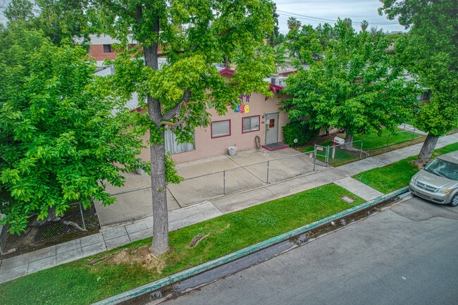
This Property Is For Sale
NEARBY LISTINGS FOR SALE OR LEASE
Property Detail
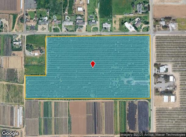
1581 S Temperance Ave
316-022-45
17.7 AC IN N1/2 OF NE1/4 OF SE1/4 SEC 15 T14R21
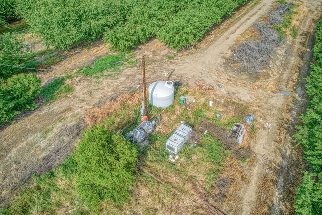
Orchard
Fresno
X
California
06019C2135H
1.77 AC
2025
E Outlying Fresno County
2025
Fresno
001413
Fresno, CA
1,305 SF
DEMOGRAPHICS near 1581 S Temperance Ave
1 Mile
3 Mile
5 Mile
2024 Total Population
4,700
42,472
126,024
2029 Population
4,918
44,059
130,096
Pop Growth 2024-2029
+ 4.64%
+ 3.74%
+ 3.23%
Average Age
34
35
35
2024 Total Households
1,290
11,782
35,497
HH Growth 2024-2029
+ 4.65%
+ 3.83%
+ 3.33%
Median Household Inc
$121,979
$92,692
$65,976
Avg Household Size
3.60
3.60
3.40
2024 Avg HH Vehicles
2.00
2.00
2.00
Median Home Value
$350,575
$354,132
$330,333
Median Year Built
2008
2000
1984
Nearby Places
- Restaurants
- Banks
- Shops
- Fitness
- Groceries
PUBLIC TRANSPORTATION
COMMUTER RAIL
Fresno (San Joaquins - Amtrak)
DRIVE
WALK
Distance
Fresno (San Joaquins - Amtrak)
14 min
9.9 mi
AIRPORT
Fresno Yosemite International
DRIVE
WALK
Distance
Fresno Yosemite International
11 min
6.9 mi
Freight Ports
Port of Stockton
DRIVE
WALK
Distance
Port of Stockton
162 min
136.0 mi
Nearby Properties
Address
Land Use
TOTAL SIZE
Lot Size
Zoning
Address
Land Use
TOTAL SIZE
Lot Size
Zoning
216,342 SF
28.49 AC
Address
Land Use
TOTAL SIZE
Lot Size
Zoning
372,862 SF
42.43 AC
R1
Address
Land Use
TOTAL SIZE
Lot Size
Zoning
84,376 SF
20 AC
AE20
Address
Land Use
TOTAL SIZE
Lot Size
Zoning
102,765 SF
8.90 AC
M1
Address
Land Use
TOTAL SIZE
Lot Size
Zoning
76,720 SF
10.78 AC
Address
Land Use
TOTAL SIZE
Lot Size
Zoning
69,015 SF
8.15 AC
C1
Address
Land Use
TOTAL SIZE
Lot Size
Zoning
20,038 SF
2 AC
CP
Address
Land Use
TOTAL SIZE
Lot Size
Zoning
62,400 SF
5.82 AC
C3
Address
Land Use
TOTAL SIZE
Lot Size
Zoning
59,442 SF
2.65 AC
R3
Address
Land Use
TOTAL SIZE
Lot Size
Zoning
52,776 SF
0.79 AC
CR/CZ
Address
Land Use
TOTAL SIZE
Lot Size
Zoning
150,080 SF
7.99 AC
M1
Address
Land Use
TOTAL SIZE
Lot Size
Zoning
25,600 SF
1.99 AC
IL
Address
Land Use
TOTAL SIZE
Lot Size
Zoning
48,941 SF
38.19 AC
AE20
Address
Land Use
TOTAL SIZE
Lot Size
Zoning
90,940 SF
5.31 AC
R2
Address
Land Use
TOTAL SIZE
Lot Size
Zoning
41,156 SF
4.64 AC
Address
Land Use
TOTAL SIZE
Lot Size
Zoning
42,630 SF
0.59 AC
CR/CZ
Address
Land Use
TOTAL SIZE
Lot Size
Zoning
217,130 SF
10.53 AC
SL
Address
Land Use
TOTAL SIZE
Lot Size
Zoning
23,749 SF
2.83 AC
C3
Address
Land Use
TOTAL SIZE
Lot Size
Zoning
52,065 SF
1.89 AC
C2
Address
Land Use
TOTAL SIZE
Lot Size
Zoning
59,978 SF
7.26 AC
C2
Address
Land Use
TOTAL SIZE
Lot Size
Zoning
57,390 SF
2.47 AC
R2
Address
Land Use
TOTAL SIZE
Lot Size
Zoning
82,984 SF
3.64 AC
R2
Address
Land Use
TOTAL SIZE
Lot Size
Zoning
40,069 SF
3.46 AC
C3
Address
Land Use
TOTAL SIZE
Lot Size
Zoning
16,671 SF
1.53 AC
C2
Address
Land Use
TOTAL SIZE
Lot Size
Zoning
9.85 AC
TP
Address
Land Use
TOTAL SIZE
Lot Size
Zoning
47,072 SF
2.75 AC
R1
Address
Land Use
TOTAL SIZE
Lot Size
Zoning
72,160 SF
2.90 AC
R2
Address
Land Use
TOTAL SIZE
Lot Size
Zoning
140,780 SF
0.92 AC
RS-5
Address
Land Use
TOTAL SIZE
Lot Size
Zoning
16,222 SF
1.66 AC
C2
The World's #1 Commercial Real Estate Marketplace
Connect with us
© 2025 CoStar Group
The information above has been obtained from sources believed reliable. While we do not doubt its accuracy we have not verified it and make no guarantee, warranty or representation about it. It is your responsibility to independently confirm its accuracy and completeness. Any projections, opinions, assumptions, or estimates used are for example only and do not represent the current or future performance of the property. The value of this transaction to you depends on tax and other factors which should be evaluated by your tax, financial, and legal advisors. You and your advisors should conduct a careful, independent investigation of the property to determine to your satisfaction the suitability of the property for your needs.