Property Record
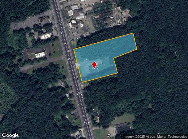
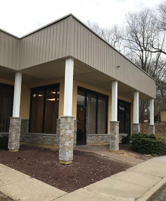
1581 Us Highway 9, Howell, NJ 07731


NEARBY LISTINGS FOR SALE OR LEASE
Property Detail
1581 Us Highway 9
21-00144-0000-00088
PIAS PLAZA
Officebuilding
Monmouth
X
New Jersey
34025C0284F
88
2024
3.58 AC
2025
Western Monmouth
811200
Northern New Jersey
4,140 SF
New York-Jersey City-White Plains, NY-NJ
DEMOGRAPHICS near 1581 Us Highway 9
1 Mile
3 Mile
5 Mile
2024 Total Population
4,636
30,160
92,660
2029 Population
4,579
30,026
93,143
Pop Growth 2024-2029
(1.23%)
(0.44%)
+ 0.52%
Average Age
39
43
41
2024 Total Households
1,727
11,102
32,287
HH Growth 2024-2029
(1.51%)
(0.79%)
+ 0.08%
Median Household Inc
$94,984
$103,128
$107,017
Avg Household Size
2.60
2.60
2.80
2024 Avg HH Vehicles
2.00
2.00
2.00
Median Home Value
$416,812
$418,821
$412,673
Median Year Built
1986
1985
1982
Nearby Places
Map Layers
Map Styles
 Street
 Aerial
- Restaurants
- Banks
- Shops
- Fitness
- Groceries
SALE & LEASE HISTORY
LISTING DATE
SALE/LEASE

Sep 26, 2016
For Lease
Sep 25, 2016
For Lease
Jul 19, 2022
For Lease
Dec 26, 2019
For Lease
Apr 14, 2017
For Lease
Nearby Properties
Address
Land Use
TOTAL SIZE
Lot Size
Zoning
Address
Land Use
TOTAL SIZE
Lot Size
Zoning
15.69 AC
HMUD
Address
Land Use
TOTAL SIZE
Lot Size
Zoning
25.63 AC
HD-1
Address
Land Use
TOTAL SIZE
Lot Size
Zoning
241,399 SF
69.89 AC
R-40
Address
Land Use
TOTAL SIZE
Lot Size
Zoning
136,800 SF
14.08 AC
ARE1
Address
Land Use
TOTAL SIZE
Lot Size
Zoning
2,674 SF
80 AC
R-E
Address
Land Use
TOTAL SIZE
Lot Size
Zoning
81,657 SF
12.62 AC
B-10
Address
Land Use
TOTAL SIZE
Lot Size
Zoning
120,000 SF
77 AC
ARE2
Address
Land Use
TOTAL SIZE
Lot Size
Zoning
77.72 AC
R-E
Address
Land Use
TOTAL SIZE
Lot Size
Zoning
8,694 SF
73.93 AC
R-40
Address
Land Use
TOTAL SIZE
Lot Size
Zoning
76.77 AC
R-E
Address
Land Use
TOTAL SIZE
Lot Size
Zoning
73.44 AC
R-E
Address
Land Use
TOTAL SIZE
Lot Size
Zoning
43.22 AC
ARE2
Address
Land Use
TOTAL SIZE
Lot Size
Zoning
106,345 SF
10.53 AC
LI-3
Address
Land Use
TOTAL SIZE
Lot Size
Zoning
70.60 AC
RE
Address
Land Use
TOTAL SIZE
Lot Size
Zoning
54,552 SF
8.04 AC
OB01
Address
Land Use
TOTAL SIZE
Lot Size
Zoning
98,731 SF
13.65 AC
HD
Address
Land Use
TOTAL SIZE
Lot Size
Zoning
117,975 SF
21.20 AC
HD-1
Address
Land Use
TOTAL SIZE
Lot Size
Zoning
14.63 AC
HMUD
Address
Land Use
TOTAL SIZE
Lot Size
Zoning
58.80 AC
R-E
Address
Land Use
TOTAL SIZE
Lot Size
Zoning
7,966 SF
44.17 AC
MH
Address
Land Use
TOTAL SIZE
Lot Size
Zoning
51,531 SF
13.30 AC
HD
Address
Land Use
TOTAL SIZE
Lot Size
Zoning
70.12 AC
R-E
Address
Land Use
TOTAL SIZE
Lot Size
Zoning
40.60 AC
MH
Address
Land Use
TOTAL SIZE
Lot Size
Zoning
50.20 AC
R-E
Address
Land Use
TOTAL SIZE
Lot Size
Zoning
50.15 AC
R-E
Address
Land Use
TOTAL SIZE
Lot Size
Zoning
94,480 SF
11.11 AC
HD-1
Address
Land Use
TOTAL SIZE
Lot Size
Zoning
49.34 AC
R-80
Address
Land Use
TOTAL SIZE
Lot Size
Zoning
46.70 AC
R-E
Address
Land Use
TOTAL SIZE
Lot Size
Zoning
66,768 SF
10.90 AC
ARE2
Address
Land Use
TOTAL SIZE
Lot Size
Zoning
4,974 SF
36.70 AC
R-80
The World's #1 Commercial Real Estate Marketplace
Connect with us
© 2025 CoStar Group
The information above has been obtained from sources believed reliable. While we do not doubt its accuracy we have not verified it and make no guarantee, warranty or representation about it. It is your responsibility to independently confirm its accuracy and completeness. Any projections, opinions, assumptions, or estimates used are for example only and do not represent the current or future performance of the property. The value of this transaction to you depends on tax and other factors which should be evaluated by your tax, financial, and legal advisors. You and your advisors should conduct a careful, independent investigation of the property to determine to your satisfaction the suitability of the property for your needs.