Property Record
15814 Se Robert Crain Hwy, Brandywine, MD 20613

NEARBY LISTINGS FOR SALE OR LEASE
Property Detail
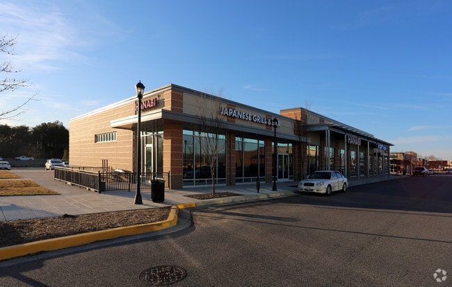
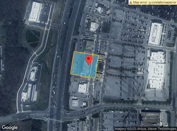
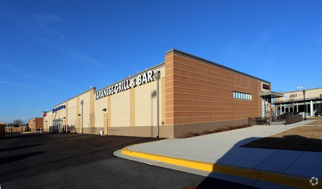
15814 Se Robert Crain Hwy
11-5512857
Brandywine 301 Indust Park
Restaurantbuilding
BRANDYWINE CROSSING,
X
Prince George's
24033C0365E
Maryland
2024
1.43 AC
2025
Outlying PG County South
801003
Washington, DC
12,800 SF
Washington-Arlington-Alexandria, DC-VA-MD-WV
DEMOGRAPHICS near 15814 Se Robert Crain Hwy
1 Mile
3 Mile
5 Mile
2024 Total Population
3,667
23,732
63,476
2029 Population
3,640
24,313
64,757
Pop Growth 2024-2029
(0.74%)
+ 2.45%
+ 2.02%
Average Age
39
39
39
2024 Total Households
1,284
8,559
22,454
HH Growth 2024-2029
(0.39%)
+ 2.64%
+ 2.10%
Median Household Inc
$128,883
$104,839
$107,005
Avg Household Size
2.80
2.70
2.80
2024 Avg HH Vehicles
2.00
2.00
2.00
Median Home Value
$451,482
$369,970
$370,604
Median Year Built
2007
1990
1991
Nearby Places
Map Layers
Map Styles
 Street
 Aerial
- Restaurants
- Banks
- Shops
- Fitness
- Groceries
PUBLIC TRANSPORTATION
AIRPORT
Ronald Reagan Washington Ntl
DRIVE
WALK
Distance
Ronald Reagan Washington Ntl
38 min
23.0 mi
Freight Ports
Port of Baltimore
DRIVE
WALK
Distance
Port of Baltimore
72 min
49.6 mi
SALE & LEASE HISTORY
LISTING DATE
SALE/LEASE

Oct 30, 2017
For Lease
Feb 22, 2019
For Lease
Dec 13, 2019
For Lease
Apr 05, 2017
For Lease
Nearby Properties
Address
Land Use
TOTAL SIZE
Lot Size
Zoning
Address
Land Use
TOTAL SIZE
Lot Size
Zoning
801,684 SF
34.05 AC
IE
Address
Land Use
TOTAL SIZE
Lot Size
Zoning
7,670 SF
9.78 AC
TACC
Address
Land Use
TOTAL SIZE
Lot Size
Zoning
392,898 SF
36.37 AC
PRD
Address
Land Use
TOTAL SIZE
Lot Size
Zoning
617,760 SF
25.75 AC
IE
Address
Land Use
TOTAL SIZE
Lot Size
Zoning
388,608 SF
28.45 AC
LCD
Address
Land Use
TOTAL SIZE
Lot Size
Zoning
126,592 SF
58.79 AC
ROS
Address
Land Use
TOTAL SIZE
Lot Size
Zoning
177,540 SF
27.64 AC
WCD
Address
Land Use
TOTAL SIZE
Lot Size
Zoning
177,540 SF
12.66 AC
WCD
Address
Land Use
TOTAL SIZE
Lot Size
Zoning
167,075 SF
11.01 AC
RH
Address
Land Use
TOTAL SIZE
Lot Size
Zoning
156,118 SF
17.01 AC
TACE
Address
Land Use
TOTAL SIZE
Lot Size
Zoning
62,838 SF
7.77 AC
TACE
Address
Land Use
TOTAL SIZE
Lot Size
Zoning
161,208 SF
10.99 AC
RH
Address
Land Use
TOTAL SIZE
Lot Size
Zoning
67,608 SF
4.01 AC
TACC
Address
Land Use
TOTAL SIZE
Lot Size
Zoning
98.41 AC
IH
Address
Land Use
TOTAL SIZE
Lot Size
Zoning
61,836 SF
9.63 AC
IE
Address
Land Use
TOTAL SIZE
Lot Size
Zoning
132,745 SF
2.59 AC
CC
Address
Land Use
TOTAL SIZE
Lot Size
Zoning
1,592.32 AC
ROS
Address
Land Use
TOTAL SIZE
Lot Size
Zoning
54,899 SF
5.23 AC
TACE
Address
Land Use
TOTAL SIZE
Lot Size
Zoning
128,909 SF
10.77 AC
TACE
Address
Land Use
TOTAL SIZE
Lot Size
Zoning
62,442 SF
4.84 AC
TACE
Address
Land Use
TOTAL SIZE
Lot Size
Zoning
28,508 SF
10 AC
TACC
Address
Land Use
TOTAL SIZE
Lot Size
Zoning
80,760 SF
5.70 AC
CC
Address
Land Use
TOTAL SIZE
Lot Size
Zoning
61,125 SF
10.10 AC
TACE
Address
Land Use
TOTAL SIZE
Lot Size
Zoning
80,922 SF
9.58 AC
PRD
Address
Land Use
TOTAL SIZE
Lot Size
Zoning
72,873 SF
8.05 AC
AUC
Address
Land Use
TOTAL SIZE
Lot Size
Zoning
127,206 SF
2.90 AC
TACE
Address
Land Use
TOTAL SIZE
Lot Size
Zoning
65,400 SF
4.41 AC
RH
Address
Land Use
TOTAL SIZE
Lot Size
Zoning
119,393 SF
12.21 AC
CC
Address
Land Use
TOTAL SIZE
Lot Size
Zoning
71,410 SF
7.67 AC
CC
Address
Land Use
TOTAL SIZE
Lot Size
Zoning
114,469 SF
17.34 AC
CC
The World's #1 Commercial Real Estate Marketplace
Connect with us
© 2025 CoStar Group
The information above has been obtained from sources believed reliable. While we do not doubt its accuracy we have not verified it and make no guarantee, warranty or representation about it. It is your responsibility to independently confirm its accuracy and completeness. Any projections, opinions, assumptions, or estimates used are for example only and do not represent the current or future performance of the property. The value of this transaction to you depends on tax and other factors which should be evaluated by your tax, financial, and legal advisors. You and your advisors should conduct a careful, independent investigation of the property to determine to your satisfaction the suitability of the property for your needs.