Property Record
1582 E 800Th Rd, Lawrence, KS 66049
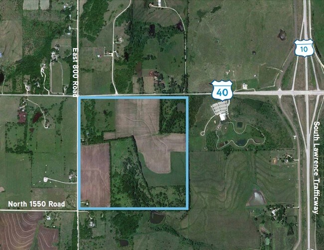
Property Detail
1582 E 800Th Rd
023-069-31-0-00-00-002.01-0
80.13A 31-12-19 S 1/2 NW 1/4,LESS 1.15A D 392/1698 WW35 (DIV 1992 400340A)
Ranch
Douglas
AG
Kansas
B and X Area of moderate flood hazard, usually the area between the limits of the 100-year and 500-year floods.
77.50 AC
2025
Lawrence
2025
Kansas City
000701
Lawrence, KS
2,040 SF
NEARBY LISTINGS FOR SALE OR LEASE
DEMOGRAPHICS near 1582 E 800Th Rd
1 mile
3 mile
5 mile
2025 Total Population
441
17,785
49,560
2030 Population
456
18,269
50,572
Pop Growth 2025-2030
+ 3.40%
+ 2.72%
+ 2.04%
Average Age
41
40
39
2025 Total Households
161
7,982
22,042
HH Growth 2025-2030
+ 3.73%
+ 3.01%
+ 2.25%
Median Household Inc
$144,117
$94,048
$72,535
Avg Household Size
2.70
2.20
2.20
2025 Avg HH Vehicles
2.00
2.00
2.00
Median Home Value
$586,309
$469,226
$356,361
Median Year Built
2007
2006
1995
Nearby Places
Map Layers
Map Styles
 Street
 Aerial
Transit
 Traffic
 Biking
Places
Listings with unknown addresses are not visible on the map
- Restaurants
- Banks
- Shops
- Fitness
- Groceries
PUBLIC TRANSPORTATION
COMMUTER RAIL
Lawrence Amtrak Station (Southwest Chief - Amtrak)
Drive
Walk
Distance
Lawrence Amtrak Station (Southwest Chief - Amtrak)
11 min
7.0 mi
Freight Ports
Tulsa Port Of Catoosa
Drive
Walk
Distance
Tulsa Port Of Catoosa
258 min
216.7 mi
Nearby Properties
Address
Land Use
TOTAL SIZE
Lot Size
Zoning
Address
Land Use
TOTAL SIZE
Lot Size
Zoning
243,311 SF
20.07 AC
AG
Address
Land Use
TOTAL SIZE
Lot Size
Zoning
190,168 SF
55.04 AC
C2
Address
Land Use
TOTAL SIZE
Lot Size
Zoning
138,043 SF
26.20 AC
AG
Address
Land Use
TOTAL SIZE
Lot Size
Zoning
11,992 SF
118.15 AC
RS1
Address
Land Use
TOTAL SIZE
Lot Size
Zoning
56,172 SF
14.05 AC
AG
Address
Land Use
TOTAL SIZE
Lot Size
Zoning
55,556 SF
24.90 AC
RM1
Address
Land Use
TOTAL SIZE
Lot Size
Zoning
55,275 SF
12.30 AC
AG
Address
Land Use
TOTAL SIZE
Lot Size
Zoning
51,366 SF
15 AC
RS2
Address
Land Use
TOTAL SIZE
Lot Size
Zoning
560,356 SF
62 AC
Address
Land Use
TOTAL SIZE
Lot Size
Zoning
40,349 SF
5.02 AC
C2
Address
Land Use
TOTAL SIZE
Lot Size
Zoning
20,062 SF
23.60 AC
A1
Address
Land Use
TOTAL SIZE
Lot Size
Zoning
24,083 SF
3.60 AC
Address
Land Use
TOTAL SIZE
Lot Size
Zoning
21,147 SF
0.49 AC
Address
Land Use
TOTAL SIZE
Lot Size
Zoning
10,000 SF
18.60 AC
AG
Address
Land Use
TOTAL SIZE
Lot Size
Zoning
11,712 SF
1.34 AC
M1
Address
Land Use
TOTAL SIZE
Lot Size
Zoning
6,516 SF
16.25 AC
Address
Land Use
TOTAL SIZE
Lot Size
Zoning
33,820 SF
22.06 AC
Address
Land Use
TOTAL SIZE
Lot Size
Zoning
643.10 AC
AG
Address
Land Use
TOTAL SIZE
Lot Size
Zoning
4,384 SF
57 AC
Address
Land Use
TOTAL SIZE
Lot Size
Zoning
13,512 SF
5 AC
AG
Address
Land Use
TOTAL SIZE
Lot Size
Zoning
26,688 SF
14.34 AC
AG
Address
Land Use
TOTAL SIZE
Lot Size
Zoning
16,792 SF
29.57 AC
AG
Address
Land Use
TOTAL SIZE
Lot Size
Zoning
21,082 SF
9.42 AC
RM1
Address
Land Use
TOTAL SIZE
Lot Size
Zoning
493.10 AC
AG
Address
Land Use
TOTAL SIZE
Lot Size
Zoning
17,025 SF
20.80 AC
Address
Land Use
TOTAL SIZE
Lot Size
Zoning
1,312 SF
11.90 AC
Address
Land Use
TOTAL SIZE
Lot Size
Zoning
448.90 AC
AG
Address
Land Use
TOTAL SIZE
Lot Size
Zoning
99,227 SF
13.13 AC
PRD2
Address
Land Use
TOTAL SIZE
Lot Size
Zoning
35,016 SF
17.30 AC
RM1
Address
Land Use
TOTAL SIZE
Lot Size
Zoning
15,336 SF
38.40 AC
AG
The World's #1 Commercial Real Estate Marketplace
Connect with us
© 2026 CoStar Group
The information above has been obtained from sources believed reliable. While we do not doubt its accuracy we have not verified it and make no guarantee, warranty or representation about it. It is your responsibility to independently confirm its accuracy and completeness. Any projections, opinions, assumptions, or estimates used are for example only and do not represent the current or future performance of the property. The value of this transaction to you depends on tax and other factors which should be evaluated by your tax, financial, and legal advisors. You and your advisors should conduct a careful, independent investigation of the property to determine to your satisfaction the suitability of the property for your needs.