Property Record
1583 Worcester Rd, Framingham, MA 01701
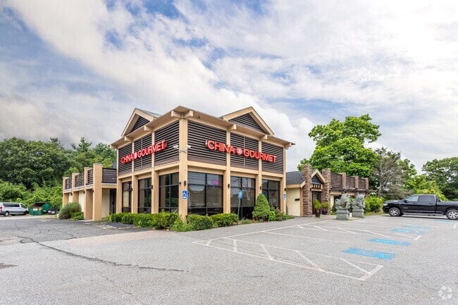

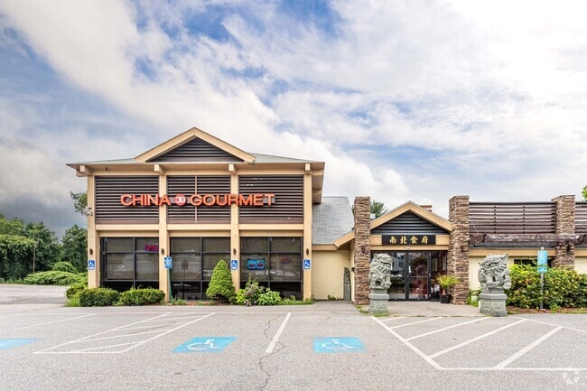
Property Detail
1583 Worcester Rd
FRAM-000097-000033-005372
Middlesex
Restaurantbuilding
Massachusetts
B
5372
AE The base floodplain where base flood elevations are provided. AE Zones are now used on new format FIRMs instead of A1-A30 Zones.
1.34 AC
2025
Framingham/Natick
2025
Boston
384003
Boston-Cambridge-Newton, MA-NH
8,351 SF
NEARBY LISTINGS FOR SALE OR LEASE
DEMOGRAPHICS near 1583 Worcester Rd
1 mile
3 mile
5 mile
2025 Total Population
6,720
47,546
145,015
2030 Population
7,105
49,807
151,124
Pop Growth 2025-2030
+ 5.73%
+ 4.76%
+ 4.21%
Average Age
40
41
41
2025 Total Households
3,131
18,089
56,071
HH Growth 2025-2030
+ 6.07%
+ 5.01%
+ 4.34%
Median Household Inc
$99,645
$123,437
$110,716
Avg Household Size
2.10
2.40
2.50
2025 Avg HH Vehicles
2.00
2.00
2.00
Median Home Value
$724,245
$731,079
$692,755
Median Year Built
1976
1971
1972
Nearby Places
Map Layers
Map Styles
 Street
 Aerial
Layers
 Traffic
 Biking
Places
Listings with unknown addresses are not visible on the map
- Restaurants
- Banks
- Shops
- Fitness
- Groceries
PUBLIC TRANSPORTATION
COMMUTER RAIL
Framingham (Framingham/Worcester Line - Massachusetts Bay Transportation Authority Commuter Rail (Purple Line))
Drive
Walk
Distance
Framingham (Framingham/Worcester Line - Massachusetts Bay Transportation Authority Commuter Rail (Purple Line))
17 min
9.5 mi
Drive
Walk
Distance
17 min
9.6 mi
AIRPORT
Worcester Regional
Drive
Walk
Distance
Worcester Regional
42 min
26.5 mi
General Edward Lawrence Logan International
Drive
Walk
Distance
General Edward Lawrence Logan International
39 min
27.8 mi
Freight Ports
Port of Boston
Drive
Walk
Distance
Port of Boston
38 min
26.1 mi
SALE & LEASE HISTORY
LISTING DATE
SALE/LEASE

Jul 15, 2020
For Lease
Feb 14, 2022
For Sale
Apr 07, 2023
For Lease
Apr 07, 2023
For Sale
Nearby Properties
Address
Land Use
TOTAL SIZE
Lot Size
Zoning
Address
Land Use
TOTAL SIZE
Lot Size
Zoning
556,849 SF
28.44 AC
R4
Address
Land Use
TOTAL SIZE
Lot Size
Zoning
906,841 SF
47.93 AC
M1
Address
Land Use
TOTAL SIZE
Lot Size
Zoning
664,397 SF
15.78 AC
TP
Address
Land Use
TOTAL SIZE
Lot Size
Zoning
340,840 SF
4.25 AC
B
Address
Land Use
TOTAL SIZE
Lot Size
Zoning
137,000 SF
18.96 AC
R1
Address
Land Use
TOTAL SIZE
Lot Size
Zoning
292,608 SF
5.19 AC
B
Address
Land Use
TOTAL SIZE
Lot Size
Zoning
493,918 SF
28.90 AC
R1
Address
Land Use
TOTAL SIZE
Lot Size
Zoning
293,180 SF
5.10 AC
B
Address
Land Use
TOTAL SIZE
Lot Size
Zoning
264,247 SF
6.09 AC
M1
Address
Land Use
TOTAL SIZE
Lot Size
Zoning
273,474 SF
7.46 AC
B
Address
Land Use
TOTAL SIZE
Lot Size
Zoning
444,182 SF
32.91 AC
TP
Address
Land Use
TOTAL SIZE
Lot Size
Zoning
207,522 SF
10.11 AC
B
Address
Land Use
TOTAL SIZE
Lot Size
Zoning
191,520 SF
7.99 AC
B
Address
Land Use
TOTAL SIZE
Lot Size
Zoning
191,520 SF
5.03 AC
B
Address
Land Use
TOTAL SIZE
Lot Size
Zoning
182,524 SF
3.60 AC
B2
Address
Land Use
TOTAL SIZE
Lot Size
Zoning
244,033 SF
25.75 AC
R1
Address
Land Use
TOTAL SIZE
Lot Size
Zoning
139,356 SF
52 AC
30
Address
Land Use
TOTAL SIZE
Lot Size
Zoning
231,897 SF
7.90 AC
B
Address
Land Use
TOTAL SIZE
Lot Size
Zoning
3.02 AC
CB
Address
Land Use
TOTAL SIZE
Lot Size
Zoning
174,988 SF
5.54 AC
TP
Address
Land Use
TOTAL SIZE
Lot Size
Zoning
183,338 SF
4.85 AC
B2
Address
Land Use
TOTAL SIZE
Lot Size
Zoning
15,204 SF
5.79 AC
BH
Address
Land Use
TOTAL SIZE
Lot Size
Zoning
112,000 SF
18.48 AC
R1
Address
Land Use
TOTAL SIZE
Lot Size
Zoning
112,000 SF
15.11 AC
G
Address
Land Use
TOTAL SIZE
Lot Size
Zoning
150,636 SF
30.34 AC
GE
Address
Land Use
TOTAL SIZE
Lot Size
Zoning
239,454 SF
12.65 AC
R3
Address
Land Use
TOTAL SIZE
Lot Size
Zoning
35,211 SF
89 AC
RA
Address
Land Use
TOTAL SIZE
Lot Size
Zoning
135,535 SF
16.01 AC
B
Address
Land Use
TOTAL SIZE
Lot Size
Zoning
91,461 SF
22.63 AC
R1
Address
Land Use
TOTAL SIZE
Lot Size
Zoning
154,724 SF
39.70 AC
R3
The World's #1 Commercial Real Estate Marketplace
Connect with us
© 2026 CoStar Group
The information above has been obtained from sources believed reliable. While we do not doubt its accuracy we have not verified it and make no guarantee, warranty or representation about it. It is your responsibility to independently confirm its accuracy and completeness. Any projections, opinions, assumptions, or estimates used are for example only and do not represent the current or future performance of the property. The value of this transaction to you depends on tax and other factors which should be evaluated by your tax, financial, and legal advisors. You and your advisors should conduct a careful, independent investigation of the property to determine to your satisfaction the suitability of the property for your needs.