Property Record
1599 Roanoke Rd, Daleville, VA 24083
NEARBY LISTINGS FOR SALE OR LEASE
-
-
View all Daleville listings for sale on LoopNet.com
Property Detail
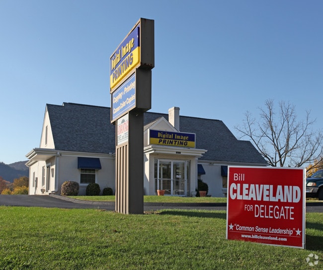
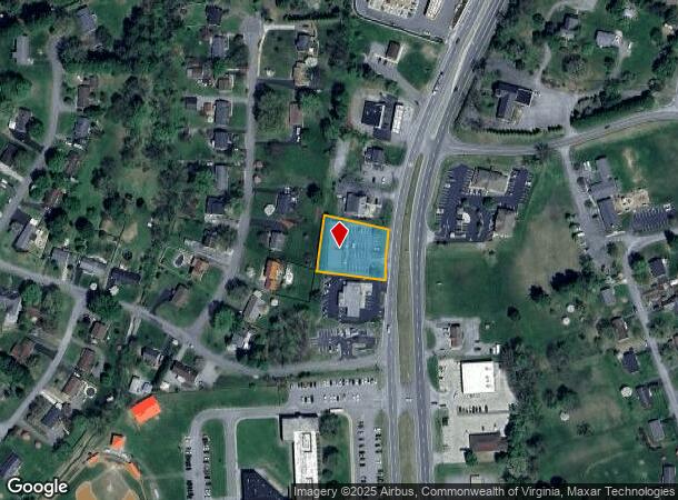
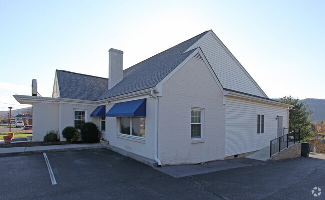
1599 Roanoke Rd
101-21
DALEVILLE
Commercialnec
Botetourt
X
Virginia
51023C0375C
0.60 AC
2024
Botetourt County
2025
Roanoke
040303
Roanoke, VA
DEMOGRAPHICS near 1599 Roanoke Rd
1 Mile
3 Mile
5 Mile
2024 Total Population
2,622
7,332
20,682
2029 Population
2,795
7,720
21,380
Pop Growth 2024-2029
+ 6.60%
+ 5.29%
+ 3.37%
Average Age
48
46
44
2024 Total Households
1,096
3,004
8,135
HH Growth 2024-2029
+ 6.57%
+ 5.29%
+ 3.42%
Median Household Inc
$102,578
$92,290
$86,019
Avg Household Size
2.30
2.40
2.40
2024 Avg HH Vehicles
2.00
2.00
2.00
Median Home Value
$361,316
$329,785
$300,828
Median Year Built
1998
1993
1989
Nearby Places
- Restaurants
- Banks
- Shops
- Fitness
- Groceries
PUBLIC TRANSPORTATION
AIRPORT
Roanoke/Blacksburg Regional (Woodrum Field)
DRIVE
WALK
Distance
Roanoke/Blacksburg Regional (Woodrum Field)
18 min
8.5 mi
Nearby Properties
Address
Land Use
TOTAL SIZE
Lot Size
Zoning
Address
Land Use
TOTAL SIZE
Lot Size
Zoning
5,957.14 AC
FC
Address
Land Use
TOTAL SIZE
Lot Size
Zoning
Address
Land Use
TOTAL SIZE
Lot Size
Zoning
4,284 SF
17.86 AC
R3
Address
Land Use
TOTAL SIZE
Lot Size
Zoning
35.57 AC
Address
Land Use
TOTAL SIZE
Lot Size
Zoning
89.99 AC
M-2
Address
Land Use
TOTAL SIZE
Lot Size
Zoning
26 AC
R-1
Address
Land Use
TOTAL SIZE
Lot Size
Zoning
33.29 AC
A1
Address
Land Use
TOTAL SIZE
Lot Size
Zoning
9.31 AC
B-1
Address
Land Use
TOTAL SIZE
Lot Size
Zoning
81 AC
M-2
Address
Land Use
TOTAL SIZE
Lot Size
Zoning
4.24 AC
Address
Land Use
TOTAL SIZE
Lot Size
Zoning
36.98 AC
M-1
Address
Land Use
TOTAL SIZE
Lot Size
Zoning
6.47 AC
A1
Address
Land Use
TOTAL SIZE
Lot Size
Zoning
2.56 AC
Address
Land Use
TOTAL SIZE
Lot Size
Zoning
25.38 AC
M-2
Address
Land Use
TOTAL SIZE
Lot Size
Zoning
312.55 AC
RAM
Address
Land Use
TOTAL SIZE
Lot Size
Zoning
51,532 SF
4.01 AC
Address
Land Use
TOTAL SIZE
Lot Size
Zoning
35,004 SF
5.07 AC
SCD
Address
Land Use
TOTAL SIZE
Lot Size
Zoning
19.43 AC
Address
Land Use
TOTAL SIZE
Lot Size
Zoning
Address
Land Use
TOTAL SIZE
Lot Size
Zoning
14.27 AC
SCD
Address
Land Use
TOTAL SIZE
Lot Size
Zoning
133.01 AC
RM
Address
Land Use
TOTAL SIZE
Lot Size
Zoning
6 AC
SCD
Address
Land Use
TOTAL SIZE
Lot Size
Zoning
8.24 AC
SCD
Address
Land Use
TOTAL SIZE
Lot Size
Zoning
12.20 AC
4
Address
Land Use
TOTAL SIZE
Lot Size
Zoning
Address
Land Use
TOTAL SIZE
Lot Size
Zoning
2.90 AC
A1
Address
Land Use
TOTAL SIZE
Lot Size
Zoning
4.57 AC
SCD
Address
Land Use
TOTAL SIZE
Lot Size
Zoning
2.40 AC
B-2
Address
Land Use
TOTAL SIZE
Lot Size
Zoning
24.96 AC
T
Address
Land Use
TOTAL SIZE
Lot Size
Zoning
2.45 AC
4
The World's #1 Commercial Real Estate Marketplace
Connect with us
© 2025 CoStar Group
The information above has been obtained from sources believed reliable. While we do not doubt its accuracy we have not verified it and make no guarantee, warranty or representation about it. It is your responsibility to independently confirm its accuracy and completeness. Any projections, opinions, assumptions, or estimates used are for example only and do not represent the current or future performance of the property. The value of this transaction to you depends on tax and other factors which should be evaluated by your tax, financial, and legal advisors. You and your advisors should conduct a careful, independent investigation of the property to determine to your satisfaction the suitability of the property for your needs.