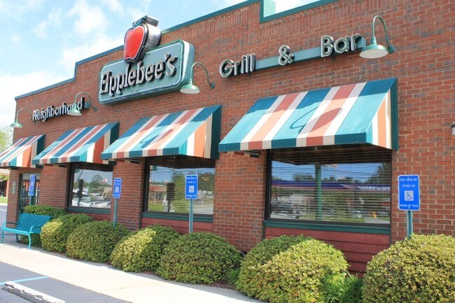
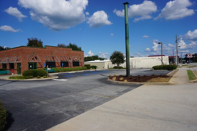
Property Record
1589 Big A Rd, Toccoa, GA 30577
NEARBY LISTINGS FOR SALE OR LEASE
Property Detail
1589 Big A Rd
Toccoa, GA
C T Bell
042I-041
LOTS 19-26 & 42-44 C T BELL S/D
Restaurantbuilding
Stephens
X
Georgia
13257C0110D
19-23
2025
1.40 AC
2025
Georgia Northeast
970102
Other Market Areas
5,076 SF
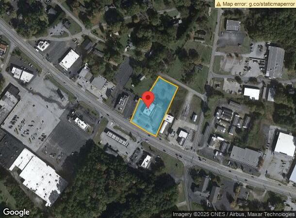
DEMOGRAPHICS near 1589 Big A Rd
1 mile
3 mile
5 mile
2024 Total Population
2,918
13,352
19,124
2029 Population
2,953
13,630
19,532
Pop Growth 2024-2029
+ 1.20%
+ 2.08%
+ 2.13%
Average Age
43
41
42
2024 Total Households
1,244
5,403
7,635
HH Growth 2024-2029
+ 0.96%
+ 2.02%
+ 2.07%
Median Household Inc
$50,503
$47,944
$49,422
Avg Household Size
2.30
2.40
2.40
2024 Avg HH Vehicles
2.00
2.00
2.00
Median Home Value
$148,449
$147,758
$157,037
Median Year Built
1975
1977
1980
Nearby Places
Map Layers
Map Styles
 Street
 Aerial
Transit
 Traffic
 Biking
Places
Listings with unknown addresses are not visible on the map
- Restaurants
- Banks
- Shops
- Fitness
- Groceries
SALE & LEASE HISTORY
LISTING DATE
SALE/LEASE

Sep 06, 2018
For Lease
Sep 01, 2022
For Sale
Jun 09, 2020
For Lease
Feb 17, 2017
For Sale
Aug 29, 2022
For Lease
Nearby Properties
Address
Land Use
TOTAL SIZE
Lot Size
Zoning
Address
Land Use
TOTAL SIZE
Lot Size
Zoning
3.47 AC
CI
Address
Land Use
TOTAL SIZE
Lot Size
Zoning
218,215 SF
25.17 AC
CG
Address
Land Use
TOTAL SIZE
Lot Size
Zoning
391,121 SF
62.73 AC
CG
Address
Land Use
TOTAL SIZE
Lot Size
Zoning
52,140 SF
115.88 AC
CG
Address
Land Use
TOTAL SIZE
Lot Size
Zoning
6.56 AC
CG
Address
Land Use
TOTAL SIZE
Lot Size
Zoning
5,120 SF
154.08 AC
CG
Address
Land Use
TOTAL SIZE
Lot Size
Zoning
4.24 AC
M-I
Address
Land Use
TOTAL SIZE
Lot Size
Zoning
49,548 SF
14.80 AC
R-II
Address
Land Use
TOTAL SIZE
Lot Size
Zoning
192,404 SF
27.79 AC
B-II
Address
Land Use
TOTAL SIZE
Lot Size
Zoning
Address
Land Use
TOTAL SIZE
Lot Size
Zoning
61,105 SF
64.49 AC
CG
Address
Land Use
TOTAL SIZE
Lot Size
Zoning
0.58 AC
CI
Address
Land Use
TOTAL SIZE
Lot Size
Zoning
148,256 SF
24.53 AC
CI
Address
Land Use
TOTAL SIZE
Lot Size
Zoning
68,998 SF
24.53 AC
CG
Address
Land Use
TOTAL SIZE
Lot Size
Zoning
66,517 SF
10.48 AC
R-II
Address
Land Use
TOTAL SIZE
Lot Size
Zoning
23,193 SF
5.89 AC
CG
Address
Land Use
TOTAL SIZE
Lot Size
Zoning
13,568 SF
7.50 AC
B-II
Address
Land Use
TOTAL SIZE
Lot Size
Zoning
123,520 SF
25.28 AC
CI
Address
Land Use
TOTAL SIZE
Lot Size
Zoning
44,496 SF
0.93 AC
B-III
Address
Land Use
TOTAL SIZE
Lot Size
Zoning
2,216 SF
2.02 AC
B-I
Address
Land Use
TOTAL SIZE
Lot Size
Zoning
111,150 SF
5.91 AC
CI
Address
Land Use
TOTAL SIZE
Lot Size
Zoning
39,460 SF
8.20 AC
B-II
Address
Land Use
TOTAL SIZE
Lot Size
Zoning
110,718 SF
10.14 AC
B-II
Address
Land Use
TOTAL SIZE
Lot Size
Zoning
34,170 SF
12.91 AC
CG
Address
Land Use
TOTAL SIZE
Lot Size
Zoning
Address
Land Use
TOTAL SIZE
Lot Size
Zoning
32,440 SF
81.75 AC
R-IA
Address
Land Use
TOTAL SIZE
Lot Size
Zoning
11,600 SF
199.79 AC
A-I
Address
Land Use
TOTAL SIZE
Lot Size
Zoning
Address
Land Use
TOTAL SIZE
Lot Size
Zoning
167,500 SF
20.98 AC
CI
Address
Land Use
TOTAL SIZE
Lot Size
Zoning
11,914 SF
2.04 AC
B-I
The World's #1 Commercial Real Estate Marketplace
Connect with us
© 2026 CoStar Group
The information above has been obtained from sources believed reliable. While we do not doubt its accuracy we have not verified it and make no guarantee, warranty or representation about it. It is your responsibility to independently confirm its accuracy and completeness. Any projections, opinions, assumptions, or estimates used are for example only and do not represent the current or future performance of the property. The value of this transaction to you depends on tax and other factors which should be evaluated by your tax, financial, and legal advisors. You and your advisors should conduct a careful, independent investigation of the property to determine to your satisfaction the suitability of the property for your needs.