Property Record
159 E Harvard Blvd, Santa Paula, CA 93060
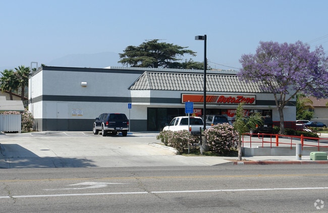


Property Detail
159 E Harvard Blvd
105-0-090-345
LOT: 30 REF: 020MR 097
Storebuilding
Ventura
C2
California
AE The base floodplain where base flood elevations are provided. AE Zones are now used on new format FIRMs instead of A1-A30 Zones.
30
2024
0.26 AC
2025
Santa Paula/Somis
000701
Los Angeles
3,360 SF
Oxnard-Thousand Oaks-Ventura, CA
NEARBY LISTINGS FOR SALE OR LEASE
DEMOGRAPHICS near 159 E Harvard Blvd
1 mile
3 mile
5 mile
2025 Total Population
19,351
32,787
34,279
2030 Population
19,218
32,862
34,351
Pop Growth 2025-2030
(0.69%)
+ 0.23%
+ 0.21%
Average Age
37
38
38
2025 Total Households
5,552
9,556
9,996
HH Growth 2025-2030
(0.85%)
+ 0.18%
+ 0.16%
Median Household Inc
$72,566
$80,872
$81,831
Avg Household Size
3.40
3.40
3.40
2025 Avg HH Vehicles
2.00
2.00
2.00
Median Home Value
$597,372
$651,891
$659,674
Median Year Built
1966
1967
1967
Nearby Places
Map Layers
Map Styles
 Street
 Aerial
Transit
 Traffic
 Biking
Places
Listings with unknown addresses are not visible on the map
- Restaurants
- Banks
- Shops
- Fitness
- Groceries
Nearby Properties
Address
Land Use
TOTAL SIZE
Lot Size
Zoning
Address
Land Use
TOTAL SIZE
Lot Size
Zoning
12,253 SF
16.59 AC
Address
Land Use
TOTAL SIZE
Lot Size
Zoning
87,287 SF
5.86 AC
Address
Land Use
TOTAL SIZE
Lot Size
Zoning
Address
Land Use
TOTAL SIZE
Lot Size
Zoning
479,160 SF
11.28 AC
AE
Address
Land Use
TOTAL SIZE
Lot Size
Zoning
105,773 SF
3.70 AC
M1
Address
Land Use
TOTAL SIZE
Lot Size
Zoning
41,050 SF
3.32 AC
MULT
Address
Land Use
TOTAL SIZE
Lot Size
Zoning
84,194 SF
7.88 AC
M1PD
Address
Land Use
TOTAL SIZE
Lot Size
Zoning
11.01 AC
M2
Address
Land Use
TOTAL SIZE
Lot Size
Zoning
Address
Land Use
TOTAL SIZE
Lot Size
Zoning
64,759 SF
4.01 AC
Address
Land Use
TOTAL SIZE
Lot Size
Zoning
24,660 SF
1.64 AC
Address
Land Use
TOTAL SIZE
Lot Size
Zoning
31,852 SF
2.46 AC
C1PD
Address
Land Use
TOTAL SIZE
Lot Size
Zoning
36,096 SF
5.74 AC
M1L
Address
Land Use
TOTAL SIZE
Lot Size
Zoning
23,591 SF
0.94 AC
Address
Land Use
TOTAL SIZE
Lot Size
Zoning
26,228 SF
1.08 AC
Address
Land Use
TOTAL SIZE
Lot Size
Zoning
13.59 AC
AEA-E/
Address
Land Use
TOTAL SIZE
Lot Size
Zoning
1,438 SF
51.64 AC
AE
Address
Land Use
TOTAL SIZE
Lot Size
Zoning
21,406 SF
6.01 AC
M1L
Address
Land Use
TOTAL SIZE
Lot Size
Zoning
66,439 SF
3.50 AC
Address
Land Use
TOTAL SIZE
Lot Size
Zoning
18,338 SF
0.96 AC
C2
Address
Land Use
TOTAL SIZE
Lot Size
Zoning
49,552 SF
4.93 AC
Address
Land Use
TOTAL SIZE
Lot Size
Zoning
11.58 AC
AE
Address
Land Use
TOTAL SIZE
Lot Size
Zoning
1.95 AC
RA
Address
Land Use
TOTAL SIZE
Lot Size
Zoning
13,210 SF
2.80 AC
M1L
Address
Land Use
TOTAL SIZE
Lot Size
Zoning
36,278 SF
8.68 AC
M-1
Address
Land Use
TOTAL SIZE
Lot Size
Zoning
21,600 SF
0.96 AC
C1
Address
Land Use
TOTAL SIZE
Lot Size
Zoning
39,410 SF
2.14 AC
M1&:
The World's #1 Commercial Real Estate Marketplace
Connect with us
© 2026 CoStar Group
The information above has been obtained from sources believed reliable. While we do not doubt its accuracy we have not verified it and make no guarantee, warranty or representation about it. It is your responsibility to independently confirm its accuracy and completeness. Any projections, opinions, assumptions, or estimates used are for example only and do not represent the current or future performance of the property. The value of this transaction to you depends on tax and other factors which should be evaluated by your tax, financial, and legal advisors. You and your advisors should conduct a careful, independent investigation of the property to determine to your satisfaction the suitability of the property for your needs.