Property Record
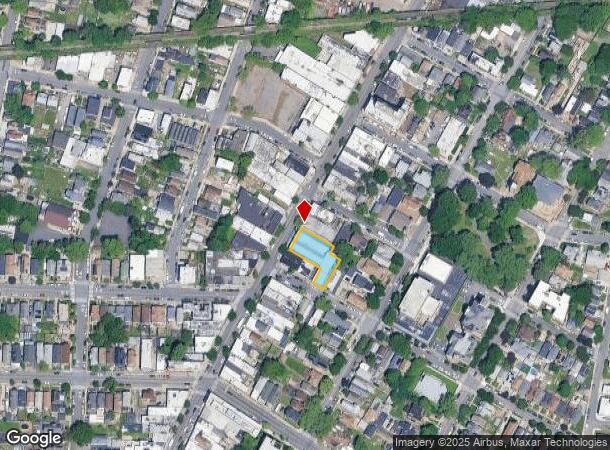
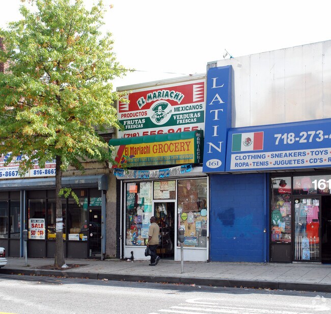
159 Port Richmond Ave, Staten Island, NY 10302

NEARBY LISTINGS FOR SALE OR LEASE
Property Detail
159 Port Richmond Ave
01023-0004
Staten Island
Storebuilding
New York
X
4
3604970169F
0.27 AC
2024
Staten Island
2025
Long Island (New York)
020702
New York-Jersey City-White Plains, NY-NJ
9,870 SF
DEMOGRAPHICS near 159 Port Richmond Ave
1 Mile
3 Mile
5 Mile
2024 Total Population
41,131
244,520
499,722
2029 Population
39,923
238,791
487,101
Pop Growth 2024-2029
(2.94%)
(2.34%)
(2.53%)
Average Age
37
39
40
2024 Total Households
13,530
85,022
173,918
HH Growth 2024-2029
(3.16%)
(2.50%)
(2.64%)
Median Household Inc
$65,331
$76,350
$72,601
Avg Household Size
2.90
2.70
2.80
2024 Avg HH Vehicles
1.00
1.00
1.00
Median Home Value
$457,716
$551,534
$561,008
Median Year Built
1952
1961
1965
Nearby Places
- Restaurants
- Banks
- Shops
- Fitness
- Groceries
PUBLIC TRANSPORTATION
COMMUTER RAIL
Stapleton (Staten Island Railway - New York MTA Subway (The Subway))
DRIVE
WALK
Distance
Stapleton (Staten Island Railway - New York MTA Subway (The Subway))
11 min
3.7 mi
Tompkinsville (Staten Island Railway - New York MTA Subway (The Subway))
DRIVE
WALK
Distance
Tompkinsville (Staten Island Railway - New York MTA Subway (The Subway))
11 min
4.5 mi
AIRPORT
Newark Liberty International
DRIVE
WALK
Distance
Newark Liberty International
18 min
11.2 mi
LaGuardia
DRIVE
WALK
Distance
LaGuardia
43 min
23.9 mi
John F Kennedy International
DRIVE
WALK
Distance
John F Kennedy International
42 min
26.6 mi
Freight Ports
New York Container Terminal
DRIVE
WALK
Distance
New York Container Terminal
7 min
3.4 mi
Nearby Properties
Address
Land Use
TOTAL SIZE
Lot Size
Zoning
Address
Land Use
TOTAL SIZE
Lot Size
Zoning
633,280 SF
202.90 AC
R3-2
Address
Land Use
TOTAL SIZE
Lot Size
Zoning
Address
Land Use
TOTAL SIZE
Lot Size
Zoning
4,450,000 SF
95.24 AC
Address
Land Use
TOTAL SIZE
Lot Size
Zoning
22.49 AC
HC
Address
Land Use
TOTAL SIZE
Lot Size
Zoning
686,130 SF
189.62 AC
R3-2
Address
Land Use
TOTAL SIZE
Lot Size
Zoning
70.39 AC
Address
Land Use
TOTAL SIZE
Lot Size
Zoning
16.63 AC
Address
Land Use
TOTAL SIZE
Lot Size
Zoning
2.21 AC
Address
Land Use
TOTAL SIZE
Lot Size
Zoning
1.01 AC
Address
Land Use
TOTAL SIZE
Lot Size
Zoning
51.62 AC
Address
Land Use
TOTAL SIZE
Lot Size
Zoning
91,760 SF
210.43 AC
M3-1
Address
Land Use
TOTAL SIZE
Lot Size
Zoning
3.27 AC
Address
Land Use
TOTAL SIZE
Lot Size
Zoning
17.60 AC
Address
Land Use
TOTAL SIZE
Lot Size
Zoning
51.61 AC
Address
Land Use
TOTAL SIZE
Lot Size
Zoning
39.64 AC
Address
Land Use
TOTAL SIZE
Lot Size
Zoning
566,000 SF
103.31 AC
R3-2
Address
Land Use
TOTAL SIZE
Lot Size
Zoning
28.47 AC
I-H
Address
Land Use
TOTAL SIZE
Lot Size
Zoning
6,188,000 SF
8.18 AC
Address
Land Use
TOTAL SIZE
Lot Size
Zoning
1 SF
20 AC
Address
Land Use
TOTAL SIZE
Lot Size
Zoning
115.33 AC
IH
Address
Land Use
TOTAL SIZE
Lot Size
Zoning
74.35 AC
TDD
Address
Land Use
TOTAL SIZE
Lot Size
Zoning
30.70 AC
Address
Land Use
TOTAL SIZE
Lot Size
Zoning
Address
Land Use
TOTAL SIZE
Lot Size
Zoning
10.86 AC
R-2
Address
Land Use
TOTAL SIZE
Lot Size
Zoning
1,502 SF
0.69 AC
C-1
Address
Land Use
TOTAL SIZE
Lot Size
Zoning
Address
Land Use
TOTAL SIZE
Lot Size
Zoning
73.86 AC
IH
Address
Land Use
TOTAL SIZE
Lot Size
Zoning
2.77 AC
Address
Land Use
TOTAL SIZE
Lot Size
Zoning
23.77 AC
Address
Land Use
TOTAL SIZE
Lot Size
Zoning
538,240 SF
12.08 AC
R2
The World's #1 Commercial Real Estate Marketplace
Connect with us
© 2025 CoStar Group
The information above has been obtained from sources believed reliable. While we do not doubt its accuracy we have not verified it and make no guarantee, warranty or representation about it. It is your responsibility to independently confirm its accuracy and completeness. Any projections, opinions, assumptions, or estimates used are for example only and do not represent the current or future performance of the property. The value of this transaction to you depends on tax and other factors which should be evaluated by your tax, financial, and legal advisors. You and your advisors should conduct a careful, independent investigation of the property to determine to your satisfaction the suitability of the property for your needs.