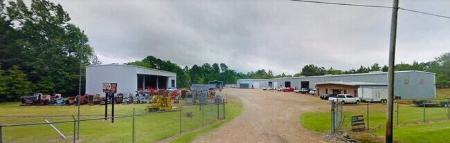
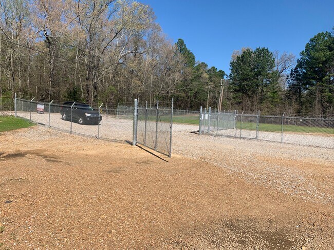
Property Record
1590 Old Whitfield Rd, Pearl, MS 39208


NEARBY LISTINGS FOR SALE OR LEASE
Property Detail
1590 Old Whitfield Rd
F07-000012-00010
5A IN S2 NW4 NE4 NW4 DB 432 PG 0390 0061082 CC 24139 0111385 DB 548 PG 0671 0022588
Officebuilding
Rankin
X
Mississippi
28121C0189F
5 AC
2024
Brandon/Flowood/Pearl
2024
Jackson
020602
Jackson, MS
1,240 SF
DEMOGRAPHICS near 1590 Old Whitfield Rd
1 Mile
3 Mile
5 Mile
2024 Total Population
1,772
26,297
48,272
2029 Population
1,801
26,891
49,418
Pop Growth 2024-2029
+ 1.64%
+ 2.26%
+ 2.37%
Average Age
40
39
39
2024 Total Households
210
8,847
17,681
HH Growth 2024-2029
+ 5.24%
+ 2.66%
+ 2.52%
Median Household Inc
$94,999
$56,033
$57,326
Avg Household Size
2.60
2.50
2.40
2024 Avg HH Vehicles
3.00
2.00
2.00
Median Home Value
$154,210
$140,524
$153,462
Median Year Built
2000
1982
1986
Nearby Places
Map Layers
Map Styles
 Street
 Aerial
- Restaurants
- Banks
- Shops
- Fitness
- Groceries
PUBLIC TRANSPORTATION
AIRPORT
Jackson-Medgar Wiley Evers International
DRIVE
WALK
Distance
Jackson-Medgar Wiley Evers International
14 min
4.8 mi
Freight Ports
Port of Greater Baton Rouge
DRIVE
WALK
Distance
Port of Greater Baton Rouge
208 min
183.6 mi
SALE & LEASE HISTORY
LISTING DATE
SALE/LEASE

May 11, 2022
For Lease
Dec 01, 2021
For Sale
Nearby Properties
Address
Land Use
TOTAL SIZE
Lot Size
Zoning
Address
Land Use
TOTAL SIZE
Lot Size
Zoning
40,697 SF
0.85 AC
Address
Land Use
TOTAL SIZE
Lot Size
Zoning
373.20 AC
Address
Land Use
TOTAL SIZE
Lot Size
Zoning
249,342 SF
29.79 AC
Address
Land Use
TOTAL SIZE
Lot Size
Zoning
20,566 SF
5.73 AC
Address
Land Use
TOTAL SIZE
Lot Size
Zoning
4,008 SF
8.30 AC
Address
Land Use
TOTAL SIZE
Lot Size
Zoning
30,800 SF
5.66 AC
Address
Land Use
TOTAL SIZE
Lot Size
Zoning
Address
Land Use
TOTAL SIZE
Lot Size
Zoning
87,948 SF
21.19 AC
Address
Land Use
TOTAL SIZE
Lot Size
Zoning
70,433 SF
2.53 AC
Address
Land Use
TOTAL SIZE
Lot Size
Zoning
87,907 SF
14.71 AC
Address
Land Use
TOTAL SIZE
Lot Size
Zoning
5.06 AC
Address
Land Use
TOTAL SIZE
Lot Size
Zoning
69.13 AC
Address
Land Use
TOTAL SIZE
Lot Size
Zoning
110,395 SF
14.71 AC
Address
Land Use
TOTAL SIZE
Lot Size
Zoning
12,244 SF
1.48 AC
Address
Land Use
TOTAL SIZE
Lot Size
Zoning
9,667 SF
1.94 AC
Address
Land Use
TOTAL SIZE
Lot Size
Zoning
6,640 SF
3 AC
Address
Land Use
TOTAL SIZE
Lot Size
Zoning
92,854 SF
7.73 AC
Address
Land Use
TOTAL SIZE
Lot Size
Zoning
39,734 SF
1.60 AC
Address
Land Use
TOTAL SIZE
Lot Size
Zoning
15.80 AC
Address
Land Use
TOTAL SIZE
Lot Size
Zoning
714 SF
4.50 AC
Address
Land Use
TOTAL SIZE
Lot Size
Zoning
12,500 SF
10.30 AC
Address
Land Use
TOTAL SIZE
Lot Size
Zoning
110,908 SF
11.65 AC
Address
Land Use
TOTAL SIZE
Lot Size
Zoning
15,075 SF
31.38 AC
Address
Land Use
TOTAL SIZE
Lot Size
Zoning
57,197 SF
5.92 AC
Address
Land Use
TOTAL SIZE
Lot Size
Zoning
6,001 SF
0.96 AC
Address
Land Use
TOTAL SIZE
Lot Size
Zoning
35,812 SF
6.41 AC
Address
Land Use
TOTAL SIZE
Lot Size
Zoning
38,777 SF
2.27 AC
Address
Land Use
TOTAL SIZE
Lot Size
Zoning
35,069 SF
1.50 AC
Address
Land Use
TOTAL SIZE
Lot Size
Zoning
2,518 SF
2.44 AC
Address
Land Use
TOTAL SIZE
Lot Size
Zoning
7,979 SF
7.02 AC
The World's #1 Commercial Real Estate Marketplace
Connect with us
© 2025 CoStar Group
The information above has been obtained from sources believed reliable. While we do not doubt its accuracy we have not verified it and make no guarantee, warranty or representation about it. It is your responsibility to independently confirm its accuracy and completeness. Any projections, opinions, assumptions, or estimates used are for example only and do not represent the current or future performance of the property. The value of this transaction to you depends on tax and other factors which should be evaluated by your tax, financial, and legal advisors. You and your advisors should conduct a careful, independent investigation of the property to determine to your satisfaction the suitability of the property for your needs.